Property Record
2900 Pershall Rd, Saint Louis, MO 63136


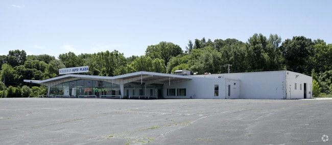
Property Detail
2900 Pershall Rd
10G-53-0161
SURVEY 2470 TWN 47 R 7 INTERSECTION OF PERSHALL RD & TRASK DR
Officebuilding
Saint Louis
22C-1
Missouri
AE The base floodplain where base flood elevations are provided. AE Zones are now used on new format FIRMs instead of A1-A30 Zones.
8.02 AC
2024
Northwest County
2025
St. Louis
211801
St. Louis, MO-IL
58,818 SF
NEARBY LISTINGS FOR SALE OR LEASE
DEMOGRAPHICS near 2900 Pershall Rd
1 mile
3 mile
5 mile
2025 Total Population
11,426
99,791
225,286
2030 Population
11,427
100,426
226,573
Pop Growth 2025-2030
+ 0.01%
+ 0.64%
+ 0.57%
Average Age
41
40
39
2025 Total Households
4,709
39,901
90,542
HH Growth 2025-2030
(0.13%)
+ 0.56%
+ 0.51%
Median Household Inc
$59,644
$55,375
$54,434
Avg Household Size
2.30
2.40
2.40
2025 Avg HH Vehicles
2.00
2.00
2.00
Median Home Value
$117,907
$128,437
$127,674
Median Year Built
1963
1962
1961
Nearby Places
Map Layers
Map Styles
 Street
 Aerial
Layers
 Traffic
 Biking
Places
Listings with unknown addresses are not visible on the map
- Restaurants
- Banks
- Shops
- Fitness
- Groceries
PUBLIC TRANSPORTATION
COMMUTER RAIL
North Hanley (Lambert Airport Shiloh-Scott - St. Louis MetroLink (MetroLink))
Drive
Walk
Distance
North Hanley (Lambert Airport Shiloh-Scott - St. Louis MetroLink (MetroLink))
12 min
7.2 mi
Um St. Louis North (Lambert Airport Shiloh-Scott - St. Louis MetroLink (MetroLink))
Drive
Walk
Distance
Um St. Louis North (Lambert Airport Shiloh-Scott - St. Louis MetroLink (MetroLink))
13 min
7.2 mi
AIRPORT
St Louis Lambert International
Drive
Walk
Distance
St Louis Lambert International
12 min
7.1 mi
Scott AFB/Midamerica St Louis
Drive
Walk
Distance
Scott AFB/Midamerica St Louis
54 min
35.1 mi
Freight Ports
Port Milwaukee
Drive
Walk
Distance
Port Milwaukee
419 min
370.0 mi
Nearby Properties
Address
Land Use
TOTAL SIZE
Lot Size
Zoning
Address
Land Use
TOTAL SIZE
Lot Size
Zoning
1,925 SF
21.27 AC
C-8
Address
Land Use
TOTAL SIZE
Lot Size
Zoning
75.13 AC
R3
Address
Land Use
TOTAL SIZE
Lot Size
Zoning
25,545 SF
82.84 AC
R1B
Address
Land Use
TOTAL SIZE
Lot Size
Zoning
71.29 AC
24R4
Address
Land Use
TOTAL SIZE
Lot Size
Zoning
35.96 AC
R2
Address
Land Use
TOTAL SIZE
Lot Size
Zoning
205,268 SF
36.09 AC
88R-1
Address
Land Use
TOTAL SIZE
Lot Size
Zoning
271,184 SF
13.67 AC
B3
Address
Land Use
TOTAL SIZE
Lot Size
Zoning
460,170 SF
152.70 AC
22M-1
Address
Land Use
TOTAL SIZE
Lot Size
Zoning
18,734 SF
38.83 AC
24R4
Address
Land Use
TOTAL SIZE
Lot Size
Zoning
93,136 SF
108.76 AC
Address
Land Use
TOTAL SIZE
Lot Size
Zoning
354,790 SF
22.46 AC
B6
Address
Land Use
TOTAL SIZE
Lot Size
Zoning
293,117 SF
26 AC
R3
Address
Land Use
TOTAL SIZE
Lot Size
Zoning
50.71 AC
R3D
Address
Land Use
TOTAL SIZE
Lot Size
Zoning
47,184 SF
119.33 AC
PS
Address
Land Use
TOTAL SIZE
Lot Size
Zoning
6,366 SF
25.07 AC
22R-1C
Address
Land Use
TOTAL SIZE
Lot Size
Zoning
15.59 AC
R4
Address
Land Use
TOTAL SIZE
Lot Size
Zoning
77,616 SF
10.56 AC
C-8
Address
Land Use
TOTAL SIZE
Lot Size
Zoning
448,714 SF
34.05 AC
22M-1
Address
Land Use
TOTAL SIZE
Lot Size
Zoning
148,974 SF
17.04 AC
C-8
Address
Land Use
TOTAL SIZE
Lot Size
Zoning
11.48 AC
24R4
Address
Land Use
TOTAL SIZE
Lot Size
Zoning
20.62 AC
R3
Address
Land Use
TOTAL SIZE
Lot Size
Zoning
5.74 AC
C1
Address
Land Use
TOTAL SIZE
Lot Size
Zoning
193,344 SF
14.37 AC
24MFD
Address
Land Use
TOTAL SIZE
Lot Size
Zoning
222,813 SF
30.12 AC
B3
Address
Land Use
TOTAL SIZE
Lot Size
Zoning
108,753 SF
18.44 AC
31C-3
Address
Land Use
TOTAL SIZE
Lot Size
Zoning
18.86 AC
R3
Address
Land Use
TOTAL SIZE
Lot Size
Zoning
12.83 AC
24R4
Address
Land Use
TOTAL SIZE
Lot Size
Zoning
1.80 AC
31R-1
Address
Land Use
TOTAL SIZE
Lot Size
Zoning
39,462 SF
8.64 AC
22C-2
The World's #1 Commercial Real Estate Marketplace
Connect with us
© 2026 CoStar Group
The information above has been obtained from sources believed reliable. While we do not doubt its accuracy we have not verified it and make no guarantee, warranty or representation about it. It is your responsibility to independently confirm its accuracy and completeness. Any projections, opinions, assumptions, or estimates used are for example only and do not represent the current or future performance of the property. The value of this transaction to you depends on tax and other factors which should be evaluated by your tax, financial, and legal advisors. You and your advisors should conduct a careful, independent investigation of the property to determine to your satisfaction the suitability of the property for your needs.