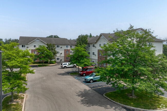
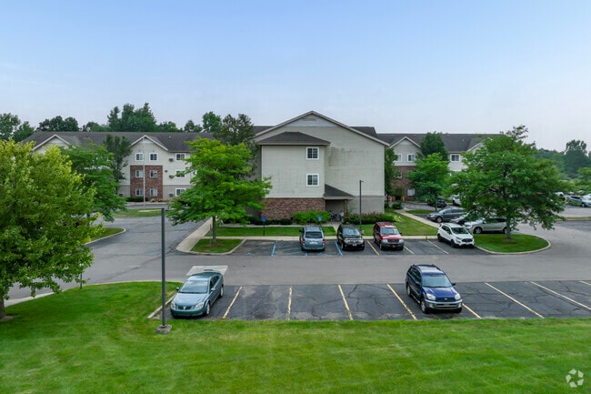
Property Record
2900 S Dettman Rd, Jackson, MI 49203

NEARBY LISTINGS FOR SALE OR LEASE
-
-
View all Jackson listings for sale on LoopNet.com
Property Detail
2900 S Dettman Rd
000-08-36-426-014-01
COMMENCING AT THE EAST 1/4 CORNER OF SEC 36 TH S 00 DEG 28'47"W 974.35 FT ALG E LN OF SD SECTION TO POB TH CONTINUING ALG SD
Retirementnursinghomecombined
Jackson
X
Michigan
26075C0215D
10 AC
2024
Jackson County
2025
West Michigan
001300
Jackson, MI
80,361 SF
DEMOGRAPHICS near 2900 S Dettman Rd
1 Mile
3 Mile
5 Mile
2024 Total Population
5,696
37,634
74,273
2029 Population
5,639
37,629
73,912
Pop Growth 2024-2029
(1.00%)
(0.01%)
(0.49%)
Average Age
38
38
40
2024 Total Households
2,313
15,200
31,230
HH Growth 2024-2029
(1.21%)
+ 0.07%
(0.49%)
Median Household Inc
$40,301
$39,162
$47,845
Avg Household Size
2.30
2.30
2.30
2024 Avg HH Vehicles
2.00
1.00
2.00
Median Home Value
$74,478
$79,080
$124,201
Median Year Built
1950
1948
1955
Nearby Places
Map Layers
Map Styles
 Street
 Aerial
- Restaurants
- Banks
- Shops
- Fitness
- Groceries
PUBLIC TRANSPORTATION
COMMUTER RAIL
Jackson (Wolverine - Amtrak)
DRIVE
WALK
Distance
Jackson (Wolverine - Amtrak)
5 min
2.3 mi
Freight Ports
Port of Toledo
DRIVE
WALK
Distance
Port of Toledo
103 min
78.3 mi
Nearby Properties
Address
Land Use
TOTAL SIZE
Lot Size
Zoning
Address
Land Use
TOTAL SIZE
Lot Size
Zoning
392,155 SF
7.01 AC
C-3
Address
Land Use
TOTAL SIZE
Lot Size
Zoning
186,754 SF
16.63 AC
R-4 HI
Address
Land Use
TOTAL SIZE
Lot Size
Zoning
332,493 SF
145.86 AC
B-4 GEN
Address
Land Use
TOTAL SIZE
Lot Size
Zoning
401,234 SF
23.40 AC
I-2
Address
Land Use
TOTAL SIZE
Lot Size
Zoning
13,124 SF
23.61 AC
I-2
Address
Land Use
TOTAL SIZE
Lot Size
Zoning
64,257 SF
1.90 AC
R-4
Address
Land Use
TOTAL SIZE
Lot Size
Zoning
252,659 SF
35 AC
M HEAVY
Address
Land Use
TOTAL SIZE
Lot Size
Zoning
223,693 SF
27.35 AC
B-4 GEN
Address
Land Use
TOTAL SIZE
Lot Size
Zoning
189,680 SF
6.90 AC
R-4
Address
Land Use
TOTAL SIZE
Lot Size
Zoning
62,227 SF
6.89 AC
R-1 ONE
Address
Land Use
TOTAL SIZE
Lot Size
Zoning
74,254 SF
12.64 AC
I-2
Address
Land Use
TOTAL SIZE
Lot Size
Zoning
57,057 SF
10.10 AC
C-3
Address
Land Use
TOTAL SIZE
Lot Size
Zoning
67,146 SF
0.80 AC
C-3
Address
Land Use
TOTAL SIZE
Lot Size
Zoning
444,936 SF
19.65 AC
I-2
Address
Land Use
TOTAL SIZE
Lot Size
Zoning
171,368 SF
18.90 AC
I-2
Address
Land Use
TOTAL SIZE
Lot Size
Zoning
111,312 SF
3.27 AC
R-2
Address
Land Use
TOTAL SIZE
Lot Size
Zoning
35,908 SF
6.60 AC
R-4
Address
Land Use
TOTAL SIZE
Lot Size
Zoning
55,209 SF
5.67 AC
C-2
Address
Land Use
TOTAL SIZE
Lot Size
Zoning
154,448 SF
12.97 AC
PR-1
Address
Land Use
TOTAL SIZE
Lot Size
Zoning
71,815 SF
3.42 AC
I-2
Address
Land Use
TOTAL SIZE
Lot Size
Zoning
196,525 SF
4.22 AC
I-2
Address
Land Use
TOTAL SIZE
Lot Size
Zoning
126,176 SF
19.62 AC
PR-1
Address
Land Use
TOTAL SIZE
Lot Size
Zoning
64,185 SF
17.13 AC
C-3
Address
Land Use
TOTAL SIZE
Lot Size
Zoning
57,804 SF
3.77 AC
C-4
Address
Land Use
TOTAL SIZE
Lot Size
Zoning
89,888 SF
8 AC
R-3
Address
Land Use
TOTAL SIZE
Lot Size
Zoning
66,464 SF
10.03 AC
ML LIGH
Address
Land Use
TOTAL SIZE
Lot Size
Zoning
174,184 SF
14.01 AC
M HEAVY
Address
Land Use
TOTAL SIZE
Lot Size
Zoning
17.22 AC
C-3
Address
Land Use
TOTAL SIZE
Lot Size
Zoning
71,985 SF
7.89 AC
I-2
Address
Land Use
TOTAL SIZE
Lot Size
Zoning
742,023 SF
53.77 AC
M HEAVY
The World's #1 Commercial Real Estate Marketplace
Connect with us
© 2025 CoStar Group
The information above has been obtained from sources believed reliable. While we do not doubt its accuracy we have not verified it and make no guarantee, warranty or representation about it. It is your responsibility to independently confirm its accuracy and completeness. Any projections, opinions, assumptions, or estimates used are for example only and do not represent the current or future performance of the property. The value of this transaction to you depends on tax and other factors which should be evaluated by your tax, financial, and legal advisors. You and your advisors should conduct a careful, independent investigation of the property to determine to your satisfaction the suitability of the property for your needs.