Property Record
2900 S Ellis Rd, Sioux Falls, SD 57106


Save to a Folder
{{folder.Name}}
{{folder.ListingIds.length}} Properties
{{folder.ListingIds.length}} Property
Create a New Folder
Property Detail
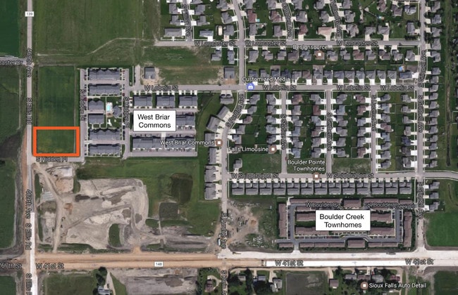
2900 S Ellis Rd
Sioux Falls, SD-MN
LOT 1 BLOCK 10 ELROD`S ADDITION TO THE CITY OF SIOUX FALLS
83588
Minnehaha
Stripcommercialcenter
South Dakota
B and X Area of moderate flood hazard, usually the area between the limits of the 100-year and 500-year floods.
1
2025
1.29 AC
2025
Sioux Falls
001112
Other Market Areas
9,877 SF
NEARBY LISTINGS FOR SALE OR LEASE
DEMOGRAPHICS near 2900 S Ellis Rd
1 mile
3 mile
5 mile
2025 Total Population
11,347
52,328
105,919
2030 Population
12,038
55,482
113,360
Pop Growth 2025-2030
+ 6.09%
+ 6.03%
+ 7.03%
Average Age
35
37
37
2025 Total Households
4,369
20,965
43,354
HH Growth 2025-2030
+ 6.64%
+ 6.45%
+ 7.31%
Median Household Inc
$90,318
$78,478
$72,786
Avg Household Size
2.60
2.40
2.40
2025 Avg HH Vehicles
2.00
2.00
2.00
Median Home Value
$358,810
$292,224
$290,180
Median Year Built
2010
2000
1998
Nearby Places
Map Layers
Map Styles
 Street
 Aerial
Layers
 Traffic
 Biking
Places
Listings with unknown addresses are not visible on the map
- Restaurants
- Banks
- Shops
- Fitness
- Groceries
PUBLIC TRANSPORTATION
AIRPORT
Joe Foss Field
Drive
Walk
Distance
Joe Foss Field
29 min
10.5 mi
Freight Ports
Port Milwaukee
Drive
Walk
Distance
Port Milwaukee
557 min
511.7 mi
SALE & LEASE HISTORY
LISTING DATE
SALE/LEASE

Mar 30, 2017
For Sale
Nearby Properties
Address
Land Use
TOTAL SIZE
Lot Size
Zoning
Address
Land Use
TOTAL SIZE
Lot Size
Zoning
408,018 SF
53.02 AC
FP;FP
Address
Land Use
TOTAL SIZE
Lot Size
Zoning
32,169 SF
9.91 AC
Address
Land Use
TOTAL SIZE
Lot Size
Zoning
201,028 SF
5.42 AC
FP;FP
Address
Land Use
TOTAL SIZE
Lot Size
Zoning
8.52 AC
MUNICIPALI
Address
Land Use
TOTAL SIZE
Lot Size
Zoning
15.40 AC
MUNICIPALI
Address
Land Use
TOTAL SIZE
Lot Size
Zoning
172,212 SF
15.89 AC
Address
Land Use
TOTAL SIZE
Lot Size
Zoning
80,964 SF
23.34 AC
Address
Land Use
TOTAL SIZE
Lot Size
Zoning
100,053 SF
8.50 AC
FP;FP
Address
Land Use
TOTAL SIZE
Lot Size
Zoning
9.56 AC
MUNICIPALI
Address
Land Use
TOTAL SIZE
Lot Size
Zoning
8.57 AC
MUNICIPALI
Address
Land Use
TOTAL SIZE
Lot Size
Zoning
16.45 AC
MUNICIPALI
Address
Land Use
TOTAL SIZE
Lot Size
Zoning
1.66 AC
FP;FP
Address
Land Use
TOTAL SIZE
Lot Size
Zoning
7.07 AC
MUNICIPALI
Address
Land Use
TOTAL SIZE
Lot Size
Zoning
3.43 AC
MUNICIPALI
Address
Land Use
TOTAL SIZE
Lot Size
Zoning
220,834 SF
11.46 AC
Address
Land Use
TOTAL SIZE
Lot Size
Zoning
211,577 SF
11.58 AC
Address
Land Use
TOTAL SIZE
Lot Size
Zoning
26,601 SF
5.31 AC
Address
Land Use
TOTAL SIZE
Lot Size
Zoning
72,601 SF
15.33 AC
Address
Land Use
TOTAL SIZE
Lot Size
Zoning
11.07 AC
MUNICIPALI
Address
Land Use
TOTAL SIZE
Lot Size
Zoning
1,796 SF
7.57 AC
Address
Land Use
TOTAL SIZE
Lot Size
Zoning
21,060 SF
6.70 AC
FP;FP
Address
Land Use
TOTAL SIZE
Lot Size
Zoning
9.27 AC
MUNICIPALI
Address
Land Use
TOTAL SIZE
Lot Size
Zoning
8,768 SF
5.48 AC
Address
Land Use
TOTAL SIZE
Lot Size
Zoning
9.16 AC
MUNICIPALI
Address
Land Use
TOTAL SIZE
Lot Size
Zoning
5,649 SF
9.13 AC
Address
Land Use
TOTAL SIZE
Lot Size
Zoning
190,412 SF
18.09 AC
Address
Land Use
TOTAL SIZE
Lot Size
Zoning
208,310 SF
14.65 AC
FP;FP
Address
Land Use
TOTAL SIZE
Lot Size
Zoning
72,342 SF
6.09 AC
FP;FP
Address
Land Use
TOTAL SIZE
Lot Size
Zoning
42,810 SF
11.57 AC
Address
Land Use
TOTAL SIZE
Lot Size
Zoning
75,319 SF
2.92 AC
The World's #1 Commercial Real Estate Marketplace
Connect with us
© 2026 CoStar Group
The information above has been obtained from sources believed reliable. While we do not doubt its accuracy we have not verified it and make no guarantee, warranty or representation about it. It is your responsibility to independently confirm its accuracy and completeness. Any projections, opinions, assumptions, or estimates used are for example only and do not represent the current or future performance of the property. The value of this transaction to you depends on tax and other factors which should be evaluated by your tax, financial, and legal advisors. You and your advisors should conduct a careful, independent investigation of the property to determine to your satisfaction the suitability of the property for your needs.