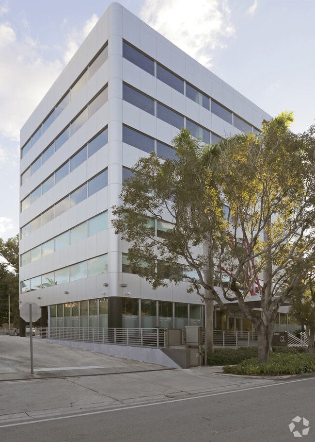
Property Record
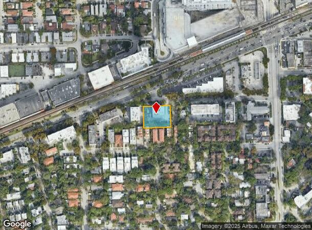
2900 Sw 28Th Ter, Miami, FL 33133


NEARBY LISTINGS FOR SALE OR LEASE
Property Detail
2900 Sw 28Th Ter
Miami-Miami Beach-Kendall, FL
Pine Terr
01-4116-028-0130
PINE TERR PB 3-51 LOT 1 BLK 4 & LOTS 15 & 16 LESS N7.5FT FOR R/W & 30FT OF ALLEY LYG BET BLKS 4 & 5 LOT SIZE 25593 SQ FT OR 19682-0255 0501 2 (2) COC 23716-0648 08 2005 2
Officebuilding
Miami/Dade
X
Florida
12086C0476L
1,15,
2024
0.59 AC
2025
Coconut Grove
007104
South Florida
60,851 SF
DEMOGRAPHICS near 2900 Sw 28Th Ter
1 Mile
3 Mile
5 Mile
2024 Total Population
32,817
186,351
447,557
2029 Population
32,280
182,131
439,825
Pop Growth 2024-2029
(1.64%)
(2.26%)
(1.73%)
Average Age
42
43
42
2024 Total Households
14,048
75,774
185,294
HH Growth 2024-2029
(1.70%)
(2.38%)
(1.75%)
Median Household Inc
$75,601
$59,722
$58,351
Avg Household Size
2.30
2.30
2.30
2024 Avg HH Vehicles
1.00
1.00
1.00
Median Home Value
$592,842
$582,084
$483,385
Median Year Built
1978
1966
1976
Nearby Places
Map Layers
Map Styles
 Street
 Aerial
- Restaurants
- Banks
- Shops
- Fitness
- Groceries
PUBLIC TRANSPORTATION
TRANSIT/SUBWAY
Coconut Grove (Metrorail Green Line - Miami-Dade Transit (Metrorail/Metromover))
DRIVE
WALK
Distance
Coconut Grove (Metrorail Green Line - Miami-Dade Transit (Metrorail/Metromover))
1 min
5 min
0.3 mi
Douglas Road (Metrorail Green Line - Miami-Dade Transit (Metrorail/Metromover))
DRIVE
WALK
Distance
Douglas Road (Metrorail Green Line - Miami-Dade Transit (Metrorail/Metromover))
4 min
20 min
1.1 mi
COMMUTER RAIL
Coconut Grove (Metrorail Green Line - Miami-Dade Transit (Metrorail/Metromover))
DRIVE
WALK
Distance
Coconut Grove (Metrorail Green Line - Miami-Dade Transit (Metrorail/Metromover))
1 min
5 min
0.3 mi
Douglas Road (Metrorail Green Line - Miami-Dade Transit (Metrorail/Metromover))
DRIVE
WALK
Distance
Douglas Road (Metrorail Green Line - Miami-Dade Transit (Metrorail/Metromover))
4 min
1.6 mi
AIRPORT
Miami International
DRIVE
WALK
Distance
Miami International
23 min
11.1 mi
Fort Lauderdale/Hollywood International
DRIVE
WALK
Distance
Fort Lauderdale/Hollywood International
39 min
27.1 mi
Freight Ports
Port of Miami
DRIVE
WALK
Distance
Port of Miami
14 min
6.7 mi
SALE & LEASE HISTORY
LISTING DATE
SALE/LEASE

Sep 25, 2016
For Lease
Nearby Properties
Address
Land Use
TOTAL SIZE
Lot Size
Zoning
Address
Land Use
TOTAL SIZE
Lot Size
Zoning
928,000 SF
14.30 AC
8000
Address
Land Use
TOTAL SIZE
Lot Size
Zoning
870,720 SF
1.90 AC
4800
Address
Land Use
TOTAL SIZE
Lot Size
Zoning
883,561 SF
5.63 AC
8200
Address
Land Use
TOTAL SIZE
Lot Size
Zoning
1,101,032 SF
5.18 AC
8000
Address
Land Use
TOTAL SIZE
Lot Size
Zoning
715,755 SF
2.66 AC
5005
Address
Land Use
TOTAL SIZE
Lot Size
Zoning
1,428,214 SF
31.07 AC
8000
Address
Land Use
TOTAL SIZE
Lot Size
Zoning
973,728 SF
76.18 AC
8200
Address
Land Use
TOTAL SIZE
Lot Size
Zoning
91,119 SF
50.72 AC
8000
Address
Land Use
TOTAL SIZE
Lot Size
Zoning
345,178 SF
6.73 AC
5005
Address
Land Use
TOTAL SIZE
Lot Size
Zoning
1,168,390 SF
0.04 AC
7100
Address
Land Use
TOTAL SIZE
Lot Size
Zoning
482,246 SF
0.83 AC
5005
Address
Land Use
TOTAL SIZE
Lot Size
Zoning
525,786 SF
2.64 AC
6100
Address
Land Use
TOTAL SIZE
Lot Size
Zoning
408,292 SF
0.88 AC
6110
Address
Land Use
TOTAL SIZE
Lot Size
Zoning
247,488 SF
4.25 AC
5005
Address
Land Use
TOTAL SIZE
Lot Size
Zoning
275,755 SF
6.73 AC
5005
Address
Land Use
TOTAL SIZE
Lot Size
Zoning
688,104 SF
3.16 AC
6101
Address
Land Use
TOTAL SIZE
Lot Size
Zoning
365,003 SF
15.05 AC
8200
Address
Land Use
TOTAL SIZE
Lot Size
Zoning
299,785 SF
0.55 AC
6110
Address
Land Use
TOTAL SIZE
Lot Size
Zoning
431,941 SF
2.06 AC
6110
Address
Land Use
TOTAL SIZE
Lot Size
Zoning
407,265 SF
1.59 AC
6100
Address
Land Use
TOTAL SIZE
Lot Size
Zoning
518,244 SF
1.06 AC
5005
Address
Land Use
TOTAL SIZE
Lot Size
Zoning
668,569 SF
2.33 AC
5004
Address
Land Use
TOTAL SIZE
Lot Size
Zoning
948,568 SF
6.20 AC
5005
Address
Land Use
TOTAL SIZE
Lot Size
Zoning
449,572 SF
1.74 AC
6110
Address
Land Use
TOTAL SIZE
Lot Size
Zoning
306,775 SF
29.70 AC
7000
Address
Land Use
TOTAL SIZE
Lot Size
Zoning
473,214 SF
2.51 AC
5005
Address
Land Use
TOTAL SIZE
Lot Size
Zoning
540,267 SF
1.74 AC
5005
Address
Land Use
TOTAL SIZE
Lot Size
Zoning
14.30 AC
0700
Address
Land Use
TOTAL SIZE
Lot Size
Zoning
173,357 SF
30.51 AC
8000
Address
Land Use
TOTAL SIZE
Lot Size
Zoning
498,294 SF
1.19 AC
5005
The World's #1 Commercial Real Estate Marketplace
Connect with us
© 2025 CoStar Group
The information above has been obtained from sources believed reliable. While we do not doubt its accuracy we have not verified it and make no guarantee, warranty or representation about it. It is your responsibility to independently confirm its accuracy and completeness. Any projections, opinions, assumptions, or estimates used are for example only and do not represent the current or future performance of the property. The value of this transaction to you depends on tax and other factors which should be evaluated by your tax, financial, and legal advisors. You and your advisors should conduct a careful, independent investigation of the property to determine to your satisfaction the suitability of the property for your needs.