Property Record
2900 Tucker St, Burlington, NC 27215


NEARBY LISTINGS FOR SALE OR LEASE
Property Detail
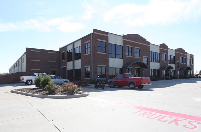
2900 Tucker St
Burlington, NC
Final Tucker Street Indus
120352
TUCKER STREET INDUSTRIAL LT 5 12-5C-32
Manufacturinglight
Alamance
X
North Carolina
3710886300K
5
2025
10.19 AC
2025
SW Alamance County
020801
Greensboro/Winston-Salem
65,000 SF
DEMOGRAPHICS near 2900 Tucker St
1 Mile
3 Mile
5 Mile
2024 Total Population
1,831
34,945
99,783
2029 Population
1,988
37,636
107,877
Pop Growth 2024-2029
+ 8.57%
+ 7.70%
+ 8.11%
Average Age
39
41
40
2024 Total Households
830
15,099
40,160
HH Growth 2024-2029
+ 8.80%
+ 7.83%
+ 8.33%
Median Household Inc
$49,714
$54,324
$53,805
Avg Household Size
2.20
2.20
2.30
2024 Avg HH Vehicles
2.00
2.00
2.00
Median Home Value
$144,723
$191,591
$192,195
Median Year Built
1980
1977
1982
Nearby Places
Map Layers
Map Styles
 Street
 Aerial
- Restaurants
- Banks
- Shops
- Fitness
- Groceries
PUBLIC TRANSPORTATION
COMMUTER RAIL
Burlington Station (Piedmont - North Carolina by Train (NC Train))
DRIVE
WALK
Distance
Burlington Station (Piedmont - North Carolina by Train (NC Train))
10 min
3.5 mi
AIRPORT
Piedmont Triad International
DRIVE
WALK
Distance
Piedmont Triad International
47 min
31.2 mi
Freight Ports
Virginia Port Authority - Richmond
DRIVE
WALK
Distance
Virginia Port Authority - Richmond
207 min
178.2 mi
Nearby Properties
Address
Land Use
TOTAL SIZE
Lot Size
Zoning
Address
Land Use
TOTAL SIZE
Lot Size
Zoning
350,000 SF
64.18 AC
O I
Address
Land Use
TOTAL SIZE
Lot Size
Zoning
2,315 SF
55.43 AC
I 1
Address
Land Use
TOTAL SIZE
Lot Size
Zoning
177,145 SF
47.79 AC
R 15
Address
Land Use
TOTAL SIZE
Lot Size
Zoning
41,892 SF
21.63 AC
CR
Address
Land Use
TOTAL SIZE
Lot Size
Zoning
10,368 SF
13.60 AC
MFA
Address
Land Use
TOTAL SIZE
Lot Size
Zoning
10,744 SF
24.60 AC
MF A
Address
Land Use
TOTAL SIZE
Lot Size
Zoning
27,803 SF
8.80 AC
CR
Address
Land Use
TOTAL SIZE
Lot Size
Zoning
12,600 SF
44.61 AC
Address
Land Use
TOTAL SIZE
Lot Size
Zoning
84,881 SF
52.87 AC
I1
Address
Land Use
TOTAL SIZE
Lot Size
Zoning
203,832 SF
36.10 AC
B 2
Address
Land Use
TOTAL SIZE
Lot Size
Zoning
10,384 SF
16.51 AC
B2
Address
Land Use
TOTAL SIZE
Lot Size
Zoning
14,760 SF
13.07 AC
MFA
Address
Land Use
TOTAL SIZE
Lot Size
Zoning
53,012 SF
18.58 AC
B 2
Address
Land Use
TOTAL SIZE
Lot Size
Zoning
90,767 SF
36.47 AC
I 1
Address
Land Use
TOTAL SIZE
Lot Size
Zoning
714,245 SF
109.43 AC
I 1
Address
Land Use
TOTAL SIZE
Lot Size
Zoning
80,865 SF
76.02 AC
I 1A
Address
Land Use
TOTAL SIZE
Lot Size
Zoning
110,612 SF
1 AC
B 3
Address
Land Use
TOTAL SIZE
Lot Size
Zoning
29,057 SF
10.99 AC
B2
Address
Land Use
TOTAL SIZE
Lot Size
Zoning
9,672 SF
10.77 AC
MF A
Address
Land Use
TOTAL SIZE
Lot Size
Zoning
43,680 SF
5.77 AC
Address
Land Use
TOTAL SIZE
Lot Size
Zoning
23,992 SF
25.66 AC
R 9
Address
Land Use
TOTAL SIZE
Lot Size
Zoning
370,000 SF
24.09 AC
B 2
Address
Land Use
TOTAL SIZE
Lot Size
Zoning
19,872 SF
9.80 AC
Address
Land Use
TOTAL SIZE
Lot Size
Zoning
31,585 SF
18.69 AC
MF A
Address
Land Use
TOTAL SIZE
Lot Size
Zoning
40,440 SF
23.57 AC
R 9
Address
Land Use
TOTAL SIZE
Lot Size
Zoning
55,500 SF
Address
Land Use
TOTAL SIZE
Lot Size
Zoning
101,469 SF
4.28 AC
CR
Address
Land Use
TOTAL SIZE
Lot Size
Zoning
30,000 SF
3.48 AC
R 15
Address
Land Use
TOTAL SIZE
Lot Size
Zoning
73,948 SF
Address
Land Use
TOTAL SIZE
Lot Size
Zoning
7,456 SF
346.75 AC
The World's #1 Commercial Real Estate Marketplace
Connect with us
© 2025 CoStar Group
The information above has been obtained from sources believed reliable. While we do not doubt its accuracy we have not verified it and make no guarantee, warranty or representation about it. It is your responsibility to independently confirm its accuracy and completeness. Any projections, opinions, assumptions, or estimates used are for example only and do not represent the current or future performance of the property. The value of this transaction to you depends on tax and other factors which should be evaluated by your tax, financial, and legal advisors. You and your advisors should conduct a careful, independent investigation of the property to determine to your satisfaction the suitability of the property for your needs.