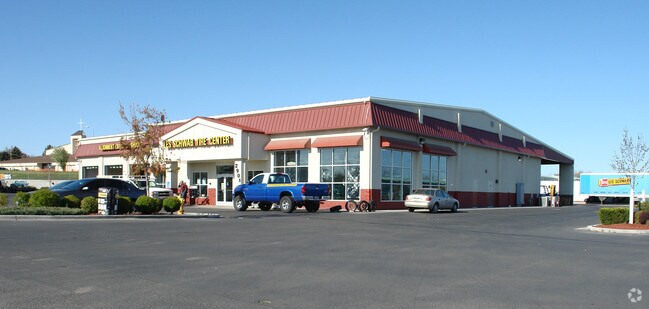
Property Record
2901 12Th Ave Rd, Nampa, ID 83686


NEARBY LISTINGS FOR SALE OR LEASE
Property Detail
2901 12Th Ave Rd
2923001400
04-2N-2W NE TX 19801 IN SENE
Commercialnec
Canyon
X
Idaho
16027C0390F
1.94 AC
2024
Nampa
2025
Boise City/Nampa
020907
Boise City, ID
13,100 SF
DEMOGRAPHICS near 2901 12Th Ave Rd
1 Mile
3 Mile
5 Mile
2024 Total Population
12,303
77,752
116,827
2029 Population
14,922
94,763
142,472
Pop Growth 2024-2029
+ 21.29%
+ 21.88%
+ 21.95%
Average Age
39
37
38
2024 Total Households
4,397
26,933
40,923
HH Growth 2024-2029
+ 21.63%
+ 22.18%
+ 22.26%
Median Household Inc
$67,731
$68,352
$65,040
Avg Household Size
2.70
2.80
2.80
2024 Avg HH Vehicles
2.00
2.00
2.00
Median Home Value
$339,981
$353,670
$353,264
Median Year Built
1998
1996
1996
Nearby Places
Map Layers
Map Styles
 Street
 Aerial
- Restaurants
- Banks
- Shops
- Fitness
- Groceries
PUBLIC TRANSPORTATION
AIRPORT
Boise Air Trml/Gowen Field
DRIVE
WALK
Distance
Boise Air Trml/Gowen Field
37 min
23.3 mi
Nearby Properties
Address
Land Use
TOTAL SIZE
Lot Size
Zoning
Address
Land Use
TOTAL SIZE
Lot Size
Zoning
44.21 AC
R1
Address
Land Use
TOTAL SIZE
Lot Size
Zoning
2.96 AC
Address
Land Use
TOTAL SIZE
Lot Size
Zoning
12.65 AC
Address
Land Use
TOTAL SIZE
Lot Size
Zoning
203,750 SF
21.20 AC
Address
Land Use
TOTAL SIZE
Lot Size
Zoning
2,184 SF
73.37 AC
Address
Land Use
TOTAL SIZE
Lot Size
Zoning
3.75 AC
Address
Land Use
TOTAL SIZE
Lot Size
Zoning
5.19 AC
Address
Land Use
TOTAL SIZE
Lot Size
Zoning
17.94 AC
Address
Land Use
TOTAL SIZE
Lot Size
Zoning
11.67 AC
Address
Land Use
TOTAL SIZE
Lot Size
Zoning
12.96 AC
Address
Land Use
TOTAL SIZE
Lot Size
Zoning
14.33 AC
RR
Address
Land Use
TOTAL SIZE
Lot Size
Zoning
6.85 AC
Address
Land Use
TOTAL SIZE
Lot Size
Zoning
0.81 AC
Address
Land Use
TOTAL SIZE
Lot Size
Zoning
2.90 AC
Address
Land Use
TOTAL SIZE
Lot Size
Zoning
12.15 AC
R1
Address
Land Use
TOTAL SIZE
Lot Size
Zoning
9.95 AC
RR
Address
Land Use
TOTAL SIZE
Lot Size
Zoning
4.79 AC
Address
Land Use
TOTAL SIZE
Lot Size
Zoning
2,100 SF
21.42 AC
Address
Land Use
TOTAL SIZE
Lot Size
Zoning
13.93 AC
Address
Land Use
TOTAL SIZE
Lot Size
Zoning
64,721 SF
1.35 AC
Address
Land Use
TOTAL SIZE
Lot Size
Zoning
13.39 AC
Address
Land Use
TOTAL SIZE
Lot Size
Zoning
5.02 AC
Address
Land Use
TOTAL SIZE
Lot Size
Zoning
12.55 AC
Address
Land Use
TOTAL SIZE
Lot Size
Zoning
43,038 SF
4.70 AC
Address
Land Use
TOTAL SIZE
Lot Size
Zoning
6.22 AC
Address
Land Use
TOTAL SIZE
Lot Size
Zoning
40,210 SF
2.98 AC
Address
Land Use
TOTAL SIZE
Lot Size
Zoning
9.97 AC
R1
Address
Land Use
TOTAL SIZE
Lot Size
Zoning
51,912 SF
5.20 AC
Address
Land Use
TOTAL SIZE
Lot Size
Zoning
8.49 AC
Address
Land Use
TOTAL SIZE
Lot Size
Zoning
0.80 AC
The World's #1 Commercial Real Estate Marketplace
Connect with us
© 2025 CoStar Group
The information above has been obtained from sources believed reliable. While we do not doubt its accuracy we have not verified it and make no guarantee, warranty or representation about it. It is your responsibility to independently confirm its accuracy and completeness. Any projections, opinions, assumptions, or estimates used are for example only and do not represent the current or future performance of the property. The value of this transaction to you depends on tax and other factors which should be evaluated by your tax, financial, and legal advisors. You and your advisors should conduct a careful, independent investigation of the property to determine to your satisfaction the suitability of the property for your needs.