Property Record
2901 Charles City Rd, Henrico, VA 23231
NEARBY LISTINGS FOR SALE OR LEASE
Property Detail
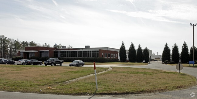
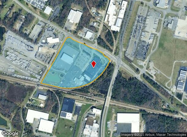
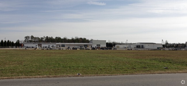
2901 Charles City Rd
818-707-5124
01830A0000 0013; CHARLES CITY AC 20.551 29 B1 37
Heavymanufacturing
Henrico
X
Virginia
51087C0230D
20.55 AC
0
Airport
2025
Richmond VA
201502
Richmond, VA
83,195 SF
DEMOGRAPHICS near 2901 Charles City Rd
1 Mile
3 Mile
5 Mile
2024 Total Population
240
27,245
86,235
2029 Population
237
27,158
87,203
Pop Growth 2024-2029
(1.25%)
(0.32%)
+ 1.12%
Average Age
41
39
40
2024 Total Households
106
11,009
36,237
HH Growth 2024-2029
(0.94%)
(0.34%)
+ 1.27%
Median Household Inc
$54,166
$56,864
$57,848
Avg Household Size
2.20
2.40
2.30
2024 Avg HH Vehicles
2.00
2.00
2.00
Median Home Value
$241,666
$185,656
$218,462
Median Year Built
1980
1982
1978
Nearby Places
Map Layers
Map Styles
 Street
 Aerial
- Restaurants
- Banks
- Shops
- Fitness
- Groceries
PUBLIC TRANSPORTATION
COMMUTER RAIL
DRIVE
WALK
Distance
13 min
7.9 mi
AIRPORT
Richmond International
DRIVE
WALK
Distance
Richmond International
9 min
3.8 mi
Freight Ports
Virginia Port Authority - Richmond
DRIVE
WALK
Distance
Virginia Port Authority - Richmond
18 min
10.3 mi
Nearby Properties
Address
Land Use
TOTAL SIZE
Lot Size
Zoning
Address
Land Use
TOTAL SIZE
Lot Size
Zoning
548,680 SF
2,298.89 AC
MIXE
Address
Land Use
TOTAL SIZE
Lot Size
Zoning
60,032 SF
62 AC
B-3C
Address
Land Use
TOTAL SIZE
Lot Size
Zoning
920,673 SF
99.01 AC
MIXE
Address
Land Use
TOTAL SIZE
Lot Size
Zoning
49,152 SF
31.21 AC
M-1
Address
Land Use
TOTAL SIZE
Lot Size
Zoning
15,894 SF
35.63 AC
A-1
Address
Land Use
TOTAL SIZE
Lot Size
Zoning
407,205 SF
286.12 AC
MIXE
Address
Land Use
TOTAL SIZE
Lot Size
Zoning
522,399 SF
58.07 AC
M-1
Address
Land Use
TOTAL SIZE
Lot Size
Zoning
190,000 SF
16.65 AC
R-5C
Address
Land Use
TOTAL SIZE
Lot Size
Zoning
446,500 SF
49.33 AC
M1-C
Address
Land Use
TOTAL SIZE
Lot Size
Zoning
186,390 SF
13.50 AC
R-5
Address
Land Use
TOTAL SIZE
Lot Size
Zoning
4,556 SF
8.76 AC
R-5C
Address
Land Use
TOTAL SIZE
Lot Size
Zoning
444,069 SF
23.82 AC
M-1
Address
Land Use
TOTAL SIZE
Lot Size
Zoning
173,637 SF
15.48 AC
R-5
Address
Land Use
TOTAL SIZE
Lot Size
Zoning
162,289 SF
35 AC
A-1
Address
Land Use
TOTAL SIZE
Lot Size
Zoning
322,000 SF
15.94 AC
M-1
Address
Land Use
TOTAL SIZE
Lot Size
Zoning
278,967 SF
26.07 AC
M1-C
Address
Land Use
TOTAL SIZE
Lot Size
Zoning
181,200 SF
14.74 AC
R-5
Address
Land Use
TOTAL SIZE
Lot Size
Zoning
146,560 SF
11.09 AC
R-5
Address
Land Use
TOTAL SIZE
Lot Size
Zoning
8,440 SF
8.27 AC
R-6
Address
Land Use
TOTAL SIZE
Lot Size
Zoning
179,359 SF
11.85 AC
M-1
Address
Land Use
TOTAL SIZE
Lot Size
Zoning
246,760 SF
59.70 AC
M-2C
Address
Land Use
TOTAL SIZE
Lot Size
Zoning
108,738 SF
6.39 AC
R-6
Address
Land Use
TOTAL SIZE
Lot Size
Zoning
241,800 SF
M-2C
Address
Land Use
TOTAL SIZE
Lot Size
Zoning
142,379 SF
17.69 AC
M-1
Address
Land Use
TOTAL SIZE
Lot Size
Zoning
76,208 SF
24.97 AC
B-3
Address
Land Use
TOTAL SIZE
Lot Size
Zoning
137,051 SF
16.39 AC
B-3C
Address
Land Use
TOTAL SIZE
Lot Size
Zoning
69,248 SF
5.24 AC
B-3C
Address
Land Use
TOTAL SIZE
Lot Size
Zoning
53,530 SF
4.50 AC
M-1C
Address
Land Use
TOTAL SIZE
Lot Size
Zoning
1,782 SF
400 AC
A-1
Address
Land Use
TOTAL SIZE
Lot Size
Zoning
202,560 SF
13.27 AC
M-1C
The World's #1 Commercial Real Estate Marketplace
Connect with us
© 2026 CoStar Group
The information above has been obtained from sources believed reliable. While we do not doubt its accuracy we have not verified it and make no guarantee, warranty or representation about it. It is your responsibility to independently confirm its accuracy and completeness. Any projections, opinions, assumptions, or estimates used are for example only and do not represent the current or future performance of the property. The value of this transaction to you depends on tax and other factors which should be evaluated by your tax, financial, and legal advisors. You and your advisors should conduct a careful, independent investigation of the property to determine to your satisfaction the suitability of the property for your needs.