Property Record
2901 Dougherty Ferry Rd, Saint Louis, MO 63122


Save to a Folder
{{folder.Name}}
{{folder.ListingIds.length}} Properties
{{folder.ListingIds.length}} Property
Create a New Folder
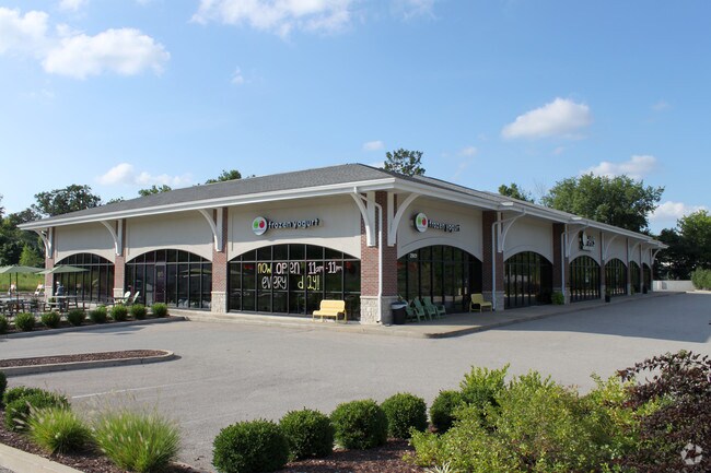
Property Detail
2901 Dougherty Ferry Rd
24P-24-0786
SHOPPES AT SEVEN OAKS (THE) LOT 4 & OUTLOTS 5 & 6 BDY ADJ LOT 6
Officebuilding
Saint Louis
58PDC
Missouri
C and X Area of minimal flood hazard, usually depicted on FIRMs as above the 500-year flood level.
4,6
2024
1.54 AC
2025
West County
218013
St. Louis
13,898 SF
St. Louis, MO-IL
NEARBY LISTINGS FOR SALE OR LEASE
DEMOGRAPHICS near 2901 Dougherty Ferry Rd
1 mile
3 mile
5 mile
2025 Total Population
8,502
56,835
157,990
2030 Population
8,326
55,960
155,788
Pop Growth 2025-2030
(2.07%)
(1.54%)
(1.39%)
Average Age
43
42
42
2025 Total Households
3,917
23,416
62,169
HH Growth 2025-2030
(2.09%)
(1.57%)
(1.43%)
Median Household Inc
$90,565
$111,694
$120,462
Avg Household Size
2.10
2.40
2.50
2025 Avg HH Vehicles
2.00
2.00
2.00
Median Home Value
$356,809
$360,354
$392,249
Median Year Built
1984
1979
1976
Nearby Places
Map Layers
Map Styles
 Street
 Aerial
Layers
 Traffic
 Biking
Places
Listings with unknown addresses are not visible on the map
- Restaurants
- Banks
- Shops
- Fitness
- Groceries
PUBLIC TRANSPORTATION
COMMUTER RAIL
Kirkwood Amtrak Station (Lincoln Service Missouri River Runner - Amtrak, Missouri River Runner - Amtrak)
Drive
Walk
Distance
Kirkwood Amtrak Station (Lincoln Service Missouri River Runner - Amtrak, Missouri River Runner - Amtrak)
11 min
4.7 mi
AIRPORT
St Louis Lambert International
Drive
Walk
Distance
St Louis Lambert International
29 min
20.4 mi
Freight Ports
Tulsa Port of Inola
Drive
Walk
Distance
Tulsa Port of Inola
405 min
368.1 mi
SALE & LEASE HISTORY
LISTING DATE
SALE/LEASE

Oct 23, 2020
For Lease
Jul 28, 2020
For Lease
Jan 30, 2024
For Lease
Feb 22, 2017
For Lease
Nearby Properties
Address
Land Use
TOTAL SIZE
Lot Size
Zoning
Address
Land Use
TOTAL SIZE
Lot Size
Zoning
429,212 SF
53.13 AC
C-8
Address
Land Use
TOTAL SIZE
Lot Size
Zoning
31,582 SF
77.77 AC
32R3
Address
Land Use
TOTAL SIZE
Lot Size
Zoning
670,149 SF
24.95 AC
17C-2
Address
Land Use
TOTAL SIZE
Lot Size
Zoning
96.62 AC
R3
Address
Land Use
TOTAL SIZE
Lot Size
Zoning
862,067 SF
40.98 AC
C-8
Address
Land Use
TOTAL SIZE
Lot Size
Zoning
476,802 SF
20.71 AC
32R3
Address
Land Use
TOTAL SIZE
Lot Size
Zoning
100,291 SF
569.29 AC
PS
Address
Land Use
TOTAL SIZE
Lot Size
Zoning
600,516 SF
4.27 AC
17C-3
Address
Land Use
TOTAL SIZE
Lot Size
Zoning
228,889 SF
43.21 AC
A
Address
Land Use
TOTAL SIZE
Lot Size
Zoning
256,956 SF
23.68 AC
21IP-1
Address
Land Use
TOTAL SIZE
Lot Size
Zoning
302,449 SF
11.44 AC
NU
Address
Land Use
TOTAL SIZE
Lot Size
Zoning
534,280 SF
23.37 AC
21IP-1
Address
Land Use
TOTAL SIZE
Lot Size
Zoning
223,541 SF
6.52 AC
17C-3
Address
Land Use
TOTAL SIZE
Lot Size
Zoning
474,239 SF
34.85 AC
R4
Address
Land Use
TOTAL SIZE
Lot Size
Zoning
415,744 SF
62.46 AC
M3
Address
Land Use
TOTAL SIZE
Lot Size
Zoning
105.49 AC
Address
Land Use
TOTAL SIZE
Lot Size
Zoning
233,381 SF
4.45 AC
C-8
Address
Land Use
TOTAL SIZE
Lot Size
Zoning
142,603 SF
1.37 AC
C-8
Address
Land Use
TOTAL SIZE
Lot Size
Zoning
183,445 SF
6.82 AC
NU
Address
Land Use
TOTAL SIZE
Lot Size
Zoning
284,400 SF
10.72 AC
55RSING
Address
Land Use
TOTAL SIZE
Lot Size
Zoning
460,421 SF
34.91 AC
21BP-2
Address
Land Use
TOTAL SIZE
Lot Size
Zoning
194,252 SF
10.66 AC
21IP-1
Address
Land Use
TOTAL SIZE
Lot Size
Zoning
144,773 SF
10.99 AC
17C-5
Address
Land Use
TOTAL SIZE
Lot Size
Zoning
68,441 SF
26.01 AC
58PDC
Address
Land Use
TOTAL SIZE
Lot Size
Zoning
19.25 AC
55INSTU
Address
Land Use
TOTAL SIZE
Lot Size
Zoning
117.18 AC
FPPS
Address
Land Use
TOTAL SIZE
Lot Size
Zoning
112,840 SF
0.54 AC
C-8
Address
Land Use
TOTAL SIZE
Lot Size
Zoning
159,696 SF
10.52 AC
21IP-1
Address
Land Use
TOTAL SIZE
Lot Size
Zoning
157,584 SF
13.60 AC
21IP-1
Address
Land Use
TOTAL SIZE
Lot Size
Zoning
10.41 AC
21IP-1
The World's #1 Commercial Real Estate Marketplace
Connect with us
© 2026 CoStar Group
The information above has been obtained from sources believed reliable. While we do not doubt its accuracy we have not verified it and make no guarantee, warranty or representation about it. It is your responsibility to independently confirm its accuracy and completeness. Any projections, opinions, assumptions, or estimates used are for example only and do not represent the current or future performance of the property. The value of this transaction to you depends on tax and other factors which should be evaluated by your tax, financial, and legal advisors. You and your advisors should conduct a careful, independent investigation of the property to determine to your satisfaction the suitability of the property for your needs.