Property Record
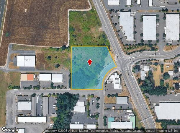
2901 E 9Th St, Newberg, OR 97132
Property Detail
2901 E 9Th St
Portland-Vancouver-Hillsboro, OR-WA
Partition Plat 2005-47
532219
PARCEL 1 PARTITION P2005-47
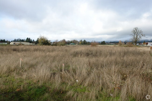
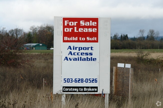
Industrialacreage
Yamhill
X
Oregon
41067C0600E
1
2025
3.24 AC
2025
Yamhill County
0302023022
Portland
NEARBY LISTINGS FOR SALE OR LEASE
DEMOGRAPHICS near 2901 E 9Th St
1 mile
3 mile
5 mile
2024 Total Population
8,607
34,342
40,945
2029 Population
8,899
35,821
42,436
Pop Growth 2024-2029
+ 3.39%
+ 4.31%
+ 3.64%
Average Age
39
39
40
2024 Total Households
3,275
12,382
14,751
HH Growth 2024-2029
+ 3.54%
+ 4.52%
+ 3.84%
Median Household Inc
$76,202
$86,416
$89,010
Avg Household Size
2.60
2.60
2.60
2024 Avg HH Vehicles
2.00
2.00
2.00
Median Home Value
$413,830
$430,985
$455,006
Median Year Built
1998
1994
1992
Nearby Places
Map Layers
Map Styles
 Street
 Aerial
Transit
 Traffic
 Biking
Places
Listings with unknown addresses are not visible on the map
- Restaurants
- Banks
- Shops
- Fitness
- Groceries
PUBLIC TRANSPORTATION
AIRPORT
Portland International
Drive
Walk
Distance
Portland International
57 min
34.6 mi
Freight Ports
Port of Portland
Drive
Walk
Distance
Port of Portland
43 min
25.8 mi
Nearby Properties
Address
Land Use
TOTAL SIZE
Lot Size
Zoning
Address
Land Use
TOTAL SIZE
Lot Size
Zoning
Address
Land Use
TOTAL SIZE
Lot Size
Zoning
30.70 AC
SD/H
Address
Land Use
TOTAL SIZE
Lot Size
Zoning
4,630 SF
4.72 AC
R-2
Address
Land Use
TOTAL SIZE
Lot Size
Zoning
72 AC
R-1
Address
Land Use
TOTAL SIZE
Lot Size
Zoning
16.49 AC
I
Address
Land Use
TOTAL SIZE
Lot Size
Zoning
17.18 AC
C-2
Address
Land Use
TOTAL SIZE
Lot Size
Zoning
Address
Land Use
TOTAL SIZE
Lot Size
Zoning
3,020 SF
6.66 AC
I
Address
Land Use
TOTAL SIZE
Lot Size
Zoning
936 SF
7.67 AC
VLDR-1
Address
Land Use
TOTAL SIZE
Lot Size
Zoning
1,728 SF
6.39 AC
R-1
Address
Land Use
TOTAL SIZE
Lot Size
Zoning
16.84 AC
R-1
Address
Land Use
TOTAL SIZE
Lot Size
Zoning
4.96 AC
R-P/SP
Address
Land Use
TOTAL SIZE
Lot Size
Zoning
17.90 AC
M-1
Address
Land Use
TOTAL SIZE
Lot Size
Zoning
4.97 AC
R-P/SP
Address
Land Use
TOTAL SIZE
Lot Size
Zoning
3.65 AC
R-P/SP
Address
Land Use
TOTAL SIZE
Lot Size
Zoning
18.91 AC
M-1
Address
Land Use
TOTAL SIZE
Lot Size
Zoning
2,049 SF
3.21 AC
R-1
Address
Land Use
TOTAL SIZE
Lot Size
Zoning
9.96 AC
C-2
Address
Land Use
TOTAL SIZE
Lot Size
Zoning
14.21 AC
R-P/SP
Address
Land Use
TOTAL SIZE
Lot Size
Zoning
1.53 AC
R-P/SP
Address
Land Use
TOTAL SIZE
Lot Size
Zoning
2.99 AC
R-P/SP
Address
Land Use
TOTAL SIZE
Lot Size
Zoning
6.50 AC
M-1
Address
Land Use
TOTAL SIZE
Lot Size
Zoning
4.19 AC
C2
Address
Land Use
TOTAL SIZE
Lot Size
Zoning
Address
Land Use
TOTAL SIZE
Lot Size
Zoning
6.70 AC
I
Address
Land Use
TOTAL SIZE
Lot Size
Zoning
14.28 AC
R-2
Address
Land Use
TOTAL SIZE
Lot Size
Zoning
5.67 AC
M-2
Address
Land Use
TOTAL SIZE
Lot Size
Zoning
0.47 AC
I
Address
Land Use
TOTAL SIZE
Lot Size
Zoning
4,578 SF
38.05 AC
I
Address
Land Use
TOTAL SIZE
Lot Size
Zoning
12 AC
M-1
The World's #1 Commercial Real Estate Marketplace
Connect with us
© 2026 CoStar Group
The information above has been obtained from sources believed reliable. While we do not doubt its accuracy we have not verified it and make no guarantee, warranty or representation about it. It is your responsibility to independently confirm its accuracy and completeness. Any projections, opinions, assumptions, or estimates used are for example only and do not represent the current or future performance of the property. The value of this transaction to you depends on tax and other factors which should be evaluated by your tax, financial, and legal advisors. You and your advisors should conduct a careful, independent investigation of the property to determine to your satisfaction the suitability of the property for your needs.