Property Record
2901 Edgely Rd, Levittown, PA 19057


NEARBY LISTINGS FOR SALE OR LEASE
-
-
View all Levittown listings for sale on LoopNet.com
Property Detail
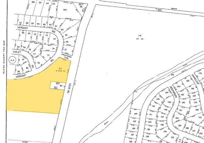
2901 Edgely Rd
05-042-084
Violetwood Sec 38-A
Publicschool
9.44AC EXEMPT
AE
Bucks
42017C0463K
Pennsylvania
0
9.44 AC
2025
Lower Bucks County
100402
Philadelphia
16,125 SF
Philadelphia-Camden-Wilmington, PA-NJ-DE-MD
DEMOGRAPHICS near 2901 Edgely Rd
1 mile
3 mile
5 mile
2024 Total Population
13,194
91,244
192,109
2029 Population
13,111
90,742
191,913
Pop Growth 2024-2029
(0.63%)
(0.55%)
(0.10%)
Average Age
41
41
42
2024 Total Households
4,748
34,134
72,509
HH Growth 2024-2029
(0.70%)
(0.60%)
(0.11%)
Median Household Inc
$89,446
$85,380
$88,988
Avg Household Size
2.70
2.60
2.60
2024 Avg HH Vehicles
2.00
2.00
2.00
Median Home Value
$240,536
$261,544
$281,300
Median Year Built
1955
1956
1962
Nearby Places
Map Layers
Map Styles
 Street
 Aerial
Transit
 Traffic
 Biking
Places
Listings with unknown addresses are not visible on the map
- Restaurants
- Banks
- Shops
- Fitness
- Groceries
PUBLIC TRANSPORTATION
COMMUTER RAIL
Levittown (R7 - Southeastern Pennsylvania Transportation Authority Regional Rail (SEPTA Regional Rail))
Drive
Walk
Distance
Levittown (R7 - Southeastern Pennsylvania Transportation Authority Regional Rail (SEPTA Regional Rail))
5 min
2.2 mi
Bristol (R7 - Southeastern Pennsylvania Transportation Authority Regional Rail (SEPTA Regional Rail))
Drive
Walk
Distance
Bristol (R7 - Southeastern Pennsylvania Transportation Authority Regional Rail (SEPTA Regional Rail))
7 min
3.2 mi
AIRPORT
Trenton Mercer
Drive
Walk
Distance
Trenton Mercer
24 min
13.7 mi
Philadelphia International
Drive
Walk
Distance
Philadelphia International
53 min
34.9 mi
Freight Ports
Port of Philadelphia
Drive
Walk
Distance
Port of Philadelphia
33 min
21.2 mi
Nearby Properties
Address
Land Use
TOTAL SIZE
Lot Size
Zoning
Address
Land Use
TOTAL SIZE
Lot Size
Zoning
65.99 AC
Address
Land Use
TOTAL SIZE
Lot Size
Zoning
22,300 SF
59.13 AC
Address
Land Use
TOTAL SIZE
Lot Size
Zoning
16,960 SF
107.84 AC
Address
Land Use
TOTAL SIZE
Lot Size
Zoning
486,812 SF
44.42 AC
Address
Land Use
TOTAL SIZE
Lot Size
Zoning
Address
Land Use
TOTAL SIZE
Lot Size
Zoning
Address
Land Use
TOTAL SIZE
Lot Size
Zoning
Address
Land Use
TOTAL SIZE
Lot Size
Zoning
27.99 AC
Address
Land Use
TOTAL SIZE
Lot Size
Zoning
Address
Land Use
TOTAL SIZE
Lot Size
Zoning
6.08 AC
Address
Land Use
TOTAL SIZE
Lot Size
Zoning
131,702 SF
10.21 AC
Address
Land Use
TOTAL SIZE
Lot Size
Zoning
29 AC
I-2
Address
Land Use
TOTAL SIZE
Lot Size
Zoning
18.15 AC
I-2
Address
Land Use
TOTAL SIZE
Lot Size
Zoning
32.60 AC
Address
Land Use
TOTAL SIZE
Lot Size
Zoning
Address
Land Use
TOTAL SIZE
Lot Size
Zoning
1.15 AC
Address
Land Use
TOTAL SIZE
Lot Size
Zoning
Address
Land Use
TOTAL SIZE
Lot Size
Zoning
150,000 SF
64 AC
HR
Address
Land Use
TOTAL SIZE
Lot Size
Zoning
5.44 AC
Address
Land Use
TOTAL SIZE
Lot Size
Zoning
25.24 AC
Address
Land Use
TOTAL SIZE
Lot Size
Zoning
40.30 AC
Address
Land Use
TOTAL SIZE
Lot Size
Zoning
27,147 SF
8.18 AC
Address
Land Use
TOTAL SIZE
Lot Size
Zoning
50.71 AC
Address
Land Use
TOTAL SIZE
Lot Size
Zoning
4.02 AC
Address
Land Use
TOTAL SIZE
Lot Size
Zoning
150,000 SF
21.46 AC
R3
Address
Land Use
TOTAL SIZE
Lot Size
Zoning
528,000 SF
74.88 AC
Address
Land Use
TOTAL SIZE
Lot Size
Zoning
163,209 SF
23.23 AC
HC
Address
Land Use
TOTAL SIZE
Lot Size
Zoning
10,464 SF
12.80 AC
I-2
Address
Land Use
TOTAL SIZE
Lot Size
Zoning
132,780 SF
11.09 AC
R3
Address
Land Use
TOTAL SIZE
Lot Size
Zoning
125,307 SF
31.79 AC
VC
The World's #1 Commercial Real Estate Marketplace
Connect with us
© 2026 CoStar Group
The information above has been obtained from sources believed reliable. While we do not doubt its accuracy we have not verified it and make no guarantee, warranty or representation about it. It is your responsibility to independently confirm its accuracy and completeness. Any projections, opinions, assumptions, or estimates used are for example only and do not represent the current or future performance of the property. The value of this transaction to you depends on tax and other factors which should be evaluated by your tax, financial, and legal advisors. You and your advisors should conduct a careful, independent investigation of the property to determine to your satisfaction the suitability of the property for your needs.