Property Record
2901 Mahoning Rd Ne, Canton, OH 44705


Property Detail
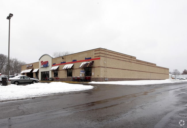
2901 Mahoning Rd Ne
10001425
OL 1335 - 1.97A
Regionalshoppingcenterormallwithanchorstore
STARK
B and X Area of moderate flood hazard, usually the area between the limits of the 100-year and 500-year floods.
Ohio
0
1.97 AC
2025
Stark County
700200
Cleveland
21,920 SF
Canton-Massillon, OH
NEARBY LISTINGS FOR SALE OR LEASE
DEMOGRAPHICS near 2901 Mahoning Rd Ne
1 mile
3 mile
5 mile
2025 Total Population
6,839
57,356
129,000
2030 Population
6,839
57,556
128,790
Pop Growth 2025-2030
0.00%
+ 0.35%
(0.16%)
Average Age
39
40
41
2025 Total Households
2,774
24,281
54,530
HH Growth 2025-2030
0.00%
+ 0.27%
(0.21%)
Median Household Inc
$37,531
$45,540
$52,635
Avg Household Size
2.40
2.20
2.20
2025 Avg HH Vehicles
1.00
2.00
2.00
Median Home Value
$56,164
$110,401
$150,316
Median Year Built
1951
1952
1956
Nearby Places
Map Layers
Map Styles
 Street
 Aerial
Transit
 Traffic
 Biking
Places
Listings with unknown addresses are not visible on the map
- Restaurants
- Banks
- Shops
- Fitness
- Groceries
PUBLIC TRANSPORTATION
AIRPORT
Akron-Canton Regional
Drive
Walk
Distance
Akron-Canton Regional
18 min
12.2 mi
Freight Ports
Port of Toledo
Drive
Walk
Distance
Port of Toledo
189 min
159.4 mi
SALE & LEASE HISTORY
LISTING DATE
SALE/LEASE

May 12, 2021
For Lease
Nearby Properties
Address
Land Use
TOTAL SIZE
Lot Size
Zoning
Address
Land Use
TOTAL SIZE
Lot Size
Zoning
521,112 SF
14.28 AC
Address
Land Use
TOTAL SIZE
Lot Size
Zoning
91.83 AC
Address
Land Use
TOTAL SIZE
Lot Size
Zoning
272,327 SF
23.62 AC
Address
Land Use
TOTAL SIZE
Lot Size
Zoning
272,888 SF
27.61 AC
Address
Land Use
TOTAL SIZE
Lot Size
Zoning
327,119 SF
50.74 AC
Address
Land Use
TOTAL SIZE
Lot Size
Zoning
1,069,826 SF
158.31 AC
Address
Land Use
TOTAL SIZE
Lot Size
Zoning
118,619 SF
2.14 AC
Address
Land Use
TOTAL SIZE
Lot Size
Zoning
423,783 SF
26.11 AC
Address
Land Use
TOTAL SIZE
Lot Size
Zoning
476,634 SF
15.08 AC
Address
Land Use
TOTAL SIZE
Lot Size
Zoning
316,099 SF
8.47 AC
Address
Land Use
TOTAL SIZE
Lot Size
Zoning
82,950 SF
Address
Land Use
TOTAL SIZE
Lot Size
Zoning
158,390 SF
0.92 AC
Address
Land Use
TOTAL SIZE
Lot Size
Zoning
1,096,089 SF
144.96 AC
Address
Land Use
TOTAL SIZE
Lot Size
Zoning
180,088 SF
71.80 AC
Address
Land Use
TOTAL SIZE
Lot Size
Zoning
0.35 AC
Address
Land Use
TOTAL SIZE
Lot Size
Zoning
59,211 SF
3.53 AC
Address
Land Use
TOTAL SIZE
Lot Size
Zoning
57,852 SF
3.32 AC
Address
Land Use
TOTAL SIZE
Lot Size
Zoning
227,370 SF
0.77 AC
Address
Land Use
TOTAL SIZE
Lot Size
Zoning
57,075 SF
4.25 AC
Address
Land Use
TOTAL SIZE
Lot Size
Zoning
153,834 SF
20.21 AC
Address
Land Use
TOTAL SIZE
Lot Size
Zoning
227,370 SF
0.77 AC
Address
Land Use
TOTAL SIZE
Lot Size
Zoning
124,758 SF
6.22 AC
Address
Land Use
TOTAL SIZE
Lot Size
Zoning
217,695 SF
19.46 AC
Address
Land Use
TOTAL SIZE
Lot Size
Zoning
135,840 SF
21 AC
Address
Land Use
TOTAL SIZE
Lot Size
Zoning
58,021 SF
13.25 AC
Address
Land Use
TOTAL SIZE
Lot Size
Zoning
52,876 SF
4.96 AC
Address
Land Use
TOTAL SIZE
Lot Size
Zoning
73,890 SF
0.77 AC
Address
Land Use
TOTAL SIZE
Lot Size
Zoning
118,052 SF
12.52 AC
Address
Land Use
TOTAL SIZE
Lot Size
Zoning
148,588 SF
1.33 AC
Address
Land Use
TOTAL SIZE
Lot Size
Zoning
63,810 SF
0.44 AC
The World's #1 Commercial Real Estate Marketplace
Connect with us
© 2026 CoStar Group
The information above has been obtained from sources believed reliable. While we do not doubt its accuracy we have not verified it and make no guarantee, warranty or representation about it. It is your responsibility to independently confirm its accuracy and completeness. Any projections, opinions, assumptions, or estimates used are for example only and do not represent the current or future performance of the property. The value of this transaction to you depends on tax and other factors which should be evaluated by your tax, financial, and legal advisors. You and your advisors should conduct a careful, independent investigation of the property to determine to your satisfaction the suitability of the property for your needs.