Property Record
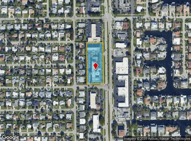
2901 N Federal Hwy, Boca Raton, FL 33431

Current Lease Availabilities
NEARBY LISTINGS FOR SALE OR LEASE
Property Detail
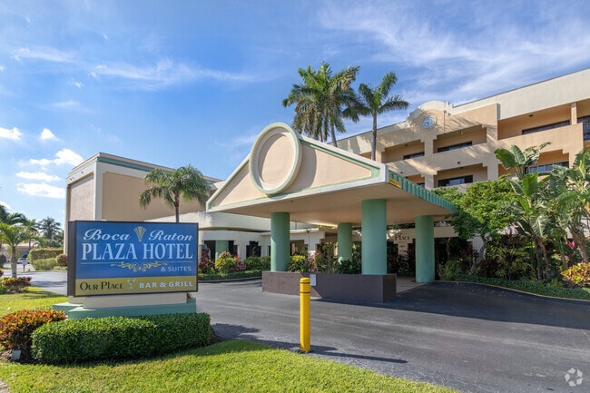
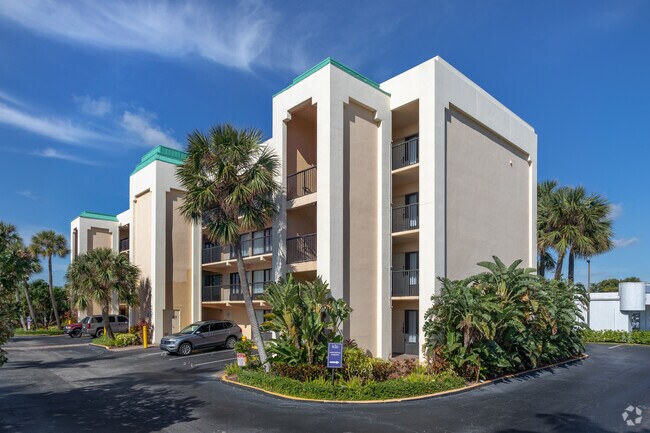
2901 N Federal Hwy
06-43-47-17-37-001-0020
King David Kosher Hotel Condo
Resorthotel
KING DAVID KOSHER HOTEL COND COMMERCIAL UNIT 2 BLDG A
X
Palm Beach
12099C0989G
Florida
2024
1.96 AC
2024
Boca Raton
007302
South Florida
579 SF
West Palm Beach-Boca Raton-Delray Beach, FL
DEMOGRAPHICS near 2901 N Federal Hwy
1 Mile
3 Mile
5 Mile
2024 Total Population
13,810
75,105
183,807
2029 Population
14,936
80,469
193,520
Pop Growth 2024-2029
+ 8.15%
+ 7.14%
+ 5.28%
Average Age
51
46
47
2024 Total Households
6,717
33,315
82,836
HH Growth 2024-2029
+ 8.59%
+ 7.73%
+ 5.47%
Median Household Inc
$97,641
$91,986
$83,251
Avg Household Size
1.90
2.00
2.10
2024 Avg HH Vehicles
2.00
2.00
2.00
Median Home Value
$584,404
$614,972
$515,214
Median Year Built
1980
1984
1983
Nearby Places
- Restaurants
- Banks
- Shops
- Fitness
- Groceries
PUBLIC TRANSPORTATION
COMMUTER RAIL
Boca Raton (Mainline - Brightline)
DRIVE
WALK
Distance
Boca Raton (Mainline - Brightline)
4 min
2.2 mi
Boca Raton (Tri-County Commuter - South Florida Regional Transportation Authority (Tri-Rail))
DRIVE
WALK
Distance
Boca Raton (Tri-County Commuter - South Florida Regional Transportation Authority (Tri-Rail))
7 min
3.2 mi
AIRPORT
Palm Beach International
DRIVE
WALK
Distance
Palm Beach International
34 min
24.7 mi
Fort Lauderdale/Hollywood International
DRIVE
WALK
Distance
Fort Lauderdale/Hollywood International
37 min
27.2 mi
Freight Ports
Port Everglades
DRIVE
WALK
Distance
Port Everglades
36 min
25.9 mi
Nearby Properties
Address
Land Use
TOTAL SIZE
Lot Size
Zoning
Address
Land Use
TOTAL SIZE
Lot Size
Zoning
2,250,267 SF
260 AC
PL
Address
Land Use
TOTAL SIZE
Lot Size
Zoning
1,481,767 SF
34.49 AC
R-5
Address
Land Use
TOTAL SIZE
Lot Size
Zoning
2,361,481 SF
120.60 AC
PL
Address
Land Use
TOTAL SIZE
Lot Size
Zoning
1,949,101 SF
123.29 AC
LIRP
Address
Land Use
TOTAL SIZE
Lot Size
Zoning
779,243 SF
267.19 AC
PL
Address
Land Use
TOTAL SIZE
Lot Size
Zoning
501,966 SF
5.82 AC
R1D/DDRI
Address
Land Use
TOTAL SIZE
Lot Size
Zoning
505,418 SF
1.98 AC
DDRI
Address
Land Use
TOTAL SIZE
Lot Size
Zoning
547,946 SF
13.89 AC
DDRI
Address
Land Use
TOTAL SIZE
Lot Size
Zoning
467,728 SF
18.73 AC
LIRP PMD
Address
Land Use
TOTAL SIZE
Lot Size
Zoning
437,556 SF
11.50 AC
LIRP PMD
Address
Land Use
TOTAL SIZE
Lot Size
Zoning
388,471 SF
12.42 AC
R5A-PUD
Address
Land Use
TOTAL SIZE
Lot Size
Zoning
373,856 SF
4.12 AC
LIRP PMD
Address
Land Use
TOTAL SIZE
Lot Size
Zoning
435,852 SF
17.38 AC
VC
Address
Land Use
TOTAL SIZE
Lot Size
Zoning
360,718 SF
3.67 AC
LIRP PMD
Address
Land Use
TOTAL SIZE
Lot Size
Zoning
760,812 SF
23.60 AC
MC
Address
Land Use
TOTAL SIZE
Lot Size
Zoning
293,358 SF
9.05 AC
LIRP PMD
Address
Land Use
TOTAL SIZE
Lot Size
Zoning
350,010 SF
8.36 AC
R-3-B
Address
Land Use
TOTAL SIZE
Lot Size
Zoning
380,823 SF
23.10 AC
LIRP PMD
Address
Land Use
TOTAL SIZE
Lot Size
Zoning
275,784 SF
2.27 AC
DDRI
Address
Land Use
TOTAL SIZE
Lot Size
Zoning
267,063 SF
2.33 AC
DDRI
Address
Land Use
TOTAL SIZE
Lot Size
Zoning
377,672 SF
35.64 AC
PL
Address
Land Use
TOTAL SIZE
Lot Size
Zoning
259,054 SF
14.95 AC
POI
Address
Land Use
TOTAL SIZE
Lot Size
Zoning
240,841 SF
2.08 AC
DDRI
Address
Land Use
TOTAL SIZE
Lot Size
Zoning
228,097 SF
10.63 AC
M-2
Address
Land Use
TOTAL SIZE
Lot Size
Zoning
299,038 SF
11.78 AC
POI*
Address
Land Use
TOTAL SIZE
Lot Size
Zoning
344,341 SF
1.86 AC
DDRI
Address
Land Use
TOTAL SIZE
Lot Size
Zoning
230,420 SF
2.64 AC
DDRI
Address
Land Use
TOTAL SIZE
Lot Size
Zoning
21.75 AC
PL
Address
Land Use
TOTAL SIZE
Lot Size
Zoning
214,166 SF
9.10 AC
LIRP PMD
Address
Land Use
TOTAL SIZE
Lot Size
Zoning
194,972 SF
48.62 AC
PL
The World's #1 Commercial Real Estate Marketplace
Connect with us
© 2025 CoStar Group
The information above has been obtained from sources believed reliable. While we do not doubt its accuracy we have not verified it and make no guarantee, warranty or representation about it. It is your responsibility to independently confirm its accuracy and completeness. Any projections, opinions, assumptions, or estimates used are for example only and do not represent the current or future performance of the property. The value of this transaction to you depends on tax and other factors which should be evaluated by your tax, financial, and legal advisors. You and your advisors should conduct a careful, independent investigation of the property to determine to your satisfaction the suitability of the property for your needs.