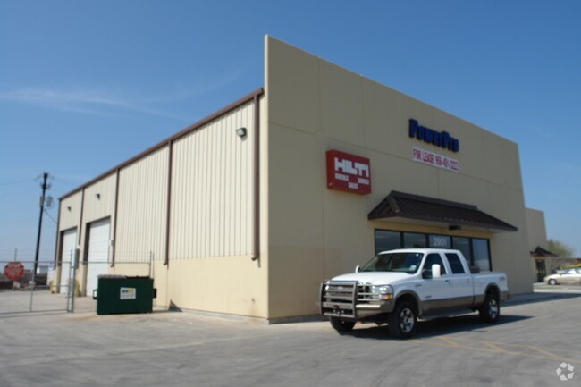
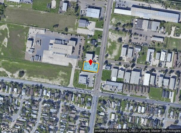
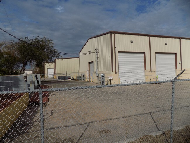
Property Record
2901 N Sugar Rd, Pharr, TX 78577
NEARBY LISTINGS FOR SALE OR LEASE
Property Detail
2901 N Sugar Rd
McAllen/Edinburg/Pharr
Trison
McAllen-Edinburg-Mission, TX
TRISON LOT 2
T7645-00-000-0002-00
Hidalgo
Commercialnec
Texas
2024
2
2025
0.40 AC
021704
Pharr
3,120 SF
DEMOGRAPHICS near 2901 N Sugar Rd
1 Mile
3 Mile
5 Mile
2024 Total Population
11,862
107,435
260,037
2029 Population
12,519
114,264
274,867
Pop Growth 2024-2029
+ 5.54%
+ 6.36%
+ 5.70%
Average Age
33
36
36
2024 Total Households
3,795
36,903
84,936
HH Growth 2024-2029
+ 5.48%
+ 6.38%
+ 5.72%
Median Household Inc
$45,707
$49,052
$49,587
Avg Household Size
3.00
2.80
3.00
2024 Avg HH Vehicles
2.00
2.00
2.00
Median Home Value
$131,537
$130,386
$140,948
Median Year Built
2002
1995
1996
Nearby Places
Map Layers
Map Styles
 Street
 Aerial
- Restaurants
- Banks
- Shops
- Fitness
- Groceries
PUBLIC TRANSPORTATION
AIRPORT
McAllen International
DRIVE
WALK
Distance
McAllen International
9 min
5.1 mi
Freight Ports
Port of Brownsville
DRIVE
WALK
Distance
Port of Brownsville
65 min
57.9 mi
SALE & LEASE HISTORY
LISTING DATE
SALE/LEASE

Sep 25, 2016
For Lease
Sep 24, 2016
For Sale
Mar 14, 2019
For Sale
Nearby Properties
Address
Land Use
TOTAL SIZE
Lot Size
Zoning
Address
Land Use
TOTAL SIZE
Lot Size
Zoning
543,452 SF
53.23 AC
CO
Address
Land Use
TOTAL SIZE
Lot Size
Zoning
27.19 AC
Address
Land Use
TOTAL SIZE
Lot Size
Zoning
407,190 SF
11.04 AC
CO
Address
Land Use
TOTAL SIZE
Lot Size
Zoning
357,818 SF
11.10 AC
Address
Land Use
TOTAL SIZE
Lot Size
Zoning
390,048 SF
30.30 AC
Address
Land Use
TOTAL SIZE
Lot Size
Zoning
1 SF
9.36 AC
Address
Land Use
TOTAL SIZE
Lot Size
Zoning
252,435 SF
9.09 AC
Address
Land Use
TOTAL SIZE
Lot Size
Zoning
1 SF
39.94 AC
CO
Address
Land Use
TOTAL SIZE
Lot Size
Zoning
7.50 AC
Address
Land Use
TOTAL SIZE
Lot Size
Zoning
202,204 SF
19.43 AC
Address
Land Use
TOTAL SIZE
Lot Size
Zoning
15,542 SF
34.23 AC
Address
Land Use
TOTAL SIZE
Lot Size
Zoning
140,904 SF
33.98 AC
Address
Land Use
TOTAL SIZE
Lot Size
Zoning
254,477 SF
51.88 AC
Address
Land Use
TOTAL SIZE
Lot Size
Zoning
79,150 SF
10.24 AC
Address
Land Use
TOTAL SIZE
Lot Size
Zoning
210,263 SF
37.52 AC
Address
Land Use
TOTAL SIZE
Lot Size
Zoning
123,548 SF
10.70 AC
Address
Land Use
TOTAL SIZE
Lot Size
Zoning
135,948 SF
2.87 AC
Address
Land Use
TOTAL SIZE
Lot Size
Zoning
173,217 SF
5.58 AC
Address
Land Use
TOTAL SIZE
Lot Size
Zoning
121,353 SF
4.59 AC
Address
Land Use
TOTAL SIZE
Lot Size
Zoning
13,632 SF
17 AC
Address
Land Use
TOTAL SIZE
Lot Size
Zoning
66,605 SF
10.05 AC
Address
Land Use
TOTAL SIZE
Lot Size
Zoning
16.83 AC
CO
Address
Land Use
TOTAL SIZE
Lot Size
Zoning
208,104 SF
15.65 AC
Address
Land Use
TOTAL SIZE
Lot Size
Zoning
108,527 SF
1.49 AC
Address
Land Use
TOTAL SIZE
Lot Size
Zoning
1 SF
7.79 AC
Address
Land Use
TOTAL SIZE
Lot Size
Zoning
82,724 SF
3.27 AC
Address
Land Use
TOTAL SIZE
Lot Size
Zoning
67,995 SF
21.10 AC
Address
Land Use
TOTAL SIZE
Lot Size
Zoning
143,400 SF
9.36 AC
Address
Land Use
TOTAL SIZE
Lot Size
Zoning
82,448 SF
4.36 AC
Address
Land Use
TOTAL SIZE
Lot Size
Zoning
78,524 SF
3.83 AC
The World's #1 Commercial Real Estate Marketplace
Connect with us
© 2025 CoStar Group
The information above has been obtained from sources believed reliable. While we do not doubt its accuracy we have not verified it and make no guarantee, warranty or representation about it. It is your responsibility to independently confirm its accuracy and completeness. Any projections, opinions, assumptions, or estimates used are for example only and do not represent the current or future performance of the property. The value of this transaction to you depends on tax and other factors which should be evaluated by your tax, financial, and legal advisors. You and your advisors should conduct a careful, independent investigation of the property to determine to your satisfaction the suitability of the property for your needs.