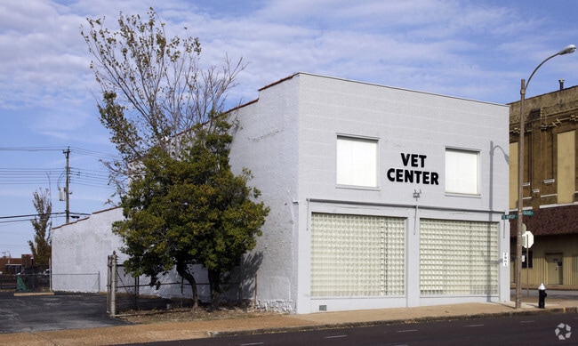
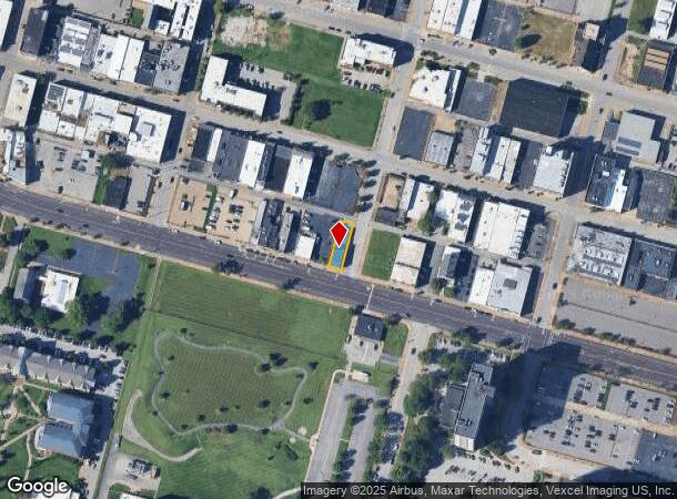
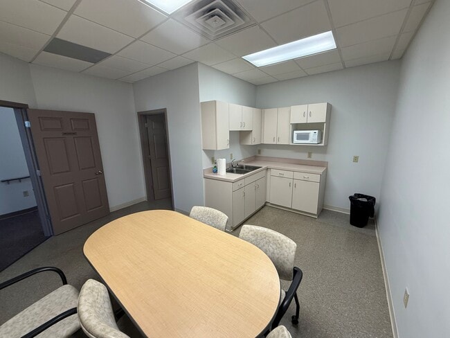
Property Record
2901 Olive St, Saint Louis, MO 63103
Current Lease Availabilities
NEARBY LISTINGS FOR SALE OR LEASE
Property Detail
2901 Olive St
St. Louis, MO-IL
Stoddard Addn
1014-00-0110-0
C.B. 1014 OLIVE ST 34 FT 9 IN X 134 FT 8 IN STODDARD ADDN BLOCK 49 LOT 1
Commercialnec
St. Louis City
X
Missouri
2903850063C
1
2024
0.11 AC
2025
St Louis City North
127800
St. Louis
5,896 SF
DEMOGRAPHICS near 2901 Olive St
1 Mile
3 Mile
5 Mile
2024 Total Population
11,429
119,046
267,375
2029 Population
10,815
113,499
256,162
Pop Growth 2024-2029
(5.37%)
(4.66%)
(4.19%)
Average Age
37
38
39
2024 Total Households
5,830
58,639
125,363
HH Growth 2024-2029
(5.40%)
(4.75%)
(4.41%)
Median Household Inc
$29,712
$50,610
$47,962
Avg Household Size
1.60
1.90
2.00
2024 Avg HH Vehicles
1.00
1.00
1.00
Median Home Value
$168,992
$219,850
$170,065
Median Year Built
1963
1947
1947
Nearby Places
Map Layers
Map Styles
 Street
 Aerial
- Restaurants
- Banks
- Shops
- Fitness
- Groceries
PUBLIC TRANSPORTATION
COMMUTER RAIL
Union Station (Lambert Airport Shiloh-Scott - St. Louis MetroLink (MetroLink), Shrewsbury-Lansdowne I-44 Emerson Park - St. Louis MetroLink (MetroLink))
DRIVE
WALK
Distance
Union Station (Lambert Airport Shiloh-Scott - St. Louis MetroLink (MetroLink), Shrewsbury-Lansdowne I-44 Emerson Park - St. Louis MetroLink (MetroLink))
3 min
1.3 mi
Grand (Lambert Airport Shiloh-Scott - St. Louis MetroLink (MetroLink), Shrewsbury-Lansdowne I-44 Emerson Park - St. Louis MetroLink (MetroLink))
DRIVE
WALK
Distance
Grand (Lambert Airport Shiloh-Scott - St. Louis MetroLink (MetroLink), Shrewsbury-Lansdowne I-44 Emerson Park - St. Louis MetroLink (MetroLink))
3 min
1.8 mi
AIRPORT
St Louis Lambert International
DRIVE
WALK
Distance
St Louis Lambert International
22 min
13.2 mi
Scott AFB/Midamerica St Louis
DRIVE
WALK
Distance
Scott AFB/Midamerica St Louis
41 min
26.4 mi
Freight Ports
Port Milwaukee
DRIVE
WALK
Distance
Port Milwaukee
420 min
370.6 mi
Nearby Properties
Address
Land Use
TOTAL SIZE
Lot Size
Zoning
Address
Land Use
TOTAL SIZE
Lot Size
Zoning
467,000 SF
11.19 AC
I
Address
Land Use
TOTAL SIZE
Lot Size
Zoning
1,037,632 SF
3.34 AC
I
Address
Land Use
TOTAL SIZE
Lot Size
Zoning
661,472 SF
7.29 AC
L
Address
Land Use
TOTAL SIZE
Lot Size
Zoning
1.72 AC
I
Address
Land Use
TOTAL SIZE
Lot Size
Zoning
1,361,485 SF
5.45 AC
E
Address
Land Use
TOTAL SIZE
Lot Size
Zoning
1.71 AC
I
Address
Land Use
TOTAL SIZE
Lot Size
Zoning
355,000 SF
0.75 AC
I
Address
Land Use
TOTAL SIZE
Lot Size
Zoning
229.57 AC
B
Address
Land Use
TOTAL SIZE
Lot Size
Zoning
472,328 SF
19.85 AC
I
Address
Land Use
TOTAL SIZE
Lot Size
Zoning
10.97 AC
I
Address
Land Use
TOTAL SIZE
Lot Size
Zoning
1,165,128 SF
1.70 AC
L
Address
Land Use
TOTAL SIZE
Lot Size
Zoning
624,049 SF
20.78 AC
K
Address
Land Use
TOTAL SIZE
Lot Size
Zoning
1,189,932 SF
1.45 AC
I
Address
Land Use
TOTAL SIZE
Lot Size
Zoning
7.38 AC
I
Address
Land Use
TOTAL SIZE
Lot Size
Zoning
1,089,750 SF
8.43 AC
I
Address
Land Use
TOTAL SIZE
Lot Size
Zoning
593,701 SF
2.08 AC
I
Address
Land Use
TOTAL SIZE
Lot Size
Zoning
246,345 SF
4.17 AC
J
Address
Land Use
TOTAL SIZE
Lot Size
Zoning
1.98 AC
H
Address
Land Use
TOTAL SIZE
Lot Size
Zoning
Address
Land Use
TOTAL SIZE
Lot Size
Zoning
423,303 SF
9.97 AC
H
Address
Land Use
TOTAL SIZE
Lot Size
Zoning
702,704 SF
2.10 AC
I
Address
Land Use
TOTAL SIZE
Lot Size
Zoning
225,920 SF
2.02 AC
H
Address
Land Use
TOTAL SIZE
Lot Size
Zoning
360,580 SF
26.13 AC
KJ
Address
Land Use
TOTAL SIZE
Lot Size
Zoning
570,135 SF
0.52 AC
I
Address
Land Use
TOTAL SIZE
Lot Size
Zoning
359,040 SF
1.33 AC
L
Address
Land Use
TOTAL SIZE
Lot Size
Zoning
248,809 SF
3.23 AC
H
Address
Land Use
TOTAL SIZE
Lot Size
Zoning
439,346 SF
1.45 AC
I
Address
Land Use
TOTAL SIZE
Lot Size
Zoning
303,680 SF
2.09 AC
I
Address
Land Use
TOTAL SIZE
Lot Size
Zoning
190,000 SF
2.71 AC
I
Address
Land Use
TOTAL SIZE
Lot Size
Zoning
189,841 SF
4.18 AC
K
The World's #1 Commercial Real Estate Marketplace
Connect with us
© 2026 CoStar Group
The information above has been obtained from sources believed reliable. While we do not doubt its accuracy we have not verified it and make no guarantee, warranty or representation about it. It is your responsibility to independently confirm its accuracy and completeness. Any projections, opinions, assumptions, or estimates used are for example only and do not represent the current or future performance of the property. The value of this transaction to you depends on tax and other factors which should be evaluated by your tax, financial, and legal advisors. You and your advisors should conduct a careful, independent investigation of the property to determine to your satisfaction the suitability of the property for your needs.