No Photo
Property Record
2901 S Fieldspan Rd, , LA

Property Detail
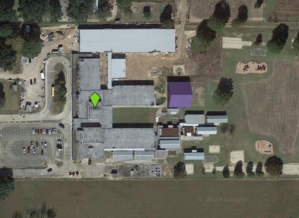
2901 S Fieldspan Rd
6001721
SEC 23 T10S R3E (15 AC) (RIDGE ELEMENTARY SCHOOL)
Privateschool
LAFAYETTE
AE The base floodplain where base flood elevations are provided. AE Zones are now used on new format FIRMs instead of A1-A30 Zones.
Louisiana
2025
15 AC
2025
Outlying Lafayette Parish
0019051014
Lafayette
66,250 SF
Lafayette, LA
NEARBY LISTINGS FOR SALE OR LEASE
-
-
View all listings for sale on LoopNet.com
DEMOGRAPHICS near 2901 S Fieldspan Rd
1 mile
3 mile
5 mile
2025 Total Population
891
13,970
52,552
2030 Population
962
14,775
54,994
Pop Growth 2025-2030
+ 7.97%
+ 5.76%
+ 4.65%
Average Age
40
38
39
2025 Total Households
344
5,326
20,601
HH Growth 2025-2030
+ 8.14%
+ 5.86%
+ 4.68%
Median Household Inc
$46,953
$61,377
$74,058
Avg Household Size
2.50
2.50
2.50
2025 Avg HH Vehicles
2.00
2.00
2.00
Median Home Value
$271,666
$244,175
$267,588
Median Year Built
2002
1997
1995
Nearby Places
Map Layers
Map Styles
 Street
 Aerial
Transit
 Traffic
 Biking
Places
Listings with unknown addresses are not visible on the map
- Restaurants
- Banks
- Shops
- Fitness
- Groceries
PUBLIC TRANSPORTATION
AIRPORT
Lafayette Regional/Paul Fournet Field
Drive
Walk
Distance
Lafayette Regional/Paul Fournet Field
22 min
12.5 mi
Freight Ports
Port of Iberia
Drive
Walk
Distance
Port of Iberia
42 min
28.7 mi
Nearby Properties
Address
Land Use
TOTAL SIZE
Lot Size
Zoning
Address
Land Use
TOTAL SIZE
Lot Size
Zoning
13,069 SF
23.27 AC
Address
Land Use
TOTAL SIZE
Lot Size
Zoning
13.39 AC
Address
Land Use
TOTAL SIZE
Lot Size
Zoning
35,914 SF
12.68 AC
Address
Land Use
TOTAL SIZE
Lot Size
Zoning
Address
Land Use
TOTAL SIZE
Lot Size
Zoning
5,944 SF
3.96 AC
Address
Land Use
TOTAL SIZE
Lot Size
Zoning
62,069 SF
32.76 AC
Address
Land Use
TOTAL SIZE
Lot Size
Zoning
23.87 AC
Address
Land Use
TOTAL SIZE
Lot Size
Zoning
9,579 SF
5 AC
Address
Land Use
TOTAL SIZE
Lot Size
Zoning
94.49 AC
Address
Land Use
TOTAL SIZE
Lot Size
Zoning
38,704 SF
5 AC
Address
Land Use
TOTAL SIZE
Lot Size
Zoning
17,848 SF
2.36 AC
Address
Land Use
TOTAL SIZE
Lot Size
Zoning
20,717 SF
4.01 AC
Address
Land Use
TOTAL SIZE
Lot Size
Zoning
20,562 SF
2.94 AC
Address
Land Use
TOTAL SIZE
Lot Size
Zoning
1,785 SF
23.27 AC
Address
Land Use
TOTAL SIZE
Lot Size
Zoning
15,722 SF
5 AC
Address
Land Use
TOTAL SIZE
Lot Size
Zoning
62.17 AC
Address
Land Use
TOTAL SIZE
Lot Size
Zoning
2,052 SF
4 AC
Address
Land Use
TOTAL SIZE
Lot Size
Zoning
7,000 SF
0.01 AC
Address
Land Use
TOTAL SIZE
Lot Size
Zoning
8,000 SF
2.49 AC
Address
Land Use
TOTAL SIZE
Lot Size
Zoning
8,522 SF
3.23 AC
Address
Land Use
TOTAL SIZE
Lot Size
Zoning
4,832 SF
1.33 AC
Address
Land Use
TOTAL SIZE
Lot Size
Zoning
10,000 SF
2.64 AC
Address
Land Use
TOTAL SIZE
Lot Size
Zoning
3,254 SF
5.43 AC
Address
Land Use
TOTAL SIZE
Lot Size
Zoning
3,781 SF
Address
Land Use
TOTAL SIZE
Lot Size
Zoning
28,650 SF
2 AC
Address
Land Use
TOTAL SIZE
Lot Size
Zoning
1,778 SF
0.01 AC
Address
Land Use
TOTAL SIZE
Lot Size
Zoning
3,871 SF
0.75 AC
Address
Land Use
TOTAL SIZE
Lot Size
Zoning
6,412 SF
3.42 AC
Address
Land Use
TOTAL SIZE
Lot Size
Zoning
3,729 SF
1.78 AC
The World's #1 Commercial Real Estate Marketplace
Connect with us
© 2026 CoStar Group
The information above has been obtained from sources believed reliable. While we do not doubt its accuracy we have not verified it and make no guarantee, warranty or representation about it. It is your responsibility to independently confirm its accuracy and completeness. Any projections, opinions, assumptions, or estimates used are for example only and do not represent the current or future performance of the property. The value of this transaction to you depends on tax and other factors which should be evaluated by your tax, financial, and legal advisors. You and your advisors should conduct a careful, independent investigation of the property to determine to your satisfaction the suitability of the property for your needs.