Property Record
2901 Silver St, Jacksonville, FL 32206


NEARBY LISTINGS FOR SALE OR LEASE
Property Detail
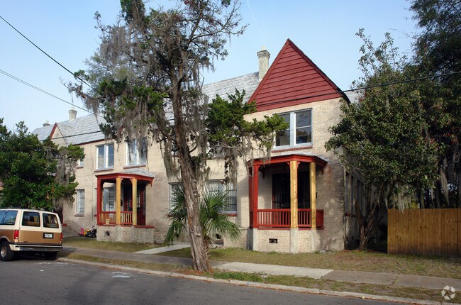
2901 Silver St
Jacksonville, FL
Arpens Rp Pt Lindsleys Sd
044357-0000
3-93 01-2S-26E .389 ARPENS R/P LOTS 5 TO 8 BLK 5
Multifamilydwelling
Duval
X
Florida
12031C0356H
5-8
2025
0.40 AC
2026
Springfield
000300
Jacksonville (Florida)
6,421 SF
DEMOGRAPHICS near 2901 Silver St
1 Mile
3 Mile
5 Mile
2024 Total Population
13,853
80,147
207,262
2029 Population
14,862
85,381
219,259
Pop Growth 2024-2029
+ 7.28%
+ 6.53%
+ 5.79%
Average Age
38
39
39
2024 Total Households
5,748
32,405
85,249
HH Growth 2024-2029
+ 7.38%
+ 6.87%
+ 6.05%
Median Household Inc
$30,559
$30,457
$39,311
Avg Household Size
2.40
2.30
2.30
2024 Avg HH Vehicles
1.00
1.00
1.00
Median Home Value
$148,333
$106,394
$162,589
Median Year Built
1952
1962
1962
Nearby Places
Map Layers
Map Styles
 Street
 Aerial
- Restaurants
- Banks
- Shops
- Fitness
- Groceries
PUBLIC TRANSPORTATION
COMMUTER RAIL
Jacksonville (Silver Meteor - Amtrak, Silver Star - Amtrak)
DRIVE
WALK
Distance
Jacksonville (Silver Meteor - Amtrak, Silver Star - Amtrak)
9 min
4.7 mi
AIRPORT
Jacksonville International
DRIVE
WALK
Distance
Jacksonville International
20 min
13.4 mi
Freight Ports
Jacksonville Port
DRIVE
WALK
Distance
Jacksonville Port
5 min
2.2 mi
Nearby Properties
Address
Land Use
TOTAL SIZE
Lot Size
Zoning
Address
Land Use
TOTAL SIZE
Lot Size
Zoning
1,086,885 SF
16.34 AC
CCBD
Address
Land Use
TOTAL SIZE
Lot Size
Zoning
543,383 SF
7.87 AC
CCBD
Address
Land Use
TOTAL SIZE
Lot Size
Zoning
1,150,143 SF
43.90 AC
CCBD
Address
Land Use
TOTAL SIZE
Lot Size
Zoning
705,940 SF
25.12 AC
PBF-1
Address
Land Use
TOTAL SIZE
Lot Size
Zoning
1,146,106 SF
206.66 AC
PBF-2
Address
Land Use
TOTAL SIZE
Lot Size
Zoning
165,408 SF
2.45 AC
CCBD
Address
Land Use
TOTAL SIZE
Lot Size
Zoning
521,850 SF
10.06 AC
CCBD
Address
Land Use
TOTAL SIZE
Lot Size
Zoning
831,560 SF
1.16 AC
PUD
Address
Land Use
TOTAL SIZE
Lot Size
Zoning
187,278 SF
1.71 AC
CCBD
Address
Land Use
TOTAL SIZE
Lot Size
Zoning
127,732 SF
1.44 AC
CCBD
Address
Land Use
TOTAL SIZE
Lot Size
Zoning
224,600 SF
3.41 AC
PUD
Address
Land Use
TOTAL SIZE
Lot Size
Zoning
313,472 SF
35.44 AC
CCBD
Address
Land Use
TOTAL SIZE
Lot Size
Zoning
355,967 SF
8.98 AC
PUD
Address
Land Use
TOTAL SIZE
Lot Size
Zoning
700,443 SF
8 AC
CCBD
Address
Land Use
TOTAL SIZE
Lot Size
Zoning
264,277 SF
2.07 AC
CCBD
Address
Land Use
TOTAL SIZE
Lot Size
Zoning
503,858 SF
1.32 AC
CCBD
Address
Land Use
TOTAL SIZE
Lot Size
Zoning
369,638 SF
6.30 AC
CCBD
Address
Land Use
TOTAL SIZE
Lot Size
Zoning
448,709 SF
2.97 AC
CCBD
Address
Land Use
TOTAL SIZE
Lot Size
Zoning
326,485 SF
1.56 AC
CCBD
Address
Land Use
TOTAL SIZE
Lot Size
Zoning
453,728 SF
8.20 AC
CCBD
Address
Land Use
TOTAL SIZE
Lot Size
Zoning
194,877 SF
11.64 AC
CCBD
Address
Land Use
TOTAL SIZE
Lot Size
Zoning
299,055 SF
18.93 AC
CCBD
Address
Land Use
TOTAL SIZE
Lot Size
Zoning
336,623 SF
2.06 AC
CCBD
Address
Land Use
TOTAL SIZE
Lot Size
Zoning
212,152 SF
8.17 AC
CCBD
Address
Land Use
TOTAL SIZE
Lot Size
Zoning
146,636 SF
2.88 AC
CCBD
Address
Land Use
TOTAL SIZE
Lot Size
Zoning
270,000 SF
8.90 AC
PUD
Address
Land Use
TOTAL SIZE
Lot Size
Zoning
329,412 SF
1.75 AC
CCBD
Address
Land Use
TOTAL SIZE
Lot Size
Zoning
229,284 SF
7.24 AC
PUD
Address
Land Use
TOTAL SIZE
Lot Size
Zoning
335,832 SF
6.67 AC
PBF-2
Address
Land Use
TOTAL SIZE
Lot Size
Zoning
189,151 SF
3.56 AC
PUD
The World's #1 Commercial Real Estate Marketplace
Connect with us
© 2026 CoStar Group
The information above has been obtained from sources believed reliable. While we do not doubt its accuracy we have not verified it and make no guarantee, warranty or representation about it. It is your responsibility to independently confirm its accuracy and completeness. Any projections, opinions, assumptions, or estimates used are for example only and do not represent the current or future performance of the property. The value of this transaction to you depends on tax and other factors which should be evaluated by your tax, financial, and legal advisors. You and your advisors should conduct a careful, independent investigation of the property to determine to your satisfaction the suitability of the property for your needs.