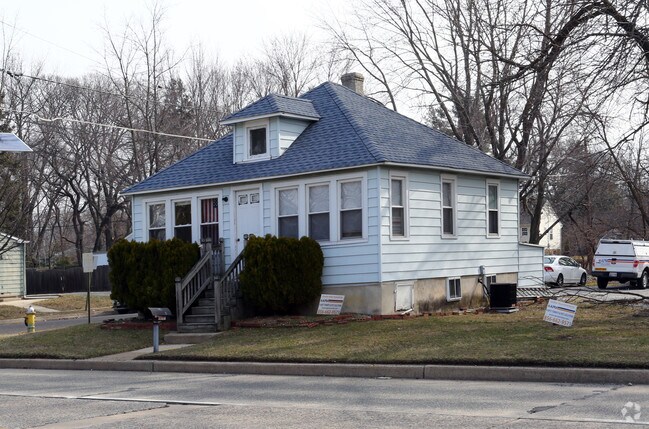
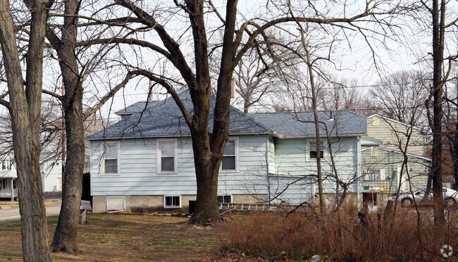
Property Record
2902 Haddonfield Rd, Pennsauken, NJ 08110
NEARBY LISTINGS FOR SALE OR LEASE
Property Detail
2902 Haddonfield Rd
27-03602-0000-00001
Camden
Commercialnec
New Jersey
X
1
34005C0207F
0.32 AC
2024
North Camden County
2025
Philadelphia
602901
Philadelphia-Camden-Wilmington, PA-NJ-DE-MD
852 SF
DEMOGRAPHICS near 2902 Haddonfield Rd
1 Mile
3 Mile
5 Mile
2024 Total Population
8,262
95,239
352,860
2029 Population
8,347
96,208
348,512
Pop Growth 2024-2029
+ 1.03%
+ 1.02%
(1.23%)
Average Age
43
41
39
2024 Total Households
3,350
36,427
131,361
HH Growth 2024-2029
+ 1.94%
+ 1.10%
(1.22%)
Median Household Inc
$87,724
$88,486
$68,970
Avg Household Size
2.40
2.50
2.60
2024 Avg HH Vehicles
2.00
2.00
2.00
Median Home Value
$224,118
$239,367
$228,127
Median Year Built
1970
1962
1954
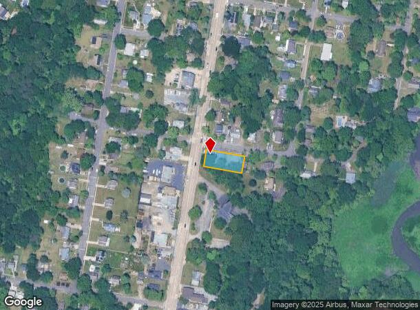
Nearby Places
Map Layers
Map Styles
 Street
 Aerial
- Restaurants
- Banks
- Shops
- Fitness
- Groceries
PUBLIC TRANSPORTATION
COMMUTER RAIL
Pennsauken Transit Center (Atlantic City Rail Line - NJ TRANSIT RAIL)
DRIVE
WALK
Distance
Pennsauken Transit Center (Atlantic City Rail Line - NJ TRANSIT RAIL)
6 min
3.4 mi
Cherry Hill (Atlantic City Line - NJ Transit Commuter Rail (NJ Transit))
DRIVE
WALK
Distance
Cherry Hill (Atlantic City Line - NJ Transit Commuter Rail (NJ Transit))
8 min
4.8 mi
AIRPORT
Philadelphia International
DRIVE
WALK
Distance
Philadelphia International
30 min
18.1 mi
Trenton Mercer
DRIVE
WALK
Distance
Trenton Mercer
45 min
32.3 mi
Freight Ports
Port of Philadelphia
DRIVE
WALK
Distance
Port of Philadelphia
10 min
6.1 mi
SALE & LEASE HISTORY
LISTING DATE
SALE/LEASE

May 29, 2019
For Sale
Nearby Properties
Address
Land Use
TOTAL SIZE
Lot Size
Zoning
Address
Land Use
TOTAL SIZE
Lot Size
Zoning
66.02 AC
Address
Land Use
TOTAL SIZE
Lot Size
Zoning
Address
Land Use
TOTAL SIZE
Lot Size
Zoning
740,701 SF
47.70 AC
I2
Address
Land Use
TOTAL SIZE
Lot Size
Zoning
90.41 AC
Address
Land Use
TOTAL SIZE
Lot Size
Zoning
20.13 AC
Address
Land Use
TOTAL SIZE
Lot Size
Zoning
72.46 AC
Address
Land Use
TOTAL SIZE
Lot Size
Zoning
54.54 AC
Address
Land Use
TOTAL SIZE
Lot Size
Zoning
1 SF
42.23 AC
Address
Land Use
TOTAL SIZE
Lot Size
Zoning
50.73 AC
C73A
Address
Land Use
TOTAL SIZE
Lot Size
Zoning
37.60 AC
Address
Land Use
TOTAL SIZE
Lot Size
Zoning
Address
Land Use
TOTAL SIZE
Lot Size
Zoning
12.80 AC
R20
Address
Land Use
TOTAL SIZE
Lot Size
Zoning
Address
Land Use
TOTAL SIZE
Lot Size
Zoning
5.35 AC
Address
Land Use
TOTAL SIZE
Lot Size
Zoning
Address
Land Use
TOTAL SIZE
Lot Size
Zoning
3.59 AC
Address
Land Use
TOTAL SIZE
Lot Size
Zoning
22.45 AC
MD
Address
Land Use
TOTAL SIZE
Lot Size
Zoning
37.39 AC
Address
Land Use
TOTAL SIZE
Lot Size
Zoning
39.53 AC
Address
Land Use
TOTAL SIZE
Lot Size
Zoning
35.57 AC
Address
Land Use
TOTAL SIZE
Lot Size
Zoning
26.17 AC
Address
Land Use
TOTAL SIZE
Lot Size
Zoning
27.77 AC
Address
Land Use
TOTAL SIZE
Lot Size
Zoning
150.59 AC
Address
Land Use
TOTAL SIZE
Lot Size
Zoning
25.37 AC
Address
Land Use
TOTAL SIZE
Lot Size
Zoning
12.19 AC
Address
Land Use
TOTAL SIZE
Lot Size
Zoning
Address
Land Use
TOTAL SIZE
Lot Size
Zoning
37.21 AC
Address
Land Use
TOTAL SIZE
Lot Size
Zoning
46.30 AC
Address
Land Use
TOTAL SIZE
Lot Size
Zoning
Address
Land Use
TOTAL SIZE
Lot Size
Zoning
7.38 AC
The World's #1 Commercial Real Estate Marketplace
Connect with us
© 2025 CoStar Group
The information above has been obtained from sources believed reliable. While we do not doubt its accuracy we have not verified it and make no guarantee, warranty or representation about it. It is your responsibility to independently confirm its accuracy and completeness. Any projections, opinions, assumptions, or estimates used are for example only and do not represent the current or future performance of the property. The value of this transaction to you depends on tax and other factors which should be evaluated by your tax, financial, and legal advisors. You and your advisors should conduct a careful, independent investigation of the property to determine to your satisfaction the suitability of the property for your needs.