Property Record
2902 Remond Dr, Dallas, TX 75211


Save to a Folder
{{folder.Name}}
{{folder.ListingIds.length}} Properties
{{folder.ListingIds.length}} Property
Create a New Folder
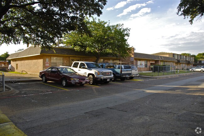
Property Detail
2902 Remond Dr
00000527728000000
BLK 6162 TR 2 ACS 6.5651 VOL99112/3288 DD05151999 CO-DC 6162 000 00200 2006162 000
Apartment
DALLAS
Z164
Texas
B and X Area of moderate flood hazard, usually the area between the limits of the 100-year and 500-year floods.
2
2025
6.57 AC
2025
North Oak Cliff
006900
Dallas/Ft Worth
97,540 SF
Dallas-Fort Worth-Arlington, TX
NEARBY LISTINGS FOR SALE OR LEASE
DEMOGRAPHICS near 2902 Remond Dr
1 mile
3 mile
5 mile
2025 Total Population
9,334
118,788
312,819
2030 Population
9,591
123,072
324,950
Pop Growth 2025-2030
+ 2.75%
+ 3.61%
+ 3.88%
Average Age
37
36
36
2025 Total Households
3,879
40,222
125,033
HH Growth 2025-2030
+ 3.87%
+ 3.95%
+ 4.34%
Median Household Inc
$62,830
$66,772
$70,984
Avg Household Size
2.30
2.90
2.40
2025 Avg HH Vehicles
2.00
2.00
2.00
Median Home Value
$310,317
$305,806
$290,952
Median Year Built
1975
1964
1986
Nearby Places
Map Layers
Map Styles
 Street
 Aerial
Layers
 Traffic
 Biking
Places
Listings with unknown addresses are not visible on the map
- Restaurants
- Banks
- Shops
- Fitness
- Groceries
PUBLIC TRANSPORTATION
COMMUTER RAIL
Medical/Market Ctr Station (TRINITY RAILWAY - Dallas Area Rapid Transit (DART))
Drive
Walk
Distance
Medical/Market Ctr Station (TRINITY RAILWAY - Dallas Area Rapid Transit (DART))
11 min
4.9 mi
Victory Station (DART LIGHT RAIL - GREEN LINE - Dallas Area Rapid Transit (DART), DART LIGHT RAIL - ORANGE LINE - Dallas Area Rapid Transit (DART), TRINITY RAILWAY - Dallas Area Rapid Transit (DART))
Drive
Walk
Distance
Victory Station (DART LIGHT RAIL - GREEN LINE - Dallas Area Rapid Transit (DART), DART LIGHT RAIL - ORANGE LINE - Dallas Area Rapid Transit (DART), TRINITY RAILWAY - Dallas Area Rapid Transit (DART))
8 min
5.5 mi
AIRPORT
Dallas Love Field
Drive
Walk
Distance
Dallas Love Field
17 min
7.3 mi
Dallas-Fort Worth International
Drive
Walk
Distance
Dallas-Fort Worth International
28 min
19.0 mi
Freight Ports
Port of Shreveport
Drive
Walk
Distance
Port of Shreveport
217 min
201.4 mi
Nearby Properties
Address
Land Use
TOTAL SIZE
Lot Size
Zoning
Address
Land Use
TOTAL SIZE
Lot Size
Zoning
1,298,826 SF
33.16 AC
Z163
Address
Land Use
TOTAL SIZE
Lot Size
Zoning
226,948 SF
20.73 AC
Z239
Address
Land Use
TOTAL SIZE
Lot Size
Zoning
732,117 SF
5 AC
Z239
Address
Land Use
TOTAL SIZE
Lot Size
Zoning
1,085,000 SF
88.02 AC
Address
Land Use
TOTAL SIZE
Lot Size
Zoning
316,447 SF
12.61 AC
Z164
Address
Land Use
TOTAL SIZE
Lot Size
Zoning
2,319,440 SF
90.19 AC
Address
Land Use
TOTAL SIZE
Lot Size
Zoning
1,010,500 SF
45.40 AC
Z116
Address
Land Use
TOTAL SIZE
Lot Size
Zoning
419,729 SF
3.62 AC
Z115
Address
Land Use
TOTAL SIZE
Lot Size
Zoning
506,299 SF
4.24 AC
Z116
Address
Land Use
TOTAL SIZE
Lot Size
Zoning
763,960 SF
41.01 AC
Address
Land Use
TOTAL SIZE
Lot Size
Zoning
646,211 SF
5.79 AC
Z239
Address
Land Use
TOTAL SIZE
Lot Size
Zoning
513,833 SF
0.17 AC
Z59
Address
Land Use
TOTAL SIZE
Lot Size
Zoning
100 SF
37.84 AC
Z115
Address
Land Use
TOTAL SIZE
Lot Size
Zoning
498,588 SF
4.33 AC
Z115
Address
Land Use
TOTAL SIZE
Lot Size
Zoning
466,681 SF
3.55 AC
Z239
Address
Land Use
TOTAL SIZE
Lot Size
Zoning
316,640 SF
5.02 AC
Z115
Address
Land Use
TOTAL SIZE
Lot Size
Zoning
512,628 SF
2.72 AC
Z239
Address
Land Use
TOTAL SIZE
Lot Size
Zoning
513,100 SF
3.23 AC
Z239
Address
Land Use
TOTAL SIZE
Lot Size
Zoning
516,478 SF
32.06 AC
Z116
Address
Land Use
TOTAL SIZE
Lot Size
Zoning
672,775 SF
36.29 AC
Address
Land Use
TOTAL SIZE
Lot Size
Zoning
404,722 SF
3.72 AC
Z239
Address
Land Use
TOTAL SIZE
Lot Size
Zoning
428,759 SF
16.39 AC
Z239
Address
Land Use
TOTAL SIZE
Lot Size
Zoning
448,378 SF
4.45 AC
Z239
Address
Land Use
TOTAL SIZE
Lot Size
Zoning
469,864 SF
4.21 AC
Z239
Address
Land Use
TOTAL SIZE
Lot Size
Zoning
343,006 SF
0.53 AC
Z239
Address
Land Use
TOTAL SIZE
Lot Size
Zoning
608,939 SF
34.99 AC
Address
Land Use
TOTAL SIZE
Lot Size
Zoning
8,727 SF
28.76 AC
Z298
Address
Land Use
TOTAL SIZE
Lot Size
Zoning
283,359 SF
16.25 AC
Z116
Address
Land Use
TOTAL SIZE
Lot Size
Zoning
663,480 SF
31.90 AC
Z163
Address
Land Use
TOTAL SIZE
Lot Size
Zoning
248,285 SF
16.59 AC
Z248
The World's #1 Commercial Real Estate Marketplace
Connect with us
© 2026 CoStar Group
The information above has been obtained from sources believed reliable. While we do not doubt its accuracy we have not verified it and make no guarantee, warranty or representation about it. It is your responsibility to independently confirm its accuracy and completeness. Any projections, opinions, assumptions, or estimates used are for example only and do not represent the current or future performance of the property. The value of this transaction to you depends on tax and other factors which should be evaluated by your tax, financial, and legal advisors. You and your advisors should conduct a careful, independent investigation of the property to determine to your satisfaction the suitability of the property for your needs.