Property Record
2903 Mcfarlane Rd, Miami, FL 33133

Property Detail
2903 Mcfarlane Rd
Miami-Miami Beach-Kendall, FL
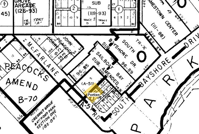
MUNROES PLAT SUB LOT 4 PB A-51 BEG AT NWLY COR OF LOT 9 BLK 1 TH SWLY1.52FT NWLY125FT NELY181.5FT SELY125FT SWLY179.98FT TO POB LOT SIZE IRREGULAR A PORT OF TR A OF SAILBOAT BAY AND PB 96-85 AS DESC IN OR 20048-4352 AKA BASEMENTS 1 & 2 WHICH ARE LESS
01-4121-039-0030
MIAMI/DADE
Parkinglot
Florida
6101
4,9
B and X Area of moderate flood hazard, usually the area between the limits of the 100-year and 500-year floods.
0.14 AC
2024
Coconut Grove
2025
South Florida
007300
NEARBY LISTINGS FOR SALE OR LEASE
DEMOGRAPHICS near 2903 Mcfarlane Rd
1 mile
3 mile
5 mile
2025 Total Population
19,922
140,697
449,731
2030 Population
21,753
151,085
484,082
Pop Growth 2025-2030
+ 9.19%
+ 7.38%
+ 7.64%
Average Age
42
43
42
2025 Total Households
8,839
57,952
187,616
HH Growth 2025-2030
+ 9.08%
+ 7.65%
+ 7.88%
Median Household Inc
$115,024
$91,585
$76,577
Avg Household Size
2.20
2.30
2.30
2025 Avg HH Vehicles
1.00
2.00
1.00
Median Home Value
$961,609
$842,056
$716,864
Median Year Built
1982
1968
1976
Nearby Places
Map Layers
Map Styles
 Street
 Aerial
Layers
 Traffic
 Biking
Places
Listings with unknown addresses are not visible on the map
- Restaurants
- Banks
- Shops
- Fitness
- Groceries
PUBLIC TRANSPORTATION
COMMUTER RAIL
Coconut Grove (Metrorail Green Line - Miami-Dade Transit (Metrorail/Metromover))
Drive
Walk
Distance
Coconut Grove (Metrorail Green Line - Miami-Dade Transit (Metrorail/Metromover))
4 min
1.2 mi
Douglas Road (Metrorail Green Line - Miami-Dade Transit (Metrorail/Metromover))
Drive
Walk
Distance
Douglas Road (Metrorail Green Line - Miami-Dade Transit (Metrorail/Metromover))
4 min
1.6 mi
AIRPORT
Miami International
Drive
Walk
Distance
Miami International
26 min
12.3 mi
Fort Lauderdale/Hollywood International
Drive
Walk
Distance
Fort Lauderdale/Hollywood International
42 min
27.9 mi
Freight Ports
Port of Miami
Drive
Walk
Distance
Port of Miami
16 min
7.5 mi
Nearby Properties
Address
Land Use
TOTAL SIZE
Lot Size
Zoning
Address
Land Use
TOTAL SIZE
Lot Size
Zoning
870,720 SF
1.90 AC
4800
Address
Land Use
TOTAL SIZE
Lot Size
Zoning
883,561 SF
5.63 AC
8200
Address
Land Use
TOTAL SIZE
Lot Size
Zoning
1,101,032 SF
5.18 AC
8000
Address
Land Use
TOTAL SIZE
Lot Size
Zoning
715,755 SF
2.66 AC
5005
Address
Land Use
TOTAL SIZE
Lot Size
Zoning
1,428,214 SF
31.07 AC
8000
Address
Land Use
TOTAL SIZE
Lot Size
Zoning
973,728 SF
76.18 AC
8200
Address
Land Use
TOTAL SIZE
Lot Size
Zoning
91,119 SF
50.72 AC
8000
Address
Land Use
TOTAL SIZE
Lot Size
Zoning
345,178 SF
6.73 AC
5005
Address
Land Use
TOTAL SIZE
Lot Size
Zoning
1,168,390 SF
0.04 AC
7100
Address
Land Use
TOTAL SIZE
Lot Size
Zoning
482,246 SF
0.83 AC
5005
Address
Land Use
TOTAL SIZE
Lot Size
Zoning
525,786 SF
2.64 AC
6100
Address
Land Use
TOTAL SIZE
Lot Size
Zoning
408,292 SF
0.88 AC
6110
Address
Land Use
TOTAL SIZE
Lot Size
Zoning
275,755 SF
6.73 AC
5005
Address
Land Use
TOTAL SIZE
Lot Size
Zoning
247,488 SF
4.25 AC
5005
Address
Land Use
TOTAL SIZE
Lot Size
Zoning
688,104 SF
3.16 AC
6101
Address
Land Use
TOTAL SIZE
Lot Size
Zoning
365,003 SF
15.05 AC
8200
Address
Land Use
TOTAL SIZE
Lot Size
Zoning
299,785 SF
0.55 AC
6110
Address
Land Use
TOTAL SIZE
Lot Size
Zoning
431,941 SF
2.06 AC
6110
Address
Land Use
TOTAL SIZE
Lot Size
Zoning
407,265 SF
1.59 AC
6100
Address
Land Use
TOTAL SIZE
Lot Size
Zoning
518,244 SF
1.06 AC
5005
Address
Land Use
TOTAL SIZE
Lot Size
Zoning
668,569 SF
2.33 AC
5004
Address
Land Use
TOTAL SIZE
Lot Size
Zoning
948,568 SF
6.20 AC
5005
Address
Land Use
TOTAL SIZE
Lot Size
Zoning
449,572 SF
1.74 AC
6110
Address
Land Use
TOTAL SIZE
Lot Size
Zoning
473,214 SF
2.51 AC
5005
Address
Land Use
TOTAL SIZE
Lot Size
Zoning
540,267 SF
1.74 AC
5005
Address
Land Use
TOTAL SIZE
Lot Size
Zoning
14.30 AC
0700
Address
Land Use
TOTAL SIZE
Lot Size
Zoning
173,357 SF
30.51 AC
8000
Address
Land Use
TOTAL SIZE
Lot Size
Zoning
498,294 SF
1.19 AC
5005
Address
Land Use
TOTAL SIZE
Lot Size
Zoning
221,047 SF
9.79 AC
0100
Address
Land Use
TOTAL SIZE
Lot Size
Zoning
551,110 SF
1.33 AC
5005
The World's #1 Commercial Real Estate Marketplace
Connect with us
© 2026 CoStar Group
The information above has been obtained from sources believed reliable. While we do not doubt its accuracy we have not verified it and make no guarantee, warranty or representation about it. It is your responsibility to independently confirm its accuracy and completeness. Any projections, opinions, assumptions, or estimates used are for example only and do not represent the current or future performance of the property. The value of this transaction to you depends on tax and other factors which should be evaluated by your tax, financial, and legal advisors. You and your advisors should conduct a careful, independent investigation of the property to determine to your satisfaction the suitability of the property for your needs.