Property Record
2905 N Bend Rd, Ashtabula, OH 44004


NEARBY LISTINGS FOR SALE OR LEASE
-
-
View all Ashtabula listings for sale on LoopNet.com
Property Detail
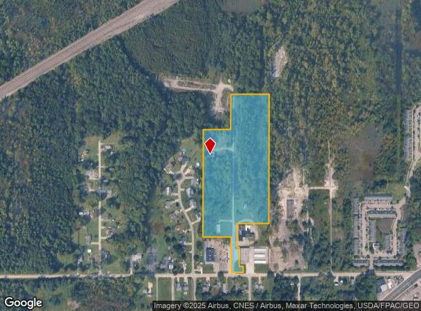
2905 N Bend Rd
480100001300
T 12--9
Warehouse
Ashtabula
X
Ohio
39007C0155D
13.71 AC
2024
Ashtabula County
2024
Cleveland
000701
Cleveland-Elyria, OH
2,752 SF
DEMOGRAPHICS near 2905 N Bend Rd
1 Mile
3 Mile
5 Mile
2024 Total Population
2,075
23,853
31,568
2029 Population
2,075
23,798
31,502
Pop Growth 2024-2029
0.00%
(0.23%)
(0.21%)
Average Age
40
41
42
2024 Total Households
876
10,081
13,529
HH Growth 2024-2029
(0.11%)
(0.35%)
(0.30%)
Median Household Inc
$38,210
$41,739
$43,195
Avg Household Size
2.30
2.20
2.20
2024 Avg HH Vehicles
2.00
2.00
2.00
Median Home Value
$80,661
$96,537
$106,099
Median Year Built
1958
1956
1956
Nearby Places
Map Layers
Map Styles
 Street
 Aerial
- Restaurants
- Banks
- Shops
- Fitness
- Groceries
SALE & LEASE HISTORY
LISTING DATE
SALE/LEASE

Jul 09, 2019
For Sale
Nearby Properties
Address
Land Use
TOTAL SIZE
Lot Size
Zoning
Address
Land Use
TOTAL SIZE
Lot Size
Zoning
311,348 SF
128.96 AC
Address
Land Use
TOTAL SIZE
Lot Size
Zoning
224,856 SF
79.47 AC
Address
Land Use
TOTAL SIZE
Lot Size
Zoning
297,379 SF
2.03 AC
Address
Land Use
TOTAL SIZE
Lot Size
Zoning
98,137 SF
40.63 AC
Address
Land Use
TOTAL SIZE
Lot Size
Zoning
936,616 SF
32.04 AC
Address
Land Use
TOTAL SIZE
Lot Size
Zoning
Address
Land Use
TOTAL SIZE
Lot Size
Zoning
231,332 SF
16.53 AC
Address
Land Use
TOTAL SIZE
Lot Size
Zoning
59,788 SF
15.88 AC
Address
Land Use
TOTAL SIZE
Lot Size
Zoning
192,830 SF
9.09 AC
Address
Land Use
TOTAL SIZE
Lot Size
Zoning
7,882 SF
13.53 AC
Address
Land Use
TOTAL SIZE
Lot Size
Zoning
59,222 SF
6.76 AC
Address
Land Use
TOTAL SIZE
Lot Size
Zoning
252,612 SF
20.47 AC
Address
Land Use
TOTAL SIZE
Lot Size
Zoning
21,912 SF
1.47 AC
Address
Land Use
TOTAL SIZE
Lot Size
Zoning
Address
Land Use
TOTAL SIZE
Lot Size
Zoning
25,607 SF
1.56 AC
Address
Land Use
TOTAL SIZE
Lot Size
Zoning
Address
Land Use
TOTAL SIZE
Lot Size
Zoning
78,016 SF
7.70 AC
Address
Land Use
TOTAL SIZE
Lot Size
Zoning
30,642 SF
0.12 AC
Address
Land Use
TOTAL SIZE
Lot Size
Zoning
119,090 SF
8.49 AC
Address
Land Use
TOTAL SIZE
Lot Size
Zoning
116,093 SF
28.16 AC
Address
Land Use
TOTAL SIZE
Lot Size
Zoning
26,026 SF
2.08 AC
Address
Land Use
TOTAL SIZE
Lot Size
Zoning
60,687 SF
3.91 AC
Address
Land Use
TOTAL SIZE
Lot Size
Zoning
40,222 SF
3.03 AC
Address
Land Use
TOTAL SIZE
Lot Size
Zoning
22,832 SF
9.89 AC
Address
Land Use
TOTAL SIZE
Lot Size
Zoning
59,936 SF
0.31 AC
Address
Land Use
TOTAL SIZE
Lot Size
Zoning
31,454 SF
0.84 AC
Address
Land Use
TOTAL SIZE
Lot Size
Zoning
206,345 SF
27.28 AC
Address
Land Use
TOTAL SIZE
Lot Size
Zoning
292,721 SF
19.05 AC
Address
Land Use
TOTAL SIZE
Lot Size
Zoning
62,044 SF
9.21 AC
Address
Land Use
TOTAL SIZE
Lot Size
Zoning
34,196 SF
2.40 AC
The World's #1 Commercial Real Estate Marketplace
Connect with us
© 2026 CoStar Group
The information above has been obtained from sources believed reliable. While we do not doubt its accuracy we have not verified it and make no guarantee, warranty or representation about it. It is your responsibility to independently confirm its accuracy and completeness. Any projections, opinions, assumptions, or estimates used are for example only and do not represent the current or future performance of the property. The value of this transaction to you depends on tax and other factors which should be evaluated by your tax, financial, and legal advisors. You and your advisors should conduct a careful, independent investigation of the property to determine to your satisfaction the suitability of the property for your needs.