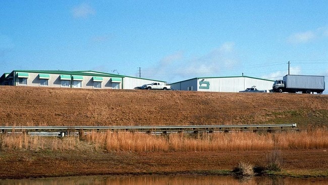
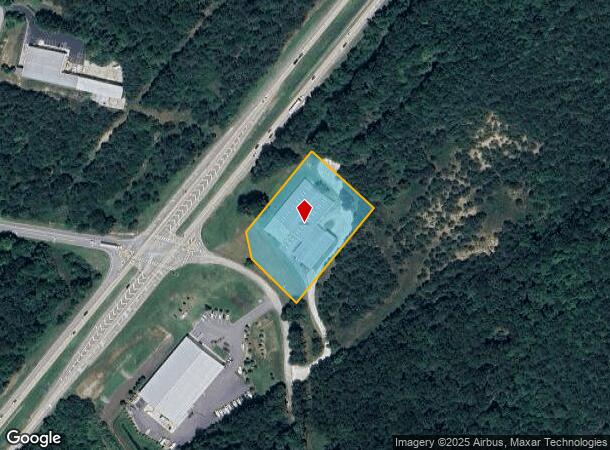
Property Record
2905 Ramsey Rd, Gainesville, GA 30507
NEARBY LISTINGS FOR SALE OR LEASE
Property Detail
2905 Ramsey Rd
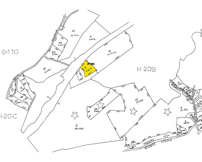
15-00020-00-057
RAMSEY ROAD
Manufacturinglight
Hall
X
Georgia
13139C0185H
0
2025
2.47 AC
2025
I-985/Gainesville
000602
Atlanta
20,140 SF
Gainesville, GA
DEMOGRAPHICS near 2905 Ramsey Rd
1 Mile
3 Mile
5 Mile
2024 Total Population
512
11,612
42,344
2029 Population
565
12,843
46,889
Pop Growth 2024-2029
+ 10.35%
+ 10.60%
+ 10.73%
Average Age
42
41
39
2024 Total Households
189
4,419
15,309
HH Growth 2024-2029
+ 10.05%
+ 10.57%
+ 10.69%
Median Household Inc
$76,420
$59,001
$56,001
Avg Household Size
2.40
2.50
2.60
2024 Avg HH Vehicles
2.00
2.00
2.00
Median Home Value
$273,999
$268,563
$260,431
Median Year Built
1994
1989
1985
Nearby Places
- Restaurants
- Banks
- Shops
- Fitness
- Groceries
PUBLIC TRANSPORTATION
COMMUTER RAIL
Gainesville Amtrak Station (Crescent - Amtrak)
DRIVE
WALK
Distance
Gainesville Amtrak Station (Crescent - Amtrak)
9 min
6.4 mi
Freight Ports
Georgia Ports - Savannah
DRIVE
WALK
Distance
Georgia Ports - Savannah
321 min
254.7 mi
Nearby Properties
Address
Land Use
TOTAL SIZE
Lot Size
Zoning
Address
Land Use
TOTAL SIZE
Lot Size
Zoning
491,092 SF
191.59 AC
I-2
Address
Land Use
TOTAL SIZE
Lot Size
Zoning
34,131 SF
80.82 AC
L-I
Address
Land Use
TOTAL SIZE
Lot Size
Zoning
44,052 SF
19.19 AC
PUD
Address
Land Use
TOTAL SIZE
Lot Size
Zoning
237,470 SF
155.08 AC
L-I
Address
Land Use
TOTAL SIZE
Lot Size
Zoning
2,038 SF
20.92 AC
R-II
Address
Land Use
TOTAL SIZE
Lot Size
Zoning
318,240 SF
18.59 AC
I-1
Address
Land Use
TOTAL SIZE
Lot Size
Zoning
148,619 SF
30.75 AC
O-I
Address
Land Use
TOTAL SIZE
Lot Size
Zoning
25,386 SF
30.22 AC
AR-1
Address
Land Use
TOTAL SIZE
Lot Size
Zoning
4,032 SF
89.43 AC
R-I
Address
Land Use
TOTAL SIZE
Lot Size
Zoning
467,600 SF
38.17 AC
L-I
Address
Land Use
TOTAL SIZE
Lot Size
Zoning
63,571 SF
31.97 AC
PUD
Address
Land Use
TOTAL SIZE
Lot Size
Zoning
82,610 SF
13.68 AC
G-B
Address
Land Use
TOTAL SIZE
Lot Size
Zoning
328,604 SF
10 AC
I-1
Address
Land Use
TOTAL SIZE
Lot Size
Zoning
47,432 SF
15.80 AC
R-II
Address
Land Use
TOTAL SIZE
Lot Size
Zoning
28,059 SF
6.33 AC
AR-1
Address
Land Use
TOTAL SIZE
Lot Size
Zoning
1,440 SF
10.29 AC
R-II
Address
Land Use
TOTAL SIZE
Lot Size
Zoning
118,917 SF
14.81 AC
PUD
Address
Land Use
TOTAL SIZE
Lot Size
Zoning
35,748 SF
10 AC
I-1
Address
Land Use
TOTAL SIZE
Lot Size
Zoning
1,348 SF
21.03 AC
AR-1
Address
Land Use
TOTAL SIZE
Lot Size
Zoning
39,880 SF
7.93 AC
R-B
Address
Land Use
TOTAL SIZE
Lot Size
Zoning
3,120 SF
25.59 AC
I-2
Address
Land Use
TOTAL SIZE
Lot Size
Zoning
99,770 SF
56.02 AC
AR-1
Address
Land Use
TOTAL SIZE
Lot Size
Zoning
112,840 SF
29.97 AC
I-2
Address
Land Use
TOTAL SIZE
Lot Size
Zoning
522,274 SF
26.70 AC
I-2
Address
Land Use
TOTAL SIZE
Lot Size
Zoning
51,275 SF
12.07 AC
G-B
Address
Land Use
TOTAL SIZE
Lot Size
Zoning
67,249 SF
10.42 AC
O-I
Address
Land Use
TOTAL SIZE
Lot Size
Zoning
88,042 SF
280.24 AC
PID
Address
Land Use
TOTAL SIZE
Lot Size
Zoning
25,998 SF
10.51 AC
AR-III
Address
Land Use
TOTAL SIZE
Lot Size
Zoning
230.86 AC
PID
Address
Land Use
TOTAL SIZE
Lot Size
Zoning
1,560 SF
167.99 AC
PUD
The World's #1 Commercial Real Estate Marketplace
Connect with us
© 2025 CoStar Group
The information above has been obtained from sources believed reliable. While we do not doubt its accuracy we have not verified it and make no guarantee, warranty or representation about it. It is your responsibility to independently confirm its accuracy and completeness. Any projections, opinions, assumptions, or estimates used are for example only and do not represent the current or future performance of the property. The value of this transaction to you depends on tax and other factors which should be evaluated by your tax, financial, and legal advisors. You and your advisors should conduct a careful, independent investigation of the property to determine to your satisfaction the suitability of the property for your needs.