Property Record
2905 W Warner Rd, Chandler, AZ 85224


Current Lease Availabilities
Property Detail
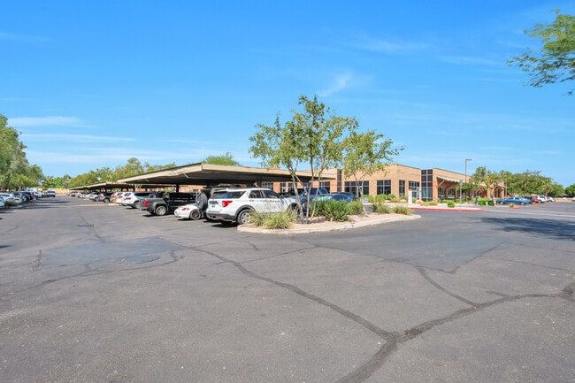
2905 W Warner Rd
302-80-950
PRICE WARNER MEDICAL CENTER MCR 625-32
Medicalbuilding
MARICOPA
PAD
Arizona
C and X Area of minimal flood hazard, usually depicted on FIRMs as above the 500-year flood level.
1
2025
7.95 AC
2025
Chandler
810300
Phoenix
88,923 SF
Phoenix-Mesa-Chandler, AZ
NEARBY LISTINGS FOR SALE OR LEASE
DEMOGRAPHICS near 2905 W Warner Rd
1 mile
3 mile
5 mile
2025 Total Population
12,345
130,266
340,462
2030 Population
12,702
133,864
350,537
Pop Growth 2025-2030
+ 2.89%
+ 2.76%
+ 2.96%
Average Age
41
40
38
2025 Total Households
4,947
51,459
134,614
HH Growth 2025-2030
+ 2.95%
+ 2.82%
+ 3.01%
Median Household Inc
$106,767
$102,510
$91,809
Avg Household Size
2.50
2.50
2.40
2025 Avg HH Vehicles
2.00
2.00
2.00
Median Home Value
$485,962
$475,204
$472,242
Median Year Built
1987
1986
1987
Nearby Places
Map Layers
Map Styles
 Street
 Aerial
Layers
 Traffic
 Biking
Places
Listings with unknown addresses are not visible on the map
- Restaurants
- Banks
- Shops
- Fitness
- Groceries
PUBLIC TRANSPORTATION
AIRPORT
Phoenix Sky Harbor International
Drive
Walk
Distance
Phoenix Sky Harbor International
21 min
14.1 mi
Phoenix-Mesa Gateway
Drive
Walk
Distance
Phoenix-Mesa Gateway
26 min
17.8 mi
Freight Ports
Port of San Diego
Drive
Walk
Distance
Port of San Diego
400 min
365.8 mi
Nearby Properties
Address
Land Use
TOTAL SIZE
Lot Size
Zoning
Address
Land Use
TOTAL SIZE
Lot Size
Zoning
221,091 SF
14.76 AC
I-1
Address
Land Use
TOTAL SIZE
Lot Size
Zoning
136,458 SF
7.85 AC
PAD
Address
Land Use
TOTAL SIZE
Lot Size
Zoning
128,194 SF
8.58 AC
PAD
Address
Land Use
TOTAL SIZE
Lot Size
Zoning
733,019 SF
13.13 AC
PAD
Address
Land Use
TOTAL SIZE
Lot Size
Zoning
1,418,890 SF
39 AC
PF
Address
Land Use
TOTAL SIZE
Lot Size
Zoning
1,149,733 SF
70.56 AC
PAD
Address
Land Use
TOTAL SIZE
Lot Size
Zoning
724,125 SF
39.23 AC
Address
Land Use
TOTAL SIZE
Lot Size
Zoning
774,482 SF
25.50 AC
PAD
Address
Land Use
TOTAL SIZE
Lot Size
Zoning
1,085,359 SF
74.95 AC
PAD
Address
Land Use
TOTAL SIZE
Lot Size
Zoning
860,343 SF
56.83 AC
I-1
Address
Land Use
TOTAL SIZE
Lot Size
Zoning
2.57 AC
Address
Land Use
TOTAL SIZE
Lot Size
Zoning
984,487 SF
37.54 AC
I-1
Address
Land Use
TOTAL SIZE
Lot Size
Zoning
15,066 SF
2.54 AC
PAD
Address
Land Use
TOTAL SIZE
Lot Size
Zoning
607,734 SF
17.89 AC
AG
Address
Land Use
TOTAL SIZE
Lot Size
Zoning
395,055 SF
8.33 AC
PAD
Address
Land Use
TOTAL SIZE
Lot Size
Zoning
269,504 SF
8.87 AC
I-1
Address
Land Use
TOTAL SIZE
Lot Size
Zoning
393,258 SF
49.79 AC
AG
Address
Land Use
TOTAL SIZE
Lot Size
Zoning
177,897 SF
17.81 AC
AG
Address
Land Use
TOTAL SIZE
Lot Size
Zoning
403,326 SF
8.71 AC
PAD
Address
Land Use
TOTAL SIZE
Lot Size
Zoning
249,019 SF
23.96 AC
AG
Address
Land Use
TOTAL SIZE
Lot Size
Zoning
444,802 SF
4.17 AC
I-1
Address
Land Use
TOTAL SIZE
Lot Size
Zoning
175,866 SF
12.46 AC
AG
Address
Land Use
TOTAL SIZE
Lot Size
Zoning
22,149 SF
6.33 AC
PAD
Address
Land Use
TOTAL SIZE
Lot Size
Zoning
301,597 SF
10.79 AC
PAD
Address
Land Use
TOTAL SIZE
Lot Size
Zoning
244,900 SF
38.47 AC
PF
Address
Land Use
TOTAL SIZE
Lot Size
Zoning
379,460 SF
11.40 AC
PAD
Address
Land Use
TOTAL SIZE
Lot Size
Zoning
317,115 SF
36.47 AC
R-6
Address
Land Use
TOTAL SIZE
Lot Size
Zoning
313,144 SF
8.62 AC
PAD
Address
Land Use
TOTAL SIZE
Lot Size
Zoning
348,379 SF
6.49 AC
PAD
Address
Land Use
TOTAL SIZE
Lot Size
Zoning
214,126 SF
11.42 AC
The World's #1 Commercial Real Estate Marketplace
Connect with us
© 2026 CoStar Group
The information above has been obtained from sources believed reliable. While we do not doubt its accuracy we have not verified it and make no guarantee, warranty or representation about it. It is your responsibility to independently confirm its accuracy and completeness. Any projections, opinions, assumptions, or estimates used are for example only and do not represent the current or future performance of the property. The value of this transaction to you depends on tax and other factors which should be evaluated by your tax, financial, and legal advisors. You and your advisors should conduct a careful, independent investigation of the property to determine to your satisfaction the suitability of the property for your needs.