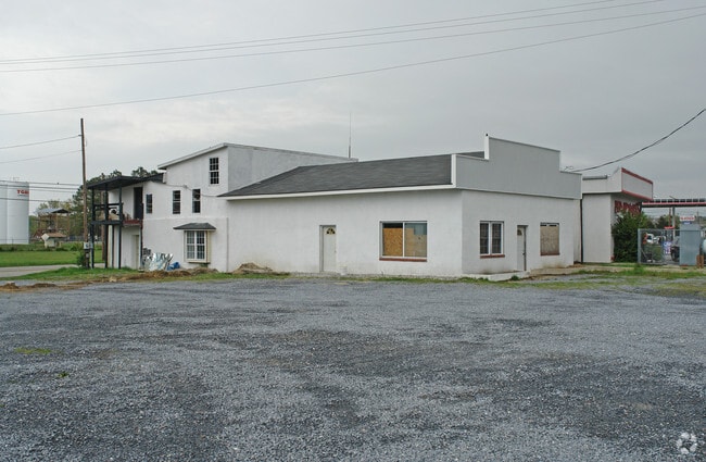
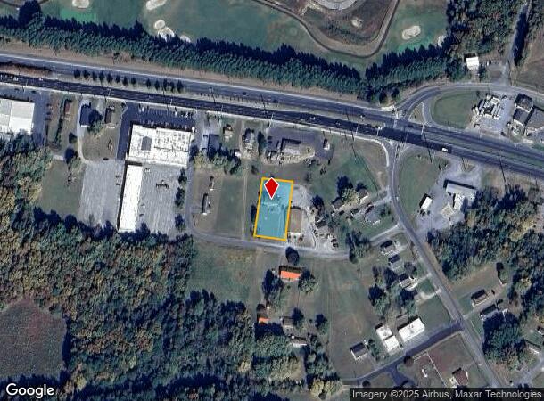
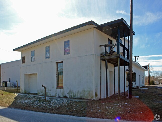
Property Record
2906 Oak Hill Rd, Cambridge, MD 21613
NEARBY LISTINGS FOR SALE OR LEASE
Property Detail
2906 Oak Hill Rd
07-158165
LOT 20,037 SQ. FT. L 29-30 S/S US RT. 50 E/S ENGLE DRIVE-CAMB.
Sfr
Dorchester
X
Maryland
24019C0191E
29
2025
0.46 AC
2025
Other Market Areas
970702
Cambridge, MD
2,668 SF
DEMOGRAPHICS near 2906 Oak Hill Rd
1 mile
3 mile
5 mile
2024 Total Population
925
13,830
18,813
2029 Population
934
14,116
19,165
Pop Growth 2024-2029
+ 0.97%
+ 2.07%
+ 1.87%
Average Age
43
41
42
2024 Total Households
372
5,884
7,979
HH Growth 2024-2029
+ 0.81%
+ 1.95%
+ 1.74%
Median Household Inc
$63,552
$45,871
$48,800
Avg Household Size
2.30
2.30
2.30
2024 Avg HH Vehicles
2.00
1.00
2.00
Median Home Value
$91,607
$203,760
$231,601
Median Year Built
1972
1970
1972
Nearby Places
Map Layers
Map Styles
 Street
 Aerial
Transit
 Traffic
 Biking
Places
Listings with unknown addresses are not visible on the map
- Restaurants
- Banks
- Shops
- Fitness
- Groceries
SALE & LEASE HISTORY
LISTING DATE
SALE/LEASE

Dec 27, 2017
For Sale
Nearby Properties
Address
Land Use
TOTAL SIZE
Lot Size
Zoning
Address
Land Use
TOTAL SIZE
Lot Size
Zoning
362,536 SF
35.35 AC
MR
Address
Land Use
TOTAL SIZE
Lot Size
Zoning
189,050 SF
126 AC
R-1
Address
Land Use
TOTAL SIZE
Lot Size
Zoning
83,112 SF
4.73 AC
C-2
Address
Land Use
TOTAL SIZE
Lot Size
Zoning
45,900 SF
92.08 AC
R-1
Address
Land Use
TOTAL SIZE
Lot Size
Zoning
115,450 SF
22 AC
R1
Address
Land Use
TOTAL SIZE
Lot Size
Zoning
67,000 SF
15 AC
I-2
Address
Land Use
TOTAL SIZE
Lot Size
Zoning
31,070 SF
9.03 AC
R
Address
Land Use
TOTAL SIZE
Lot Size
Zoning
2,548 SF
17.40 AC
R-3
Address
Land Use
TOTAL SIZE
Lot Size
Zoning
150,397 SF
13.47 AC
C-2
Address
Land Use
TOTAL SIZE
Lot Size
Zoning
43,206 SF
30.77 AC
INST
Address
Land Use
TOTAL SIZE
Lot Size
Zoning
7,204 SF
207.24 AC
MR
Address
Land Use
TOTAL SIZE
Lot Size
Zoning
219,293 SF
33.66 AC
I-1
Address
Land Use
TOTAL SIZE
Lot Size
Zoning
70,000 SF
1.61 AC
Address
Land Use
TOTAL SIZE
Lot Size
Zoning
62,913 SF
4.34 AC
Address
Land Use
TOTAL SIZE
Lot Size
Zoning
61,714 SF
1.94 AC
I-2
Address
Land Use
TOTAL SIZE
Lot Size
Zoning
24,201 SF
4.09 AC
C-2
Address
Land Use
TOTAL SIZE
Lot Size
Zoning
41,436 SF
1.47 AC
Address
Land Use
TOTAL SIZE
Lot Size
Zoning
90,776 SF
3.81 AC
C-2
Address
Land Use
TOTAL SIZE
Lot Size
Zoning
21,423 SF
5.01 AC
R
Address
Land Use
TOTAL SIZE
Lot Size
Zoning
45,412 SF
4 AC
R
Address
Land Use
TOTAL SIZE
Lot Size
Zoning
40,180 SF
7.75 AC
I2
Address
Land Use
TOTAL SIZE
Lot Size
Zoning
54,134 SF
4.55 AC
C-2
Address
Land Use
TOTAL SIZE
Lot Size
Zoning
28,958 SF
1.75 AC
C-2
Address
Land Use
TOTAL SIZE
Lot Size
Zoning
186,813 SF
17.28 AC
I1
Address
Land Use
TOTAL SIZE
Lot Size
Zoning
6,144 SF
10 AC
AC
Address
Land Use
TOTAL SIZE
Lot Size
Zoning
7,749 SF
5.76 AC
I-2
Address
Land Use
TOTAL SIZE
Lot Size
Zoning
48,399 SF
2.67 AC
B-3
Address
Land Use
TOTAL SIZE
Lot Size
Zoning
39,484 SF
5.93 AC
R-1
Address
Land Use
TOTAL SIZE
Lot Size
Zoning
37,836 SF
7.75 AC
R
Address
Land Use
TOTAL SIZE
Lot Size
Zoning
26,928 SF
4.91 AC
C-2
The World's #1 Commercial Real Estate Marketplace
Connect with us
© 2026 CoStar Group
The information above has been obtained from sources believed reliable. While we do not doubt its accuracy we have not verified it and make no guarantee, warranty or representation about it. It is your responsibility to independently confirm its accuracy and completeness. Any projections, opinions, assumptions, or estimates used are for example only and do not represent the current or future performance of the property. The value of this transaction to you depends on tax and other factors which should be evaluated by your tax, financial, and legal advisors. You and your advisors should conduct a careful, independent investigation of the property to determine to your satisfaction the suitability of the property for your needs.