Property Record
2906 Route 9 W, Ballston Spa, NY 12020


NEARBY LISTINGS FOR SALE OR LEASE
-
-
View all Ballston Spa listings for sale on LoopNet.com
Property Detail
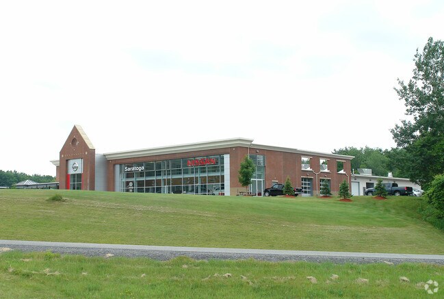
2906 Route 9 W
Albany-Schenectady-Troy, NY
SIDE: W PRIOR UNIVERSAL MEDICAL
414089-204-000-0003-009-000-0000
Saratoga
Vehiclerentalsvehiclesales
New York
2024
9.000
2024
6.22 AC
061800
Saratoga County
32,344 SF
Albany/Schenectady/Troy
DEMOGRAPHICS near 2906 Route 9 W
1 Mile
3 Mile
5 Mile
2024 Total Population
403
11,931
60,209
2029 Population
425
12,503
63,148
Pop Growth 2024-2029
+ 5.46%
+ 4.79%
+ 4.88%
Average Age
45
43
43
2024 Total Households
161
5,196
27,476
HH Growth 2024-2029
+ 5.59%
+ 4.93%
+ 4.96%
Median Household Inc
$104,000
$96,610
$90,166
Avg Household Size
2.40
2.30
2.10
2024 Avg HH Vehicles
2.00
2.00
2.00
Median Home Value
$398,332
$285,136
$332,081
Median Year Built
1991
1985
1985
Nearby Places
Map Layers
Map Styles
 Street
 Aerial
- Restaurants
- Banks
- Shops
- Fitness
- Groceries
PUBLIC TRANSPORTATION
COMMUTER RAIL
Saratoga Springs Amtrak Station (Adirondack - Amtrak, Ethan Allen Express - Amtrak)
DRIVE
WALK
Distance
Saratoga Springs Amtrak Station (Adirondack - Amtrak, Ethan Allen Express - Amtrak)
11 min
6.0 mi
AIRPORT
Albany International
DRIVE
WALK
Distance
Albany International
29 min
22.0 mi
Freight Ports
Albany, NY Port
DRIVE
WALK
Distance
Albany, NY Port
44 min
32.4 mi
Nearby Properties
Address
Land Use
TOTAL SIZE
Lot Size
Zoning
Address
Land Use
TOTAL SIZE
Lot Size
Zoning
131,572 SF
9.96 AC
C1
Address
Land Use
TOTAL SIZE
Lot Size
Zoning
10,322 SF
29.43 AC
PDD
Address
Land Use
TOTAL SIZE
Lot Size
Zoning
2,160 SF
14.67 AC
R1
Address
Land Use
TOTAL SIZE
Lot Size
Zoning
1,377 SF
75.07 AC
Address
Land Use
TOTAL SIZE
Lot Size
Zoning
86,475 SF
0.14 AC
PDD
Address
Land Use
TOTAL SIZE
Lot Size
Zoning
105,772 SF
5.17 AC
C6
Address
Land Use
TOTAL SIZE
Lot Size
Zoning
600 SF
50.28 AC
R3
Address
Land Use
TOTAL SIZE
Lot Size
Zoning
58,334 SF
7.96 AC
PDD
Address
Land Use
TOTAL SIZE
Lot Size
Zoning
23,280 SF
25.19 AC
PDD
Address
Land Use
TOTAL SIZE
Lot Size
Zoning
5,200 SF
9.49 AC
C6
Address
Land Use
TOTAL SIZE
Lot Size
Zoning
25,292 SF
291.60 AC
C6
Address
Land Use
TOTAL SIZE
Lot Size
Zoning
17,800 SF
2.82 AC
DA-2
Address
Land Use
TOTAL SIZE
Lot Size
Zoning
28,279 SF
5.91 AC
GC-3
Address
Land Use
TOTAL SIZE
Lot Size
Zoning
1,248 SF
10.24 AC
C6
Address
Land Use
TOTAL SIZE
Lot Size
Zoning
19,972 SF
4.18 AC
GC-3
Address
Land Use
TOTAL SIZE
Lot Size
Zoning
283.08 AC
INSPR
Address
Land Use
TOTAL SIZE
Lot Size
Zoning
16,000 SF
165.20 AC
C6
Address
Land Use
TOTAL SIZE
Lot Size
Zoning
5,576 SF
14.51 AC
C8
Address
Land Use
TOTAL SIZE
Lot Size
Zoning
7,560 SF
4.25 AC
C6
Address
Land Use
TOTAL SIZE
Lot Size
Zoning
40,346 SF
10.58 AC
C6
Address
Land Use
TOTAL SIZE
Lot Size
Zoning
19,298 SF
6.07 AC
PDD
Address
Land Use
TOTAL SIZE
Lot Size
Zoning
19,137 SF
12.56 AC
PDD
Address
Land Use
TOTAL SIZE
Lot Size
Zoning
20,310 SF
5.44 AC
C9
Address
Land Use
TOTAL SIZE
Lot Size
Zoning
53,166 SF
46.45 AC
INDG
Address
Land Use
TOTAL SIZE
Lot Size
Zoning
2,900 SF
142.21 AC
INSPR
Address
Land Use
TOTAL SIZE
Lot Size
Zoning
1,600 SF
116.43 AC
C6
Address
Land Use
TOTAL SIZE
Lot Size
Zoning
4,752 SF
128.57 AC
INSPR
Address
Land Use
TOTAL SIZE
Lot Size
Zoning
8,377 SF
5.59 AC
C7
Address
Land Use
TOTAL SIZE
Lot Size
Zoning
16,704 SF
2.37 AC
PDD
The World's #1 Commercial Real Estate Marketplace
Connect with us
© 2026 CoStar Group
The information above has been obtained from sources believed reliable. While we do not doubt its accuracy we have not verified it and make no guarantee, warranty or representation about it. It is your responsibility to independently confirm its accuracy and completeness. Any projections, opinions, assumptions, or estimates used are for example only and do not represent the current or future performance of the property. The value of this transaction to you depends on tax and other factors which should be evaluated by your tax, financial, and legal advisors. You and your advisors should conduct a careful, independent investigation of the property to determine to your satisfaction the suitability of the property for your needs.