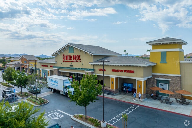
Property Record
29061 Newport Rd, Menifee, CA 92584

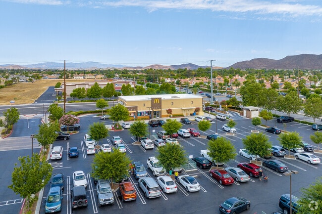
NEARBY LISTINGS FOR SALE OR LEASE
Property Detail
29061 Newport Rd
364-390-003
4.72 ACRES M/L IN PAR 3 PM 241/021 PM 36728
Supermarket
Riverside
X
California
06065C2070H
4.72 AC
2024
South Riverside
2025
Inland Empire (California)
042738
Riverside-San Bernardino-Ontario, CA
90,524 SF
DEMOGRAPHICS near 29061 Newport Rd
1 Mile
3 Mile
5 Mile
2024 Total Population
14,087
65,440
126,747
2029 Population
14,761
69,257
134,144
Pop Growth 2024-2029
+ 4.78%
+ 5.83%
+ 5.84%
Average Age
38
38
39
2024 Total Households
4,535
20,967
40,850
HH Growth 2024-2029
+ 4.30%
+ 5.38%
+ 5.39%
Median Household Inc
$100,541
$92,312
$87,976
Avg Household Size
3.00
3.00
3.00
2024 Avg HH Vehicles
2.00
2.00
2.00
Median Home Value
$458,465
$447,048
$446,462
Median Year Built
2001
2001
2000
Nearby Places
Map Layers
Map Styles
 Street
 Aerial
- Restaurants
- Banks
- Shops
- Fitness
- Groceries
SALE & LEASE HISTORY
LISTING DATE
SALE/LEASE

Mar 31, 2017
For Lease
Jan 24, 2017
For Lease
Nearby Properties
Address
Land Use
TOTAL SIZE
Lot Size
Zoning
Address
Land Use
TOTAL SIZE
Lot Size
Zoning
61,012 SF
19.12 AC
SPZONE
Address
Land Use
TOTAL SIZE
Lot Size
Zoning
33,793 SF
8.47 AC
Address
Land Use
TOTAL SIZE
Lot Size
Zoning
136,706 SF
10.85 AC
RR
Address
Land Use
TOTAL SIZE
Lot Size
Zoning
31,477 SF
4.24 AC
RR
Address
Land Use
TOTAL SIZE
Lot Size
Zoning
128,991 SF
10.20 AC
SPZONE
Address
Land Use
TOTAL SIZE
Lot Size
Zoning
134,641 SF
5.39 AC
Address
Land Use
TOTAL SIZE
Lot Size
Zoning
5,757 SF
314.61 AC
A110
Address
Land Use
TOTAL SIZE
Lot Size
Zoning
130,830 SF
26 AC
SP
Address
Land Use
TOTAL SIZE
Lot Size
Zoning
172,887 SF
15.10 AC
SPZONE
Address
Land Use
TOTAL SIZE
Lot Size
Zoning
40,349 SF
9.89 AC
R3
Address
Land Use
TOTAL SIZE
Lot Size
Zoning
61,487 SF
5.73 AC
Address
Land Use
TOTAL SIZE
Lot Size
Zoning
139,410 SF
13 AC
SPZONE
Address
Land Use
TOTAL SIZE
Lot Size
Zoning
5,000 SF
4.07 AC
RR
Address
Land Use
TOTAL SIZE
Lot Size
Zoning
38,106 SF
3.50 AC
SP
Address
Land Use
TOTAL SIZE
Lot Size
Zoning
63,039 SF
2.80 AC
SP
Address
Land Use
TOTAL SIZE
Lot Size
Zoning
56,135 SF
3.45 AC
SPZONE
Address
Land Use
TOTAL SIZE
Lot Size
Zoning
83,814 SF
8.87 AC
CPS
Address
Land Use
TOTAL SIZE
Lot Size
Zoning
89,137 SF
7.39 AC
SPZONE
Address
Land Use
TOTAL SIZE
Lot Size
Zoning
56,284 SF
5.06 AC
C1CP
Address
Land Use
TOTAL SIZE
Lot Size
Zoning
14,081 SF
1.39 AC
SPZONE
Address
Land Use
TOTAL SIZE
Lot Size
Zoning
27,252 SF
5.42 AC
R6
Address
Land Use
TOTAL SIZE
Lot Size
Zoning
12,645 SF
1.33 AC
RR
Address
Land Use
TOTAL SIZE
Lot Size
Zoning
67,520 SF
74.53 AC
RR
Address
Land Use
TOTAL SIZE
Lot Size
Zoning
1,782 SF
119.21 AC
A210
Address
Land Use
TOTAL SIZE
Lot Size
Zoning
61,678 SF
4.91 AC
RR
Address
Land Use
TOTAL SIZE
Lot Size
Zoning
86,403 SF
6.17 AC
R2
Address
Land Use
TOTAL SIZE
Lot Size
Zoning
11,165 SF
1.05 AC
SPZONE
The World's #1 Commercial Real Estate Marketplace
Connect with us
© 2026 CoStar Group
The information above has been obtained from sources believed reliable. While we do not doubt its accuracy we have not verified it and make no guarantee, warranty or representation about it. It is your responsibility to independently confirm its accuracy and completeness. Any projections, opinions, assumptions, or estimates used are for example only and do not represent the current or future performance of the property. The value of this transaction to you depends on tax and other factors which should be evaluated by your tax, financial, and legal advisors. You and your advisors should conduct a careful, independent investigation of the property to determine to your satisfaction the suitability of the property for your needs.