Property Record
2907 Blake Rd, Jackson, MI 49201
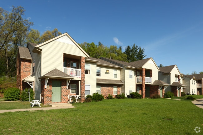

Property Detail
2907 Blake Rd
000-08-25-201-002-04
BEG AT N 1/4 POST OF SEC 25 TH S 01 DEG 06'54"W 257.18 FT TO S LN OF BLAKE RD (I-94 SERVICE RD) TH 141.94 FT ALG SD S LN AND
Clubslodgesprofessionalassociations
JACKSON
PR-1
Michigan
B and X Area of moderate flood hazard, usually the area between the limits of the 100-year and 500-year floods.
12.97 AC
0
Jackson County
2025
West Michigan
005900
Jackson, MI
154,448 SF
NEARBY LISTINGS FOR SALE OR LEASE
-
-
View all Jackson listings for sale on LoopNet.com
DEMOGRAPHICS near 2907 Blake Rd
1 mile
3 mile
5 mile
2025 Total Population
1,133
25,291
65,870
2030 Population
1,140
25,255
65,737
Pop Growth 2025-2030
+ 0.62%
(0.14%)
(0.20%)
Average Age
41
39
40
2025 Total Households
475
10,354
27,696
HH Growth 2025-2030
+ 0.63%
(0.09%)
(0.20%)
Median Household Inc
$46,964
$42,158
$49,762
Avg Household Size
2.30
2.30
2.30
2025 Avg HH Vehicles
2.00
2.00
2.00
Median Home Value
$161,328
$118,930
$142,389
Median Year Built
1961
1950
1955
Nearby Places
Map Layers
Map Styles
 Street
 Aerial
Transit
 Traffic
 Biking
Places
Listings with unknown addresses are not visible on the map
- Restaurants
- Banks
- Shops
- Fitness
- Groceries
PUBLIC TRANSPORTATION
COMMUTER RAIL
Jackson (Wolverine - Amtrak)
Drive
Walk
Distance
Jackson (Wolverine - Amtrak)
7 min
3.4 mi
Freight Ports
Port of Toledo
Drive
Walk
Distance
Port of Toledo
106 min
79.7 mi
Nearby Properties
Address
Land Use
TOTAL SIZE
Lot Size
Zoning
Address
Land Use
TOTAL SIZE
Lot Size
Zoning
392,155 SF
7.01 AC
C-3
Address
Land Use
TOTAL SIZE
Lot Size
Zoning
415,004 SF
19.97 AC
PB
Address
Land Use
TOTAL SIZE
Lot Size
Zoning
186,754 SF
16.63 AC
R-4 HI
Address
Land Use
TOTAL SIZE
Lot Size
Zoning
332,493 SF
145.86 AC
B-4 GEN
Address
Land Use
TOTAL SIZE
Lot Size
Zoning
401,234 SF
23.40 AC
I-2
Address
Land Use
TOTAL SIZE
Lot Size
Zoning
13,124 SF
23.61 AC
I-2
Address
Land Use
TOTAL SIZE
Lot Size
Zoning
64,257 SF
1.90 AC
R-4
Address
Land Use
TOTAL SIZE
Lot Size
Zoning
251,350 SF
23.11 AC
I-1
Address
Land Use
TOTAL SIZE
Lot Size
Zoning
223,693 SF
27.35 AC
B-4 GEN
Address
Land Use
TOTAL SIZE
Lot Size
Zoning
189,680 SF
6.90 AC
R-4
Address
Land Use
TOTAL SIZE
Lot Size
Zoning
62,227 SF
6.89 AC
R-1 ONE
Address
Land Use
TOTAL SIZE
Lot Size
Zoning
74,254 SF
12.64 AC
I-2
Address
Land Use
TOTAL SIZE
Lot Size
Zoning
91,108 SF
5.42 AC
C-2
Address
Land Use
TOTAL SIZE
Lot Size
Zoning
57,057 SF
10.10 AC
C-3
Address
Land Use
TOTAL SIZE
Lot Size
Zoning
112,571 SF
9.35 AC
C-4
Address
Land Use
TOTAL SIZE
Lot Size
Zoning
67,146 SF
0.80 AC
C-3
Address
Land Use
TOTAL SIZE
Lot Size
Zoning
444,936 SF
19.65 AC
I-2
Address
Land Use
TOTAL SIZE
Lot Size
Zoning
171,368 SF
18.90 AC
I-2
Address
Land Use
TOTAL SIZE
Lot Size
Zoning
180,410 SF
12.60 AC
RM-1
Address
Land Use
TOTAL SIZE
Lot Size
Zoning
111,312 SF
3.27 AC
R-2
Address
Land Use
TOTAL SIZE
Lot Size
Zoning
35,908 SF
6.60 AC
R-4
Address
Land Use
TOTAL SIZE
Lot Size
Zoning
55,209 SF
5.67 AC
C-2
Address
Land Use
TOTAL SIZE
Lot Size
Zoning
270,966 SF
67.93 AC
I-1
Address
Land Use
TOTAL SIZE
Lot Size
Zoning
196,525 SF
4.22 AC
I-2
Address
Land Use
TOTAL SIZE
Lot Size
Zoning
47,765 SF
2.30 AC
C-2
Address
Land Use
TOTAL SIZE
Lot Size
Zoning
126,176 SF
19.62 AC
PR-1
Address
Land Use
TOTAL SIZE
Lot Size
Zoning
64,185 SF
17.13 AC
C-3
Address
Land Use
TOTAL SIZE
Lot Size
Zoning
57,804 SF
3.77 AC
C-4
Address
Land Use
TOTAL SIZE
Lot Size
Zoning
89,888 SF
8 AC
R-3
The World's #1 Commercial Real Estate Marketplace
Connect with us
© 2026 CoStar Group
The information above has been obtained from sources believed reliable. While we do not doubt its accuracy we have not verified it and make no guarantee, warranty or representation about it. It is your responsibility to independently confirm its accuracy and completeness. Any projections, opinions, assumptions, or estimates used are for example only and do not represent the current or future performance of the property. The value of this transaction to you depends on tax and other factors which should be evaluated by your tax, financial, and legal advisors. You and your advisors should conduct a careful, independent investigation of the property to determine to your satisfaction the suitability of the property for your needs.