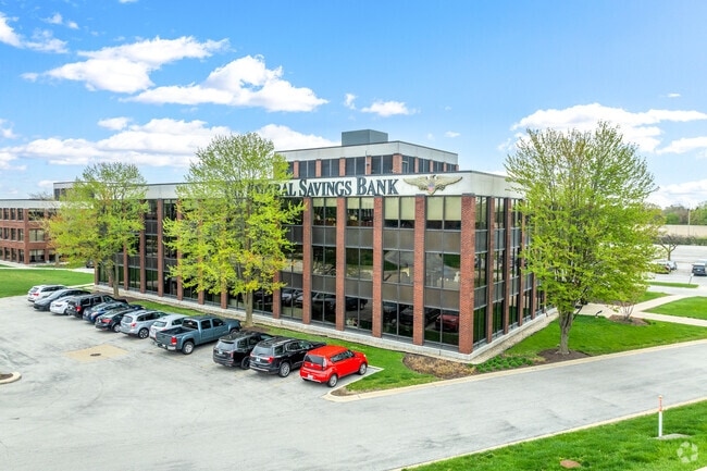
Property Record
2905 Butterfield Rd, Oak Brook, IL 60523


NEARBY LISTINGS FOR SALE OR LEASE
Property Detail
2905 Butterfield Rd
Chicago-Naperville-Elgin, IL-IN-WI
Oak Brook International Subdivision
06-28-104-013
OAK BROOK INTERNATIONAL SUBDIVISION /EX HWY DESC 98-106956/
Commercialnec
DuPage
X
Illinois
17043C0178J
3
2024
3.37 AC
2024
Eastern East/West Corr
844402
Chicago
51,639 SF
DEMOGRAPHICS near 2905 Butterfield Rd
1 Mile
3 Mile
5 Mile
2024 Total Population
10,726
90,662
271,081
2029 Population
10,833
90,123
268,578
Pop Growth 2024-2029
+ 1.00%
(0.59%)
(0.92%)
Average Age
45
43
42
2024 Total Households
4,920
36,452
105,087
HH Growth 2024-2029
+ 0.83%
(0.62%)
(0.99%)
Median Household Inc
$79,033
$92,888
$104,014
Avg Household Size
2.10
2.40
2.50
2024 Avg HH Vehicles
2.00
2.00
2.00
Median Home Value
$335,626
$344,794
$395,533
Median Year Built
1979
1972
1970
Nearby Places
Map Layers
Map Styles
 Street
 Aerial
- Restaurants
- Banks
- Shops
- Fitness
- Groceries
PUBLIC TRANSPORTATION
COMMUTER RAIL
Downers Grove Fairview Avenue Station (Burlington Northern-Santa Fe Railway Line - Northeast Illinois Regional Commuter Railroad (Metra))
DRIVE
WALK
Distance
Downers Grove Fairview Avenue Station (Burlington Northern-Santa Fe Railway Line - Northeast Illinois Regional Commuter Railroad (Metra))
7 min
3.5 mi
Westmont Station (Burlington Northern-Santa Fe Railway Line - Northeast Illinois Regional Commuter Railroad (Metra))
DRIVE
WALK
Distance
Westmont Station (Burlington Northern-Santa Fe Railway Line - Northeast Illinois Regional Commuter Railroad (Metra))
9 min
4.5 mi
AIRPORT
Chicago Midway International
DRIVE
WALK
Distance
Chicago Midway International
27 min
15.6 mi
Chicago O'Hare International
DRIVE
WALK
Distance
Chicago O'Hare International
28 min
17.4 mi
Freight Ports
Port Milwaukee
DRIVE
WALK
Distance
Port Milwaukee
109 min
89.1 mi
SALE & LEASE HISTORY
LISTING DATE
SALE/LEASE

Sep 25, 2016
For Lease
Jun 16, 2022
For Lease
Jun 13, 2020
For Lease
Nearby Properties
Address
Land Use
TOTAL SIZE
Lot Size
Zoning
Address
Land Use
TOTAL SIZE
Lot Size
Zoning
588,603 SF
11.92 AC
C
Address
Land Use
TOTAL SIZE
Lot Size
Zoning
345,161 SF
23.37 AC
C
Address
Land Use
TOTAL SIZE
Lot Size
Zoning
365,658 SF
5 AC
C
Address
Land Use
TOTAL SIZE
Lot Size
Zoning
347,240 SF
1.18 AC
Address
Land Use
TOTAL SIZE
Lot Size
Zoning
834,293 SF
40.24 AC
M
Address
Land Use
TOTAL SIZE
Lot Size
Zoning
4.69 AC
Address
Land Use
TOTAL SIZE
Lot Size
Zoning
368,004 SF
5.95 AC
C
Address
Land Use
TOTAL SIZE
Lot Size
Zoning
435,740 SF
17.74 AC
C
Address
Land Use
TOTAL SIZE
Lot Size
Zoning
534,583 SF
16.04 AC
C
Address
Land Use
TOTAL SIZE
Lot Size
Zoning
376,629 SF
16.26 AC
C
Address
Land Use
TOTAL SIZE
Lot Size
Zoning
268,057 SF
5.03 AC
C
Address
Land Use
TOTAL SIZE
Lot Size
Zoning
403,248 SF
24.98 AC
M
Address
Land Use
TOTAL SIZE
Lot Size
Zoning
12.21 AC
Address
Land Use
TOTAL SIZE
Lot Size
Zoning
740,508 SF
9.82 AC
C
Address
Land Use
TOTAL SIZE
Lot Size
Zoning
338,664 SF
11.42 AC
M
Address
Land Use
TOTAL SIZE
Lot Size
Zoning
227,285 SF
1.75 AC
Address
Land Use
TOTAL SIZE
Lot Size
Zoning
313,920 SF
13.18 AC
M
Address
Land Use
TOTAL SIZE
Lot Size
Zoning
240,678 SF
19.83 AC
C
Address
Land Use
TOTAL SIZE
Lot Size
Zoning
440,000 SF
5.32 AC
C
Address
Land Use
TOTAL SIZE
Lot Size
Zoning
192,397 SF
20.01 AC
C
Address
Land Use
TOTAL SIZE
Lot Size
Zoning
319,650 SF
20.12 AC
M
Address
Land Use
TOTAL SIZE
Lot Size
Zoning
442,326 SF
12.47 AC
C
Address
Land Use
TOTAL SIZE
Lot Size
Zoning
317,925 SF
7.10 AC
M
Address
Land Use
TOTAL SIZE
Lot Size
Zoning
200,237 SF
2.98 AC
C
Address
Land Use
TOTAL SIZE
Lot Size
Zoning
552,111 SF
4.48 AC
C
Address
Land Use
TOTAL SIZE
Lot Size
Zoning
518,123 SF
18.20 AC
C
Address
Land Use
TOTAL SIZE
Lot Size
Zoning
239,756 SF
13.43 AC
M
Address
Land Use
TOTAL SIZE
Lot Size
Zoning
12.40 AC
Address
Land Use
TOTAL SIZE
Lot Size
Zoning
299,435 SF
11.16 AC
C
Address
Land Use
TOTAL SIZE
Lot Size
Zoning
252,596 SF
3.67 AC
C
The World's #1 Commercial Real Estate Marketplace
Connect with us
© 2025 CoStar Group
The information above has been obtained from sources believed reliable. While we do not doubt its accuracy we have not verified it and make no guarantee, warranty or representation about it. It is your responsibility to independently confirm its accuracy and completeness. Any projections, opinions, assumptions, or estimates used are for example only and do not represent the current or future performance of the property. The value of this transaction to you depends on tax and other factors which should be evaluated by your tax, financial, and legal advisors. You and your advisors should conduct a careful, independent investigation of the property to determine to your satisfaction the suitability of the property for your needs.