Property Record
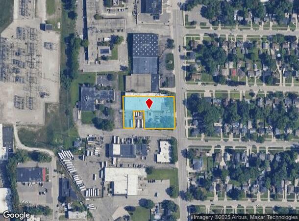
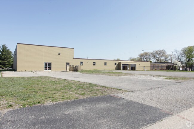
2909 Buchanan Ave Sw, Grand Rapids, MI 49548

NEARBY LISTINGS FOR SALE OR LEASE
Property Detail
2909 Buchanan Ave Sw
41-17-13-201-017
W 300 FT OF E 340 FT OF THAT PART NW 1/4 NE 1/4 LYING N OF N LINE OF COLRAIN ST /66 FT WIDE/ EX E 60 FT OF W 120 FT OF S 100
Commercialnec
Kent
X
Michigan
26081C0416D
1.26 AC
2024
S Grand Rapids/Kentwood
2025
West Michigan
013600
Grand Rapids-Wyoming, MI
24,751 SF
DEMOGRAPHICS near 2909 Buchanan Ave Sw
1 Mile
3 Mile
5 Mile
2024 Total Population
12,916
125,668
284,619
2029 Population
12,907
126,245
286,350
Pop Growth 2024-2029
(0.07%)
+ 0.46%
+ 0.61%
Average Age
35
36
36
2024 Total Households
4,454
45,121
110,463
HH Growth 2024-2029
(0.04%)
+ 0.51%
+ 0.67%
Median Household Inc
$56,612
$56,797
$62,053
Avg Household Size
2.80
2.70
2.50
2024 Avg HH Vehicles
2.00
2.00
2.00
Median Home Value
$146,574
$161,858
$202,666
Median Year Built
1953
1957
1963
Nearby Places
Map Layers
Map Styles
 Street
 Aerial
- Restaurants
- Banks
- Shops
- Fitness
- Groceries
PUBLIC TRANSPORTATION
COMMUTER RAIL
DRIVE
WALK
Distance
7 min
4.0 mi
AIRPORT
Gerald R Ford International
DRIVE
WALK
Distance
Gerald R Ford International
20 min
10.2 mi
SALE & LEASE HISTORY
LISTING DATE
SALE/LEASE

Oct 31, 2016
For Sale
Nearby Properties
Address
Land Use
TOTAL SIZE
Lot Size
Zoning
Address
Land Use
TOTAL SIZE
Lot Size
Zoning
649,177 SF
55.67 AC
SD-IT
Address
Land Use
TOTAL SIZE
Lot Size
Zoning
941,968 SF
38.56 AC
SD-IT
Address
Land Use
TOTAL SIZE
Lot Size
Zoning
398,607 SF
33.51 AC
R4
Address
Land Use
TOTAL SIZE
Lot Size
Zoning
1,426,319 SF
54.81 AC
SD-IT
Address
Land Use
TOTAL SIZE
Lot Size
Zoning
87.39 AC
I2
Address
Land Use
TOTAL SIZE
Lot Size
Zoning
264,739 SF
26.56 AC
I2
Address
Land Use
TOTAL SIZE
Lot Size
Zoning
13.71 AC
MCN-LDR
Address
Land Use
TOTAL SIZE
Lot Size
Zoning
22.35 AC
Address
Land Use
TOTAL SIZE
Lot Size
Zoning
536,296 SF
26.16 AC
SD-IT
Address
Land Use
TOTAL SIZE
Lot Size
Zoning
179,436 SF
24.94 AC
I2
Address
Land Use
TOTAL SIZE
Lot Size
Zoning
212,353 SF
16.52 AC
R4
Address
Land Use
TOTAL SIZE
Lot Size
Zoning
20.30 AC
Address
Land Use
TOTAL SIZE
Lot Size
Zoning
348,367 SF
12.15 AC
SD-IT
Address
Land Use
TOTAL SIZE
Lot Size
Zoning
29.13 AC
Address
Land Use
TOTAL SIZE
Lot Size
Zoning
251,562 SF
15.56 AC
MZ
Address
Land Use
TOTAL SIZE
Lot Size
Zoning
162,228 SF
14.31 AC
R4
Address
Land Use
TOTAL SIZE
Lot Size
Zoning
Address
Land Use
TOTAL SIZE
Lot Size
Zoning
349,885 SF
8.92 AC
I1
Address
Land Use
TOTAL SIZE
Lot Size
Zoning
174,256 SF
10.83 AC
SD-IT
Address
Land Use
TOTAL SIZE
Lot Size
Zoning
248,360 SF
7.03 AC
SD-IT
Address
Land Use
TOTAL SIZE
Lot Size
Zoning
157,386 SF
13.11 AC
R4
Address
Land Use
TOTAL SIZE
Lot Size
Zoning
442,193 SF
17.90 AC
I1
Address
Land Use
TOTAL SIZE
Lot Size
Zoning
116,832 SF
14.32 AC
R4
Address
Land Use
TOTAL SIZE
Lot Size
Zoning
260,000 SF
10.49 AC
SD-IT
Address
Land Use
TOTAL SIZE
Lot Size
Zoning
6.37 AC
MCN-MDR
Address
Land Use
TOTAL SIZE
Lot Size
Zoning
50.15 AC
Address
Land Use
TOTAL SIZE
Lot Size
Zoning
203,567 SF
17.48 AC
I2
Address
Land Use
TOTAL SIZE
Lot Size
Zoning
192,852 SF
4.27 AC
MON-MDR
Address
Land Use
TOTAL SIZE
Lot Size
Zoning
132,600 SF
14 AC
R-PUD-1
Address
Land Use
TOTAL SIZE
Lot Size
Zoning
137,114 SF
12.50 AC
R4
The World's #1 Commercial Real Estate Marketplace
Connect with us
© 2025 CoStar Group
The information above has been obtained from sources believed reliable. While we do not doubt its accuracy we have not verified it and make no guarantee, warranty or representation about it. It is your responsibility to independently confirm its accuracy and completeness. Any projections, opinions, assumptions, or estimates used are for example only and do not represent the current or future performance of the property. The value of this transaction to you depends on tax and other factors which should be evaluated by your tax, financial, and legal advisors. You and your advisors should conduct a careful, independent investigation of the property to determine to your satisfaction the suitability of the property for your needs.