Property Record
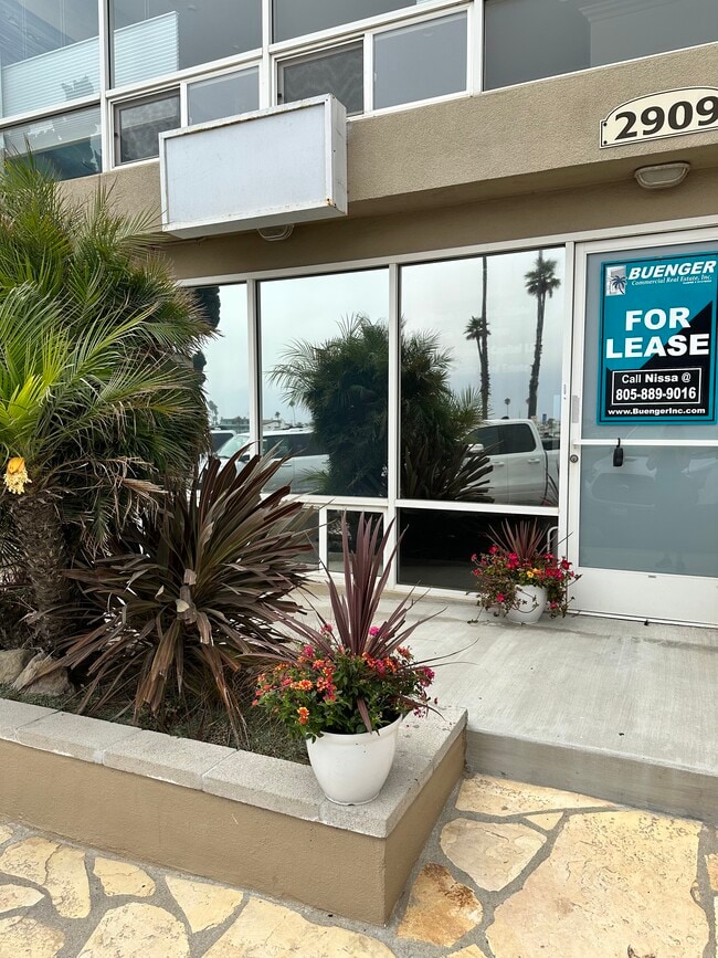
2909 Ocean Dr, Oxnard, CA 93035


Current Lease Availabilities
Property Detail
2909 Ocean Dr
206-0-226-235
LOT 30
Officebuilding
Ventura
CVC
California
C and X Area of minimal flood hazard, usually depicted on FIRMs as above the 500-year flood level.
0.03 AC
2024
Oxnard/Port Hueneme
2025
Los Angeles
003617
Oxnard-Thousand Oaks-Ventura, CA
2,620 SF
NEARBY LISTINGS FOR SALE OR LEASE
DEMOGRAPHICS near 2909 Ocean Dr
1 mile
3 mile
5 mile
2025 Total Population
4,838
91,115
184,119
2030 Population
5,071
91,328
182,990
Pop Growth 2025-2030
+ 4.82%
+ 0.23%
(0.61%)
Average Age
47
39
38
2025 Total Households
2,349
27,311
50,537
HH Growth 2025-2030
+ 4.56%
+ 0.80%
(0.31%)
Median Household Inc
$95,159
$89,518
$89,528
Avg Household Size
2.10
3.20
3.40
2025 Avg HH Vehicles
2.00
2.00
2.00
Median Home Value
$1,057,004
$739,362
$713,343
Median Year Built
1975
1973
1973
Nearby Places
Map Layers
Map Styles
 Street
 Aerial
Transit
 Traffic
 Biking
Places
Listings with unknown addresses are not visible on the map
- Restaurants
- Banks
- Shops
- Fitness
- Groceries
PUBLIC TRANSPORTATION
COMMUTER RAIL
Oxnard (Ventura County Line - Southern California Regional Rail Authority (Metrolink))
Drive
Walk
Distance
Oxnard (Ventura County Line - Southern California Regional Rail Authority (Metrolink))
13 min
6.1 mi
Drive
Walk
Distance
14 min
7.8 mi
Freight Ports
The Port of Hueneme
Drive
Walk
Distance
The Port of Hueneme
12 min
5.3 mi
Nearby Properties
Address
Land Use
TOTAL SIZE
Lot Size
Zoning
Address
Land Use
TOTAL SIZE
Lot Size
Zoning
241,298 SF
8 AC
R3C
Address
Land Use
TOTAL SIZE
Lot Size
Zoning
90,086 SF
10.48 AC
CDI
Address
Land Use
TOTAL SIZE
Lot Size
Zoning
166,920 SF
7.15 AC
R3PD
Address
Land Use
TOTAL SIZE
Lot Size
Zoning
129,018 SF
5.09 AC
R3PD
Address
Land Use
TOTAL SIZE
Lot Size
Zoning
20,349 SF
9.65 AC
C2
Address
Land Use
TOTAL SIZE
Lot Size
Zoning
81,233 SF
3.29 AC
R3PD
Address
Land Use
TOTAL SIZE
Lot Size
Zoning
79,117 SF
3.25 AC
R3PD
Address
Land Use
TOTAL SIZE
Lot Size
Zoning
Address
Land Use
TOTAL SIZE
Lot Size
Zoning
94,375 SF
7.94 AC
Address
Land Use
TOTAL SIZE
Lot Size
Zoning
14,931 SF
14.08 AC
Address
Land Use
TOTAL SIZE
Lot Size
Zoning
70,600 SF
3.75 AC
R3PD
Address
Land Use
TOTAL SIZE
Lot Size
Zoning
98,276 SF
14 AC
R3
Address
Land Use
TOTAL SIZE
Lot Size
Zoning
56,230 SF
1.19 AC
Address
Land Use
TOTAL SIZE
Lot Size
Zoning
86,627 SF
6.59 AC
CMPD
Address
Land Use
TOTAL SIZE
Lot Size
Zoning
57,224 SF
3.17 AC
R1
Address
Land Use
TOTAL SIZE
Lot Size
Zoning
1,316 SF
3.86 AC
Address
Land Use
TOTAL SIZE
Lot Size
Zoning
58,400 SF
4.89 AC
Address
Land Use
TOTAL SIZE
Lot Size
Zoning
66,390 SF
7.09 AC
CDI
Address
Land Use
TOTAL SIZE
Lot Size
Zoning
33,756 SF
1.19 AC
C2PD
Address
Land Use
TOTAL SIZE
Lot Size
Zoning
31,631 SF
2.45 AC
Address
Land Use
TOTAL SIZE
Lot Size
Zoning
40,179 SF
5.83 AC
Address
Land Use
TOTAL SIZE
Lot Size
Zoning
122,040 SF
7.52 AC
R2PD
Address
Land Use
TOTAL SIZE
Lot Size
Zoning
122,512 SF
3.51 AC
Address
Land Use
TOTAL SIZE
Lot Size
Zoning
37,500 SF
1.37 AC
Address
Land Use
TOTAL SIZE
Lot Size
Zoning
33,609 SF
2.60 AC
Address
Land Use
TOTAL SIZE
Lot Size
Zoning
40,977 SF
4.14 AC
R1PD
Address
Land Use
TOTAL SIZE
Lot Size
Zoning
77,645 SF
2.99 AC
R4PD
Address
Land Use
TOTAL SIZE
Lot Size
Zoning
30,276 SF
1.02 AC
R4
Address
Land Use
TOTAL SIZE
Lot Size
Zoning
32,016 SF
2.28 AC
Address
Land Use
TOTAL SIZE
Lot Size
Zoning
84,024 SF
5.10 AC
R3PD
The World's #1 Commercial Real Estate Marketplace
Connect with us
© 2026 CoStar Group
The information above has been obtained from sources believed reliable. While we do not doubt its accuracy we have not verified it and make no guarantee, warranty or representation about it. It is your responsibility to independently confirm its accuracy and completeness. Any projections, opinions, assumptions, or estimates used are for example only and do not represent the current or future performance of the property. The value of this transaction to you depends on tax and other factors which should be evaluated by your tax, financial, and legal advisors. You and your advisors should conduct a careful, independent investigation of the property to determine to your satisfaction the suitability of the property for your needs.