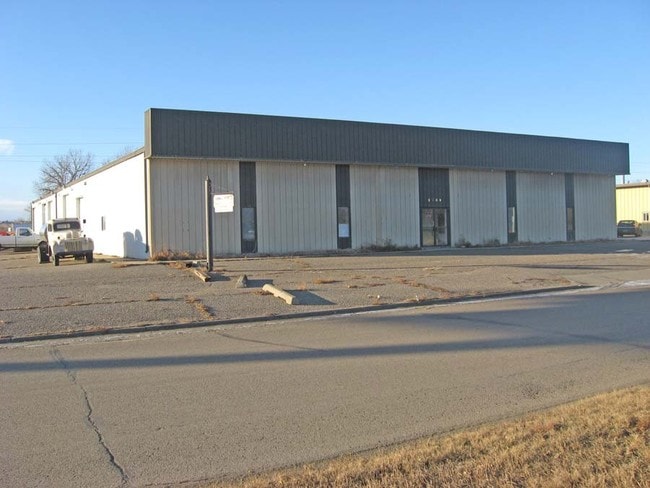
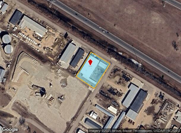
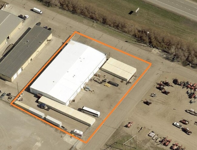
Property Record
2909 Twin City Dr, Mandan, ND 58554
Current Lease Availabilities
NEARBY LISTINGS FOR SALE OR LEASE
-
-
View all Mandan listings for lease on LoopNet.com
Property Detail
2909 Twin City Dr
Other Market Areas
Twin City Industrial Sites
Bismarck, ND
Morton
65-5280000
North Dakota
Residentialnec
1.20 AC
X
Prairie West
38015C0780E
DEMOGRAPHICS near 2909 Twin City Dr
1 Mile
3 Mile
5 Mile
2024 Total Population
1,507
39,106
91,761
2029 Population
1,569
40,486
94,735
Pop Growth 2024-2029
+ 4.11%
+ 3.53%
+ 3.24%
Average Age
38
40
40
2024 Total Households
611
16,454
39,677
HH Growth 2024-2029
+ 3.93%
+ 3.56%
+ 3.26%
Median Household Inc
$58,513
$73,641
$66,853
Avg Household Size
2.20
2.30
2.20
2024 Avg HH Vehicles
2.00
2.00
2.00
Median Home Value
$191,208
$266,422
$259,548
Median Year Built
1976
1982
1981
Nearby Places
- Restaurants
- Banks
- Shops
- Fitness
- Groceries
PUBLIC TRANSPORTATION
AIRPORT
Bismarck Municipal
DRIVE
WALK
Distance
Bismarck Municipal
22 min
8.3 mi
Freight Ports
Port Milwaukee
DRIVE
WALK
Distance
Port Milwaukee
827 min
768.8 mi
Nearby Properties
Address
Land Use
TOTAL SIZE
Lot Size
Zoning
Address
Land Use
TOTAL SIZE
Lot Size
Zoning
13.47 AC
PUD
Address
Land Use
TOTAL SIZE
Lot Size
Zoning
38,467 SF
13.89 AC
CG
Address
Land Use
TOTAL SIZE
Lot Size
Zoning
13.98 AC
CG
Address
Land Use
TOTAL SIZE
Lot Size
Zoning
57,580 SF
8.85 AC
CG
Address
Land Use
TOTAL SIZE
Lot Size
Zoning
8.64 AC
ETZ
Address
Land Use
TOTAL SIZE
Lot Size
Zoning
88,263 SF
8.58 AC
CG
Address
Land Use
TOTAL SIZE
Lot Size
Zoning
48,661 SF
4.91 AC
CG
Address
Land Use
TOTAL SIZE
Lot Size
Zoning
68,211 SF
10 AC
RT
Address
Land Use
TOTAL SIZE
Lot Size
Zoning
8,280 SF
9.76 AC
RM30
Address
Land Use
TOTAL SIZE
Lot Size
Zoning
35,354 SF
3.75 AC
RT
Address
Land Use
TOTAL SIZE
Lot Size
Zoning
77,477 SF
3.43 AC
RM30
Address
Land Use
TOTAL SIZE
Lot Size
Zoning
34,611 SF
6.52 AC
RT
Address
Land Use
TOTAL SIZE
Lot Size
Zoning
28,532 SF
4.43 AC
RM30
Address
Land Use
TOTAL SIZE
Lot Size
Zoning
84,230 SF
7.33 AC
CA
Address
Land Use
TOTAL SIZE
Lot Size
Zoning
28,802 SF
1.82 AC
CG
Address
Land Use
TOTAL SIZE
Lot Size
Zoning
60,141 SF
4.80 AC
RM15
Address
Land Use
TOTAL SIZE
Lot Size
Zoning
55,629 SF
6 AC
CG
Address
Land Use
TOTAL SIZE
Lot Size
Zoning
37,611 SF
3.57 AC
RM30
Address
Land Use
TOTAL SIZE
Lot Size
Zoning
27,375 SF
3.28 AC
RM30
Address
Land Use
TOTAL SIZE
Lot Size
Zoning
22,474 SF
2.04 AC
CG
Address
Land Use
TOTAL SIZE
Lot Size
Zoning
30,015 SF
1.83 AC
CG
Address
Land Use
TOTAL SIZE
Lot Size
Zoning
43,708 SF
3.87 AC
CG
Address
Land Use
TOTAL SIZE
Lot Size
Zoning
24,283 SF
2.02 AC
RT
Address
Land Use
TOTAL SIZE
Lot Size
Zoning
24,611 SF
3.10 AC
RM30
Address
Land Use
TOTAL SIZE
Lot Size
Zoning
53,834 SF
1.96 AC
CG
Address
Land Use
TOTAL SIZE
Lot Size
Zoning
46,106 SF
2.18 AC
RT
Address
Land Use
TOTAL SIZE
Lot Size
Zoning
60,582 SF
2.21 AC
CG
Address
Land Use
TOTAL SIZE
Lot Size
Zoning
45,519 SF
2.33 AC
RT
Address
Land Use
TOTAL SIZE
Lot Size
Zoning
13,910 SF
1.52 AC
CG
Address
Land Use
TOTAL SIZE
Lot Size
Zoning
0.72 AC
ETZ
The World's #1 Commercial Real Estate Marketplace
Connect with us
© 2025 CoStar Group
The information above has been obtained from sources believed reliable. While we do not doubt its accuracy we have not verified it and make no guarantee, warranty or representation about it. It is your responsibility to independently confirm its accuracy and completeness. Any projections, opinions, assumptions, or estimates used are for example only and do not represent the current or future performance of the property. The value of this transaction to you depends on tax and other factors which should be evaluated by your tax, financial, and legal advisors. You and your advisors should conduct a careful, independent investigation of the property to determine to your satisfaction the suitability of the property for your needs.