Property Record
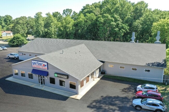
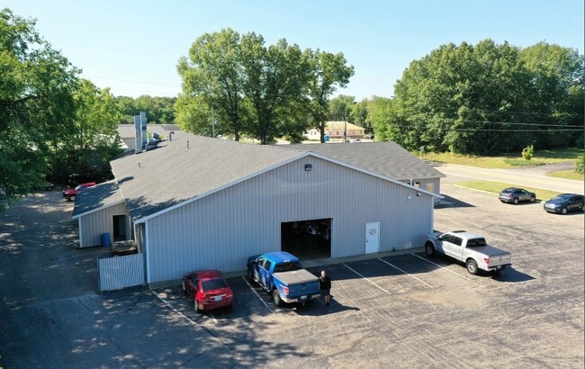
291 12Th St, Plainwell, MI 49080


This Property Is For Sale
Property Detail
291 12Th St
17-025-113-00
E 247.5 FT OF N 352 FT OF NE 1/4 EX STATE HWY SE 1/4 ALSO EX THAT PT OF THE E 247.5' OF N 352' LYING W'LY OF THE US-131 SERVICE RD IN NE 1/4 SE 1/4 SEC 25 T1N R12W SKETCH: 1.4 AC (87)
Autorepair
ALLEGAN
B and X Area of moderate flood hazard, usually the area between the limits of the 100-year and 500-year floods.
Michigan
2024
1.39 AC
2025
Outlying Allegan County
032000
West Michigan
12,480 SF
Holland, MI
NEARBY LISTINGS FOR SALE OR LEASE
DEMOGRAPHICS near 291 12Th St
1 mile
3 mile
5 mile
2025 Total Population
3,413
13,693
19,681
2030 Population
3,375
13,555
19,506
Pop Growth 2025-2030
(1.11%)
(1.01%)
(0.89%)
Average Age
40
41
42
2025 Total Households
1,374
5,385
7,702
HH Growth 2025-2030
(1.38%)
(1.19%)
(1.09%)
Median Household Inc
$54,051
$72,460
$73,933
Avg Household Size
2.30
2.50
2.50
2025 Avg HH Vehicles
2.00
2.00
2.00
Median Home Value
$209,200
$205,394
$224,268
Median Year Built
1974
1972
1974
Nearby Places
Map Layers
Map Styles
 Street
 Aerial
Layers
 Traffic
 Biking
Places
Listings with unknown addresses are not visible on the map
- Restaurants
- Banks
- Shops
- Fitness
- Groceries
PUBLIC TRANSPORTATION
AIRPORT
Kalamazoo/Battle Creek International
Drive
Walk
Distance
Kalamazoo/Battle Creek International
32 min
21.6 mi
Gerald R Ford International
Drive
Walk
Distance
Gerald R Ford International
51 min
38.8 mi
Nearby Properties
Address
Land Use
TOTAL SIZE
Lot Size
Zoning
Address
Land Use
TOTAL SIZE
Lot Size
Zoning
209,000 SF
29.66 AC
Address
Land Use
TOTAL SIZE
Lot Size
Zoning
189,919 SF
Address
Land Use
TOTAL SIZE
Lot Size
Zoning
164,105 SF
18.53 AC
Address
Land Use
TOTAL SIZE
Lot Size
Zoning
223,854 SF
24.74 AC
Address
Land Use
TOTAL SIZE
Lot Size
Zoning
71,337 SF
7.04 AC
Address
Land Use
TOTAL SIZE
Lot Size
Zoning
53,661 SF
6.30 AC
Address
Land Use
TOTAL SIZE
Lot Size
Zoning
214,356 SF
23.34 AC
Address
Land Use
TOTAL SIZE
Lot Size
Zoning
48,898 SF
5.30 AC
Address
Land Use
TOTAL SIZE
Lot Size
Zoning
296,432 SF
27 AC
Address
Land Use
TOTAL SIZE
Lot Size
Zoning
72,500 SF
Address
Land Use
TOTAL SIZE
Lot Size
Zoning
40,081 SF
3.92 AC
Address
Land Use
TOTAL SIZE
Lot Size
Zoning
40,864 SF
Address
Land Use
TOTAL SIZE
Lot Size
Zoning
18,388 SF
8.85 AC
R-2
Address
Land Use
TOTAL SIZE
Lot Size
Zoning
66,575 SF
6.31 AC
Address
Land Use
TOTAL SIZE
Lot Size
Zoning
95,484 SF
8.83 AC
Address
Land Use
TOTAL SIZE
Lot Size
Zoning
76,142 SF
43.96 AC
R1
Address
Land Use
TOTAL SIZE
Lot Size
Zoning
345,769 SF
33 AC
Address
Land Use
TOTAL SIZE
Lot Size
Zoning
33,665 SF
2.40 AC
Address
Land Use
TOTAL SIZE
Lot Size
Zoning
35,555 SF
1.10 AC
Address
Land Use
TOTAL SIZE
Lot Size
Zoning
107,850 SF
15 AC
Address
Land Use
TOTAL SIZE
Lot Size
Zoning
21,047 SF
4.74 AC
Address
Land Use
TOTAL SIZE
Lot Size
Zoning
16,886 SF
1.86 AC
Address
Land Use
TOTAL SIZE
Lot Size
Zoning
39,656 SF
5.56 AC
Address
Land Use
TOTAL SIZE
Lot Size
Zoning
155,146 SF
6.31 AC
Address
Land Use
TOTAL SIZE
Lot Size
Zoning
30,220 SF
7.28 AC
Address
Land Use
TOTAL SIZE
Lot Size
Zoning
34,801 SF
0.92 AC
Address
Land Use
TOTAL SIZE
Lot Size
Zoning
41,362 SF
0.92 AC
Address
Land Use
TOTAL SIZE
Lot Size
Zoning
51,300 SF
1.84 AC
Address
Land Use
TOTAL SIZE
Lot Size
Zoning
1,000 SF
1.40 AC
R-2
Address
Land Use
TOTAL SIZE
Lot Size
Zoning
86,907 SF
3.44 AC
The World's #1 Commercial Real Estate Marketplace
Connect with us
© 2026 CoStar Group
The information above has been obtained from sources believed reliable. While we do not doubt its accuracy we have not verified it and make no guarantee, warranty or representation about it. It is your responsibility to independently confirm its accuracy and completeness. Any projections, opinions, assumptions, or estimates used are for example only and do not represent the current or future performance of the property. The value of this transaction to you depends on tax and other factors which should be evaluated by your tax, financial, and legal advisors. You and your advisors should conduct a careful, independent investigation of the property to determine to your satisfaction the suitability of the property for your needs.