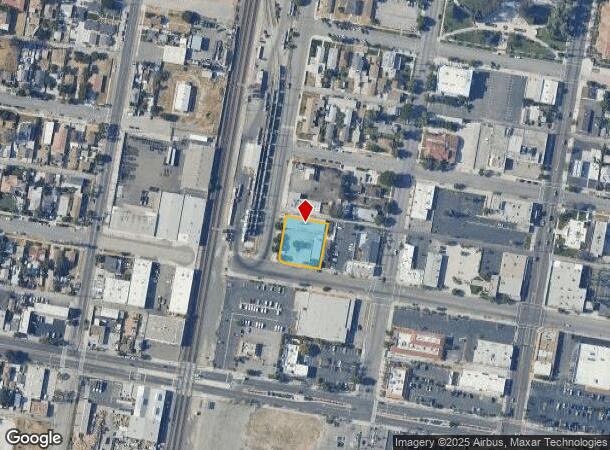
Property Record
291 W H St, Colton, CA 92324
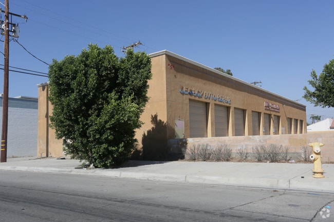
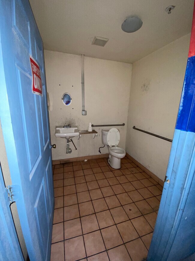

This Property Is For Sale
Current Lease Availabilities
NEARBY LISTINGS FOR SALE OR LEASE
Property Detail
291 W H St
Riverside-San Bernardino-Ontario, CA
Colton
0162-093-20
PARCEL MAP 18148 PARCEL 1 BOOK 228 PAGE 43
Autorepair
San Bernardino
X
California
06071C8679J
24
2024
0.47 AC
2025
San Bernardino
012500
Inland Empire (California)
7,762 SF
DEMOGRAPHICS near 291 W H St
1 Mile
3 Mile
5 Mile
2024 Total Population
15,840
105,776
313,827
2029 Population
16,069
107,439
319,687
Pop Growth 2024-2029
+ 1.45%
+ 1.57%
+ 1.87%
Average Age
35
35
35
2024 Total Households
4,457
30,573
88,617
HH Growth 2024-2029
+ 1.46%
+ 1.63%
+ 1.95%
Median Household Inc
$55,112
$63,317
$62,065
Avg Household Size
3.50
3.40
3.40
2024 Avg HH Vehicles
2.00
2.00
2.00
Median Home Value
$342,042
$345,996
$363,817
Median Year Built
1957
1975
1974
Nearby Places
Map Layers
Map Styles
 Street
 Aerial
- Restaurants
- Banks
- Shops
- Fitness
- Groceries
PUBLIC TRANSPORTATION
COMMUTER RAIL
San Bernardino (Inland Empire-Orange County Line - Southern California Regional Rail Authority (Metrolink), San Bernardino Line - Southern California Regional Rail Authority (Metrolink))
DRIVE
WALK
Distance
San Bernardino (Inland Empire-Orange County Line - Southern California Regional Rail Authority (Metrolink), San Bernardino Line - Southern California Regional Rail Authority (Metrolink))
7 min
3.2 mi
San Bernardino - Downtown Metrolink Station (Metrolink Inland Empire-Orange County Line - Metrolink Trains, Metrolink San Bernardino Line - Metrolink Trains)
DRIVE
WALK
Distance
San Bernardino - Downtown Metrolink Station (Metrolink Inland Empire-Orange County Line - Metrolink Trains, Metrolink San Bernardino Line - Metrolink Trains)
8 min
3.6 mi
AIRPORT
Ontario International
DRIVE
WALK
Distance
Ontario International
22 min
16.6 mi
Freight Ports
Port of Long Beach
DRIVE
WALK
Distance
Port of Long Beach
81 min
63.3 mi
Nearby Properties
Address
Land Use
TOTAL SIZE
Lot Size
Zoning
Address
Land Use
TOTAL SIZE
Lot Size
Zoning
308,030 SF
16.20 AC
Address
Land Use
TOTAL SIZE
Lot Size
Zoning
1,032,072 SF
61.74 AC
Address
Land Use
TOTAL SIZE
Lot Size
Zoning
411,707 SF
19.34 AC
Address
Land Use
TOTAL SIZE
Lot Size
Zoning
330,420 SF
15.31 AC
Address
Land Use
TOTAL SIZE
Lot Size
Zoning
340,120 SF
36.36 AC
Address
Land Use
TOTAL SIZE
Lot Size
Zoning
525,110 SF
24.25 AC
Address
Land Use
TOTAL SIZE
Lot Size
Zoning
492,631 SF
21 AC
Address
Land Use
TOTAL SIZE
Lot Size
Zoning
182,624 SF
16.07 AC
Address
Land Use
TOTAL SIZE
Lot Size
Zoning
245,476 SF
15.61 AC
Address
Land Use
TOTAL SIZE
Lot Size
Zoning
424,904 SF
23.03 AC
Address
Land Use
TOTAL SIZE
Lot Size
Zoning
391,468 SF
16.73 AC
Address
Land Use
TOTAL SIZE
Lot Size
Zoning
206,244 SF
15.22 AC
Address
Land Use
TOTAL SIZE
Lot Size
Zoning
210,418 SF
12.09 AC
Address
Land Use
TOTAL SIZE
Lot Size
Zoning
225,324 SF
11.03 AC
Address
Land Use
TOTAL SIZE
Lot Size
Zoning
851,880 SF
42.20 AC
Address
Land Use
TOTAL SIZE
Lot Size
Zoning
178,400 SF
8.23 AC
Address
Land Use
TOTAL SIZE
Lot Size
Zoning
549,796 SF
13.61 AC
Address
Land Use
TOTAL SIZE
Lot Size
Zoning
182,446 SF
9.01 AC
Address
Land Use
TOTAL SIZE
Lot Size
Zoning
151,859 SF
7.23 AC
Address
Land Use
TOTAL SIZE
Lot Size
Zoning
592,710 SF
28.89 AC
Address
Land Use
TOTAL SIZE
Lot Size
Zoning
16,000 SF
11.17 AC
Address
Land Use
TOTAL SIZE
Lot Size
Zoning
153,093 SF
2.69 AC
Address
Land Use
TOTAL SIZE
Lot Size
Zoning
122,738 SF
10.77 AC
Address
Land Use
TOTAL SIZE
Lot Size
Zoning
166,376 SF
18.75 AC
Address
Land Use
TOTAL SIZE
Lot Size
Zoning
198,818 SF
8.94 AC
Address
Land Use
TOTAL SIZE
Lot Size
Zoning
174,995 SF
10.52 AC
Address
Land Use
TOTAL SIZE
Lot Size
Zoning
179,550 SF
8.04 AC
Address
Land Use
TOTAL SIZE
Lot Size
Zoning
81,494 SF
4.10 AC
Address
Land Use
TOTAL SIZE
Lot Size
Zoning
457,216 SF
23.30 AC
The World's #1 Commercial Real Estate Marketplace
Connect with us
© 2025 CoStar Group
The information above has been obtained from sources believed reliable. While we do not doubt its accuracy we have not verified it and make no guarantee, warranty or representation about it. It is your responsibility to independently confirm its accuracy and completeness. Any projections, opinions, assumptions, or estimates used are for example only and do not represent the current or future performance of the property. The value of this transaction to you depends on tax and other factors which should be evaluated by your tax, financial, and legal advisors. You and your advisors should conduct a careful, independent investigation of the property to determine to your satisfaction the suitability of the property for your needs.