Property Record
291 Main St, Orono, ME 04473
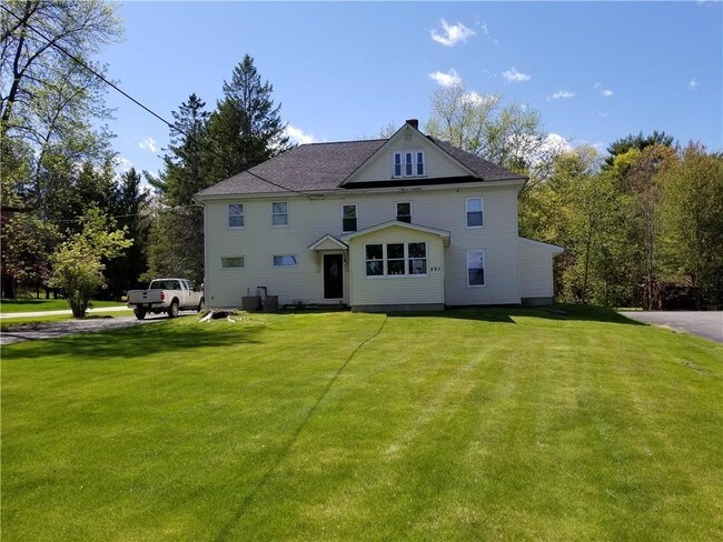

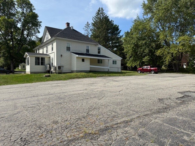
Property Detail
291 Main St
ORON-031001-000000-000014
Penobscot
Departmentstore
Maine
B and X Area of moderate flood hazard, usually the area between the limits of the 100-year and 500-year floods.
14
2025
0.82 AC
2025
Maine North & Bangor
006200
Other Market Areas
3,526 SF
Bangor, ME
NEARBY LISTINGS FOR SALE OR LEASE
-
-
View all Orono listings for sale on LoopNet.com
DEMOGRAPHICS near 291 Main St
1 mile
3 mile
5 mile
2025 Total Population
1,524
14,057
25,290
2030 Population
1,504
14,191
25,483
Pop Growth 2025-2030
(1.31%)
+ 0.95%
+ 0.76%
Average Age
44
34
37
2025 Total Households
705
4,292
9,144
HH Growth 2025-2030
(1.42%)
+ 0.44%
+ 0.54%
Median Household Inc
$69,621
$64,910
$66,437
Avg Household Size
2.10
2.30
2.20
2025 Avg HH Vehicles
2.00
2.00
2.00
Median Home Value
$278,888
$310,802
$273,605
Median Year Built
1961
1979
1976
Nearby Places
Map Layers
Map Styles
 Street
 Aerial
Layers
 Traffic
 Biking
Places
Listings with unknown addresses are not visible on the map
- Restaurants
- Banks
- Shops
- Fitness
- Groceries
PUBLIC TRANSPORTATION
AIRPORT
Bangor International
Drive
Walk
Distance
Bangor International
22 min
12.2 mi
Freight Ports
Searsport, ME
Drive
Walk
Distance
Searsport, ME
61 min
37.5 mi
SALE & LEASE HISTORY
LISTING DATE
SALE/LEASE

Sep 17, 2025
For Sale
Nov 14, 2023
For Sale
Jun 07, 2018
For Sale
Nearby Properties
Address
Land Use
TOTAL SIZE
Lot Size
Zoning
Address
Land Use
TOTAL SIZE
Lot Size
Zoning
45.74 AC
Address
Land Use
TOTAL SIZE
Lot Size
Zoning
25.37 AC
Address
Land Use
TOTAL SIZE
Lot Size
Zoning
128,812 SF
11.44 AC
Address
Land Use
TOTAL SIZE
Lot Size
Zoning
152,892 SF
Address
Land Use
TOTAL SIZE
Lot Size
Zoning
Address
Land Use
TOTAL SIZE
Lot Size
Zoning
61.03 AC
Address
Land Use
TOTAL SIZE
Lot Size
Zoning
134,456 SF
Address
Land Use
TOTAL SIZE
Lot Size
Zoning
3,917 SF
10.16 AC
Address
Land Use
TOTAL SIZE
Lot Size
Zoning
40.90 AC
Address
Land Use
TOTAL SIZE
Lot Size
Zoning
85,904 SF
Address
Land Use
TOTAL SIZE
Lot Size
Zoning
127,149 SF
Address
Land Use
TOTAL SIZE
Lot Size
Zoning
27,544 SF
4.35 AC
Address
Land Use
TOTAL SIZE
Lot Size
Zoning
172,006 SF
Address
Land Use
TOTAL SIZE
Lot Size
Zoning
77,824 SF
Address
Land Use
TOTAL SIZE
Lot Size
Zoning
9.85 AC
Address
Land Use
TOTAL SIZE
Lot Size
Zoning
2,346 SF
9.51 AC
Address
Land Use
TOTAL SIZE
Lot Size
Zoning
97,005 SF
Address
Land Use
TOTAL SIZE
Lot Size
Zoning
90,400 SF
Address
Land Use
TOTAL SIZE
Lot Size
Zoning
77,272 SF
Address
Land Use
TOTAL SIZE
Lot Size
Zoning
8,844 SF
0.54 AC
Address
Land Use
TOTAL SIZE
Lot Size
Zoning
64,563 SF
Address
Land Use
TOTAL SIZE
Lot Size
Zoning
Address
Land Use
TOTAL SIZE
Lot Size
Zoning
67,419 SF
Address
Land Use
TOTAL SIZE
Lot Size
Zoning
71,887 SF
Address
Land Use
TOTAL SIZE
Lot Size
Zoning
Address
Land Use
TOTAL SIZE
Lot Size
Zoning
44,628 SF
Address
Land Use
TOTAL SIZE
Lot Size
Zoning
41,260 SF
Address
Land Use
TOTAL SIZE
Lot Size
Zoning
48,450 SF
Address
Land Use
TOTAL SIZE
Lot Size
Zoning
13.80 AC
Address
Land Use
TOTAL SIZE
Lot Size
Zoning
12.38 AC
The World's #1 Commercial Real Estate Marketplace
Connect with us
© 2026 CoStar Group
The information above has been obtained from sources believed reliable. While we do not doubt its accuracy we have not verified it and make no guarantee, warranty or representation about it. It is your responsibility to independently confirm its accuracy and completeness. Any projections, opinions, assumptions, or estimates used are for example only and do not represent the current or future performance of the property. The value of this transaction to you depends on tax and other factors which should be evaluated by your tax, financial, and legal advisors. You and your advisors should conduct a careful, independent investigation of the property to determine to your satisfaction the suitability of the property for your needs.