Property Record
291 Ne 61St St, Miami, FL 33137

NEARBY LISTINGS FOR SALE OR LEASE
Property Detail
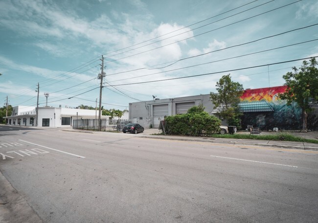
291 Ne 61St St
01-3218-057-0020
M & R Condo
Lightindustrial
M & R CONDO UNIT 291 UNDIV 4.36% INT IN COMMON ELEMENTS OFF REC 10278-1849 OR 20519-1902 06 2002 1
X
Miami/Dade
12086C0304L
Florida
2024
East Miami
2025
South Florida
002004
Miami-Miami Beach-Kendall, FL
1,228 SF
DEMOGRAPHICS near 291 Ne 61St St
1 Mile
3 Mile
5 Mile
2024 Total Population
25,172
184,368
580,707
2029 Population
24,974
183,597
577,101
Pop Growth 2024-2029
(0.79%)
(0.42%)
(0.62%)
Average Age
41
39
41
2024 Total Households
10,156
73,388
239,852
HH Growth 2024-2029
(0.93%)
(0.34%)
(0.46%)
Median Household Inc
$39,743
$47,574
$51,374
Avg Household Size
2.30
2.40
2.30
2024 Avg HH Vehicles
1.00
1.00
1.00
Median Home Value
$495,339
$402,813
$394,410
Median Year Built
1972
1974
1973
Nearby Places
Map Layers
Map Styles
 Street
 Aerial
- Restaurants
- Banks
- Shops
- Fitness
- Groceries
PUBLIC TRANSPORTATION
COMMUTER RAIL
Tri-Rail and Metrorail Transfer Station (Tri-County Commuter - South Florida Regional Transportation Authority (Tri-Rail))
DRIVE
WALK
Distance
Tri-Rail and Metrorail Transfer Station (Tri-County Commuter - South Florida Regional Transportation Authority (Tri-Rail))
17 min
5.5 mi
Hialeah Market (Tri-County Commuter - South Florida Regional Transportation Authority (Tri-Rail))
DRIVE
WALK
Distance
Hialeah Market (Tri-County Commuter - South Florida Regional Transportation Authority (Tri-Rail))
11 min
6.1 mi
AIRPORT
Miami International
DRIVE
WALK
Distance
Miami International
28 min
13.8 mi
Fort Lauderdale/Hollywood International
DRIVE
WALK
Distance
Fort Lauderdale/Hollywood International
30 min
20.0 mi
Freight Ports
Port of Miami
DRIVE
WALK
Distance
Port of Miami
1 min
3.8 mi
SALE & LEASE HISTORY
LISTING DATE
SALE/LEASE

Nov 20, 2019
For Sale
Jan 29, 2018
For Lease
Aug 21, 2020
For Lease
Nearby Properties
Address
Land Use
TOTAL SIZE
Lot Size
Zoning
Address
Land Use
TOTAL SIZE
Lot Size
Zoning
16.13 AC
6100
Address
Land Use
TOTAL SIZE
Lot Size
Zoning
1,938,271 SF
6.62 AC
6402
Address
Land Use
TOTAL SIZE
Lot Size
Zoning
1,075,124 SF
1.61 AC
6405
Address
Land Use
TOTAL SIZE
Lot Size
Zoning
256,089 SF
20.35 AC
7600
Address
Land Use
TOTAL SIZE
Lot Size
Zoning
585,775 SF
1.86 AC
6101
Address
Land Use
TOTAL SIZE
Lot Size
Zoning
868,860 SF
2.14 AC
6402
Address
Land Use
TOTAL SIZE
Lot Size
Zoning
615,785 SF
3.81 AC
4604
Address
Land Use
TOTAL SIZE
Lot Size
Zoning
790,139 SF
1.80 AC
6110
Address
Land Use
TOTAL SIZE
Lot Size
Zoning
570,694 SF
1.37 AC
4604
Address
Land Use
TOTAL SIZE
Lot Size
Zoning
566,165 SF
2.09 AC
6101
Address
Land Use
TOTAL SIZE
Lot Size
Zoning
701,056 SF
1.58 AC
6402
Address
Land Use
TOTAL SIZE
Lot Size
Zoning
600,250 SF
2.03 AC
6402
Address
Land Use
TOTAL SIZE
Lot Size
Zoning
627,685 SF
2.06 AC
6100
Address
Land Use
TOTAL SIZE
Lot Size
Zoning
519,775 SF
2.27 AC
6100
Address
Land Use
TOTAL SIZE
Lot Size
Zoning
669,245 SF
0.69 AC
6600
Address
Land Use
TOTAL SIZE
Lot Size
Zoning
768,663 SF
2.85 AC
4600
Address
Land Use
TOTAL SIZE
Lot Size
Zoning
737,810 SF
1.05 AC
6600
Address
Land Use
TOTAL SIZE
Lot Size
Zoning
595,100 SF
0.92 AC
4604
Address
Land Use
TOTAL SIZE
Lot Size
Zoning
428,154 SF
1.39 AC
6101
Address
Land Use
TOTAL SIZE
Lot Size
Zoning
221,570 SF
1.79 AC
6100
Address
Land Use
TOTAL SIZE
Lot Size
Zoning
596,081 SF
4.33 AC
9600
Address
Land Use
TOTAL SIZE
Lot Size
Zoning
264,272 SF
2.18 AC
6110
Address
Land Use
TOTAL SIZE
Lot Size
Zoning
545,562 SF
1.71 AC
6110
Address
Land Use
TOTAL SIZE
Lot Size
Zoning
469,492 SF
2.06 AC
4604
Address
Land Use
TOTAL SIZE
Lot Size
Zoning
567,884 SF
4.51 AC
4000
Address
Land Use
TOTAL SIZE
Lot Size
Zoning
505,007 SF
1.99 AC
4604
Address
Land Use
TOTAL SIZE
Lot Size
Zoning
473,168 SF
3.27 AC
6405
Address
Land Use
TOTAL SIZE
Lot Size
Zoning
690,466 SF
0.85 AC
6420
Address
Land Use
TOTAL SIZE
Lot Size
Zoning
303,688 SF
1.01 AC
6100
The World's #1 Commercial Real Estate Marketplace
Connect with us
© 2025 CoStar Group
The information above has been obtained from sources believed reliable. While we do not doubt its accuracy we have not verified it and make no guarantee, warranty or representation about it. It is your responsibility to independently confirm its accuracy and completeness. Any projections, opinions, assumptions, or estimates used are for example only and do not represent the current or future performance of the property. The value of this transaction to you depends on tax and other factors which should be evaluated by your tax, financial, and legal advisors. You and your advisors should conduct a careful, independent investigation of the property to determine to your satisfaction the suitability of the property for your needs.