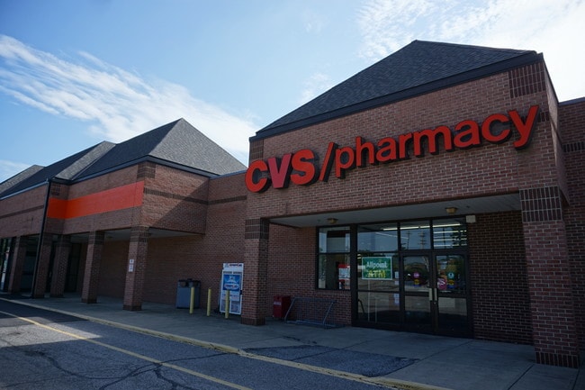
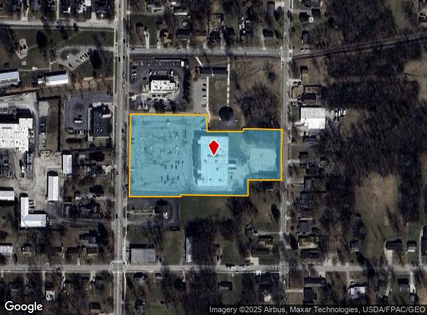
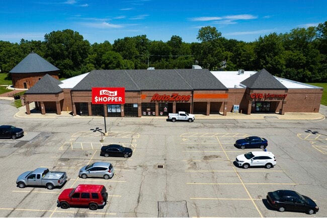
Property Record
291 S Main St, Oberlin, OH 44074
NEARBY LISTINGS FOR SALE OR LEASE
Property Detail
291 S Main St
09-00-096-103-044
FROM -042
Regionalshoppingcenterormallwithanchorstore
Lorain
X
Ohio
39093C0212D
4.36 AC
2024
Lorain County
2024
Cleveland
060100
Cleveland-Elyria, OH
29,298 SF
DEMOGRAPHICS near 291 S Main St
1 Mile
3 Mile
5 Mile
2024 Total Population
5,503
10,589
14,337
2029 Population
5,727
10,959
14,775
Pop Growth 2024-2029
+ 4.07%
+ 3.49%
+ 3.06%
Average Age
39
41
42
2024 Total Households
1,969
3,658
5,119
HH Growth 2024-2029
+ 5.13%
+ 4.48%
+ 3.75%
Median Household Inc
$63,589
$67,733
$70,324
Avg Household Size
2.10
2.20
2.30
2024 Avg HH Vehicles
2.00
2.00
2.00
Median Home Value
$193,498
$192,967
$208,429
Median Year Built
1963
1969
1970
Nearby Places
Map Layers
Map Styles
 Street
 Aerial
- Restaurants
- Banks
- Shops
- Fitness
- Groceries
PUBLIC TRANSPORTATION
AIRPORT
Cleveland-Hopkins International
DRIVE
WALK
Distance
Cleveland-Hopkins International
34 min
24.2 mi
SALE & LEASE HISTORY
LISTING DATE
SALE/LEASE

Sep 25, 2016
For Lease
Sep 17, 2021
For Lease
Sep 14, 2021
For Sale
Oct 06, 2022
For Lease
Jul 19, 2019
For Sale
Jul 16, 2020
For Lease
Jan 29, 2019
For Lease
Nearby Properties
Address
Land Use
TOTAL SIZE
Lot Size
Zoning
Address
Land Use
TOTAL SIZE
Lot Size
Zoning
8,264 SF
7.38 AC
Address
Land Use
TOTAL SIZE
Lot Size
Zoning
291,775 SF
95.89 AC
Address
Land Use
TOTAL SIZE
Lot Size
Zoning
149,607 SF
2.78 AC
Address
Land Use
TOTAL SIZE
Lot Size
Zoning
92,998 SF
2.66 AC
Address
Land Use
TOTAL SIZE
Lot Size
Zoning
13.20 AC
Address
Land Use
TOTAL SIZE
Lot Size
Zoning
61,554 SF
60.08 AC
Address
Land Use
TOTAL SIZE
Lot Size
Zoning
83,979 SF
2.36 AC
Address
Land Use
TOTAL SIZE
Lot Size
Zoning
87,116 SF
13.44 AC
Address
Land Use
TOTAL SIZE
Lot Size
Zoning
48,146 SF
3.91 AC
Address
Land Use
TOTAL SIZE
Lot Size
Zoning
201,983 SF
48.98 AC
Address
Land Use
TOTAL SIZE
Lot Size
Zoning
57,732 SF
2.12 AC
Address
Land Use
TOTAL SIZE
Lot Size
Zoning
75,984 SF
1.67 AC
Address
Land Use
TOTAL SIZE
Lot Size
Zoning
104,155 SF
3.49 AC
Address
Land Use
TOTAL SIZE
Lot Size
Zoning
102,839 SF
5.51 AC
Address
Land Use
TOTAL SIZE
Lot Size
Zoning
80,519 SF
2.71 AC
Address
Land Use
TOTAL SIZE
Lot Size
Zoning
112,071 SF
1.48 AC
Address
Land Use
TOTAL SIZE
Lot Size
Zoning
38,350 SF
1.66 AC
Address
Land Use
TOTAL SIZE
Lot Size
Zoning
49,290 SF
2.80 AC
Address
Land Use
TOTAL SIZE
Lot Size
Zoning
48,471 SF
2.76 AC
Address
Land Use
TOTAL SIZE
Lot Size
Zoning
160,255 SF
23.01 AC
Address
Land Use
TOTAL SIZE
Lot Size
Zoning
84,783 SF
9.50 AC
Address
Land Use
TOTAL SIZE
Lot Size
Zoning
79,127 SF
4.71 AC
Address
Land Use
TOTAL SIZE
Lot Size
Zoning
51,675 SF
3.83 AC
Address
Land Use
TOTAL SIZE
Lot Size
Zoning
50,996 SF
1.80 AC
Address
Land Use
TOTAL SIZE
Lot Size
Zoning
16,902 SF
7.50 AC
Address
Land Use
TOTAL SIZE
Lot Size
Zoning
47,503 SF
3.60 AC
Address
Land Use
TOTAL SIZE
Lot Size
Zoning
44,194 SF
17.80 AC
Address
Land Use
TOTAL SIZE
Lot Size
Zoning
65,280 SF
1.24 AC
Address
Land Use
TOTAL SIZE
Lot Size
Zoning
25,950 SF
1.89 AC
Address
Land Use
TOTAL SIZE
Lot Size
Zoning
45,788 SF
1.52 AC
The World's #1 Commercial Real Estate Marketplace
Connect with us
© 2025 CoStar Group
The information above has been obtained from sources believed reliable. While we do not doubt its accuracy we have not verified it and make no guarantee, warranty or representation about it. It is your responsibility to independently confirm its accuracy and completeness. Any projections, opinions, assumptions, or estimates used are for example only and do not represent the current or future performance of the property. The value of this transaction to you depends on tax and other factors which should be evaluated by your tax, financial, and legal advisors. You and your advisors should conduct a careful, independent investigation of the property to determine to your satisfaction the suitability of the property for your needs.