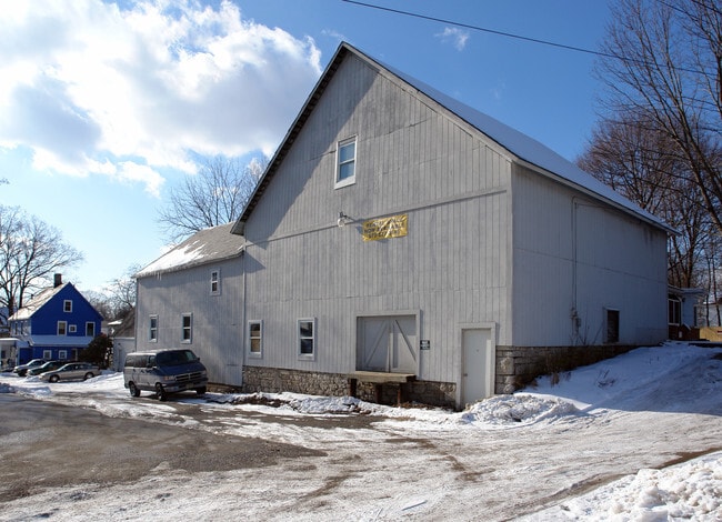
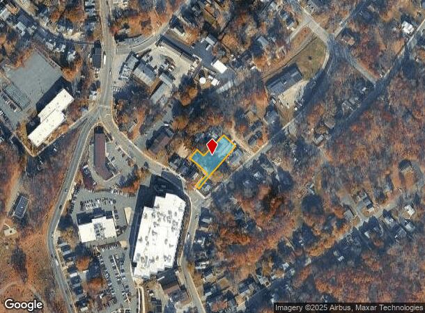
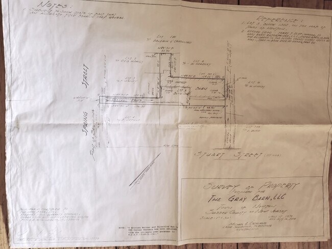
Property Record
291 Spring St, Newton, NJ 07860
NEARBY LISTINGS FOR SALE OR LEASE
Property Detail
291 Spring St
Newark, NJ-PA
Final Plat Section One Rambling Woods
15-00019-01-00008
ADDITIONAL LOTS: FORMER 4 DILLER-REAR
Commercialnec
Sussex
X
New Jersey
34037C0311E
8
2024
0.25 AC
2025
Sussex County
373800
Northern New Jersey
DEMOGRAPHICS near 291 Spring St
1 Mile
3 Mile
5 Mile
2024 Total Population
7,322
14,815
27,950
2029 Population
7,379
14,922
28,165
Pop Growth 2024-2029
+ 0.78%
+ 0.72%
+ 0.77%
Average Age
42
44
44
2024 Total Households
2,973
5,845
10,662
HH Growth 2024-2029
+ 0.84%
+ 0.82%
+ 0.83%
Median Household Inc
$69,626
$85,473
$105,232
Avg Household Size
2.30
2.40
2.50
2024 Avg HH Vehicles
2.00
2.00
2.00
Median Home Value
$257,267
$295,013
$343,648
Median Year Built
1957
1971
1971
Nearby Places
Map Layers
Map Styles
 Street
 Aerial
- Restaurants
- Banks
- Shops
- Fitness
- Groceries
SALE & LEASE HISTORY
LISTING DATE
SALE/LEASE

Sep 23, 2016
For Sale
Jan 17, 2018
For Sale
Jan 17, 2018
For Lease
Dec 15, 2023
For Sale
Nearby Properties
Address
Land Use
TOTAL SIZE
Lot Size
Zoning
Address
Land Use
TOTAL SIZE
Lot Size
Zoning
20 AC
SD-1
Address
Land Use
TOTAL SIZE
Lot Size
Zoning
49.29 AC
SD-7
Address
Land Use
TOTAL SIZE
Lot Size
Zoning
6.10 AC
T-5+
Address
Land Use
TOTAL SIZE
Lot Size
Zoning
4.56 AC
T-4
Address
Land Use
TOTAL SIZE
Lot Size
Zoning
88.63 AC
SD-2
Address
Land Use
TOTAL SIZE
Lot Size
Zoning
20.50 AC
SD-6
Address
Land Use
TOTAL SIZE
Lot Size
Zoning
47,400 SF
71 AC
SD-4
Address
Land Use
TOTAL SIZE
Lot Size
Zoning
800 SF
13.50 AC
T-3
Address
Land Use
TOTAL SIZE
Lot Size
Zoning
11.96 AC
SD-3
Address
Land Use
TOTAL SIZE
Lot Size
Zoning
7.21 AC
T-5
Address
Land Use
TOTAL SIZE
Lot Size
Zoning
12,504 SF
3.14 AC
SD-3
Address
Land Use
TOTAL SIZE
Lot Size
Zoning
Address
Land Use
TOTAL SIZE
Lot Size
Zoning
17.79 AC
SD-3
Address
Land Use
TOTAL SIZE
Lot Size
Zoning
2.09 AC
T-5
Address
Land Use
TOTAL SIZE
Lot Size
Zoning
20.62 AC
HCMF
Address
Land Use
TOTAL SIZE
Lot Size
Zoning
52.16 AC
HCMF
Address
Land Use
TOTAL SIZE
Lot Size
Zoning
72,992 SF
4.75 AC
SD-3
Address
Land Use
TOTAL SIZE
Lot Size
Zoning
5.20 AC
T-3
Address
Land Use
TOTAL SIZE
Lot Size
Zoning
50,814 SF
8.62 AC
SD-3
Address
Land Use
TOTAL SIZE
Lot Size
Zoning
26,185 SF
552.92 AC
I/A
Address
Land Use
TOTAL SIZE
Lot Size
Zoning
26,611 SF
1.21 AC
T-5+
Address
Land Use
TOTAL SIZE
Lot Size
Zoning
45,532 SF
10.31 AC
R1
Address
Land Use
TOTAL SIZE
Lot Size
Zoning
68,221 SF
7.89 AC
SD-1
Address
Land Use
TOTAL SIZE
Lot Size
Zoning
1,140 SF
1.45 AC
SD-6
Address
Land Use
TOTAL SIZE
Lot Size
Zoning
8.90 AC
HCMF
Address
Land Use
TOTAL SIZE
Lot Size
Zoning
11 AC
SD-6
Address
Land Use
TOTAL SIZE
Lot Size
Zoning
0.56 AC
T-5
Address
Land Use
TOTAL SIZE
Lot Size
Zoning
2,982 SF
5.41 AC
SD-3
Address
Land Use
TOTAL SIZE
Lot Size
Zoning
2.24 AC
T-5
Address
Land Use
TOTAL SIZE
Lot Size
Zoning
2.49 AC
SD-3
The World's #1 Commercial Real Estate Marketplace
Connect with us
© 2025 CoStar Group
The information above has been obtained from sources believed reliable. While we do not doubt its accuracy we have not verified it and make no guarantee, warranty or representation about it. It is your responsibility to independently confirm its accuracy and completeness. Any projections, opinions, assumptions, or estimates used are for example only and do not represent the current or future performance of the property. The value of this transaction to you depends on tax and other factors which should be evaluated by your tax, financial, and legal advisors. You and your advisors should conduct a careful, independent investigation of the property to determine to your satisfaction the suitability of the property for your needs.