Property Record
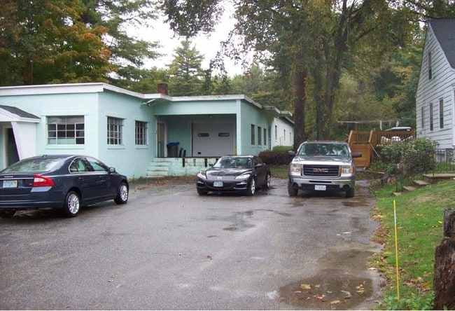
291 Squantum Rd, Jaffrey, NH 03452

NEARBY LISTINGS FOR SALE OR LEASE
Property Detail
291 Squantum Rd
Commercialacreage
Cheshire
X
New Hampshire
33011C0415D
6.10 AC
2024
Other Market Areas
2024
Keene, NH
970500
JAFF-000242-000045
20,767 SF
DEMOGRAPHICS near 291 Squantum Rd
1 mile
3 mile
5 mile
2024 Total Population
630
7,149
12,445
2029 Population
667
7,514
13,075
Pop Growth 2024-2029
+ 5.87%
+ 5.11%
+ 5.06%
Average Age
41
40
41
2024 Total Households
241
2,602
4,621
HH Growth 2024-2029
+ 5.81%
+ 5.19%
+ 5.04%
Median Household Inc
$87,500
$74,814
$82,392
Avg Household Size
2.30
2.40
2.40
2024 Avg HH Vehicles
2.00
2.00
2.00
Median Home Value
$224,742
$237,696
$258,573
Median Year Built
1960
1973
1977
Nearby Places
Map Layers
Map Styles
 Street
 Aerial
Transit
 Traffic
 Biking
Places
Listings with unknown addresses are not visible on the map
- Restaurants
- Banks
- Shops
- Fitness
- Groceries
Nearby Properties
Address
Land Use
TOTAL SIZE
Lot Size
Zoning
Address
Land Use
TOTAL SIZE
Lot Size
Zoning
2,276 SF
146 AC
IND
Address
Land Use
TOTAL SIZE
Lot Size
Zoning
67,754 SF
28 AC
RB2
Address
Land Use
TOTAL SIZE
Lot Size
Zoning
4.36 AC
RA1
Address
Land Use
TOTAL SIZE
Lot Size
Zoning
171,426 SF
51.73 AC
IND
Address
Land Use
TOTAL SIZE
Lot Size
Zoning
56,684 SF
3.51 AC
RA2
Address
Land Use
TOTAL SIZE
Lot Size
Zoning
1,860 SF
COLLEG
Address
Land Use
TOTAL SIZE
Lot Size
Zoning
Address
Land Use
TOTAL SIZE
Lot Size
Zoning
39,133 SF
10.88 AC
GB
Address
Land Use
TOTAL SIZE
Lot Size
Zoning
30,677 SF
5.14 AC
IND
Address
Land Use
TOTAL SIZE
Lot Size
Zoning
44.39 AC
Address
Land Use
TOTAL SIZE
Lot Size
Zoning
80,781 SF
8.88 AC
IND
Address
Land Use
TOTAL SIZE
Lot Size
Zoning
32,597 SF
5.17 AC
GB
Address
Land Use
TOTAL SIZE
Lot Size
Zoning
17,360 SF
4.01 AC
RA2
Address
Land Use
TOTAL SIZE
Lot Size
Zoning
4.96 AC
GATEWA
Address
Land Use
TOTAL SIZE
Lot Size
Zoning
16,096 SF
2.89 AC
GB
Address
Land Use
TOTAL SIZE
Lot Size
Zoning
28,141 SF
72.70 AC
IND
Address
Land Use
TOTAL SIZE
Lot Size
Zoning
6,872 SF
22.50 AC
RURAL
Address
Land Use
TOTAL SIZE
Lot Size
Zoning
5,888 SF
8.35 AC
RA2
Address
Land Use
TOTAL SIZE
Lot Size
Zoning
42.50 AC
RESIDE
Address
Land Use
TOTAL SIZE
Lot Size
Zoning
5,423 SF
17 AC
RURAL
Address
Land Use
TOTAL SIZE
Lot Size
Zoning
24.30 AC
COM
Address
Land Use
TOTAL SIZE
Lot Size
Zoning
8,270 SF
7.24 AC
GATEWA
Address
Land Use
TOTAL SIZE
Lot Size
Zoning
9,628 SF
3.70 AC
R2
Address
Land Use
TOTAL SIZE
Lot Size
Zoning
5,799 SF
7 AC
RURAL
Address
Land Use
TOTAL SIZE
Lot Size
Zoning
5,667 SF
117.60 AC
RURAL
Address
Land Use
TOTAL SIZE
Lot Size
Zoning
13,842 SF
19.99 AC
R1
Address
Land Use
TOTAL SIZE
Lot Size
Zoning
131.20 AC
RESIDE
Address
Land Use
TOTAL SIZE
Lot Size
Zoning
7,780 SF
0.77 AC
GB
Address
Land Use
TOTAL SIZE
Lot Size
Zoning
3,200 SF
49 AC
R1
Address
Land Use
TOTAL SIZE
Lot Size
Zoning
6,736 SF
7 AC
RA2
The World's #1 Commercial Real Estate Marketplace
Connect with us
© 2026 CoStar Group
The information above has been obtained from sources believed reliable. While we do not doubt its accuracy we have not verified it and make no guarantee, warranty or representation about it. It is your responsibility to independently confirm its accuracy and completeness. Any projections, opinions, assumptions, or estimates used are for example only and do not represent the current or future performance of the property. The value of this transaction to you depends on tax and other factors which should be evaluated by your tax, financial, and legal advisors. You and your advisors should conduct a careful, independent investigation of the property to determine to your satisfaction the suitability of the property for your needs.