Property Record
291 State Highway Rte 6, Wellfleet, MA 02667

NEARBY LISTINGS FOR SALE OR LEASE
-
-
View all Wellfleet listings for sale on LoopNet.com
Property Detail
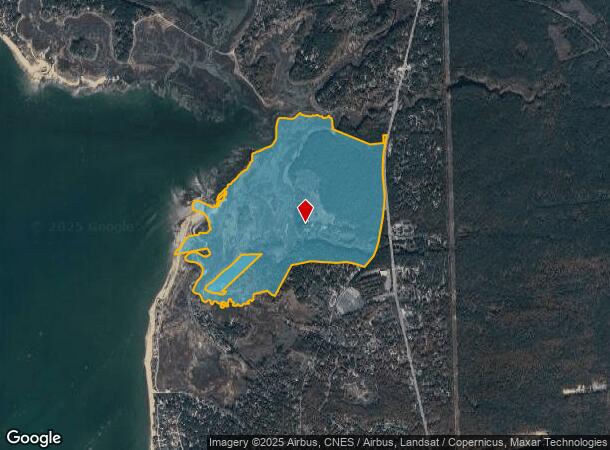
291 State Highway Rte 6
Taxexempt
Barnstable
AE
Massachusetts
25001C0263J
304 AC
0
Other Market Areas
2025
Barnstable Town, MA
010206
WELL-000460-000016
8,128 SF
DEMOGRAPHICS near 291 State Highway Rte 6
1 Mile
3 Mile
5 Mile
2024 Total Population
755
3,964
7,586
2029 Population
728
3,895
7,631
Pop Growth 2024-2029
(3.58%)
(1.74%)
+ 0.59%
Average Age
53
52
53
2024 Total Households
359
1,916
3,700
HH Growth 2024-2029
(3.90%)
(2.04%)
+ 0.30%
Median Household Inc
$114,285
$94,380
$92,292
Avg Household Size
2.10
2.10
2.00
2024 Avg HH Vehicles
2.00
2.00
2.00
Median Home Value
$535,494
$598,769
$636,157
Median Year Built
1979
1979
1977
Nearby Places
Map Layers
Map Styles
 Street
 Aerial
- Restaurants
- Banks
- Shops
- Fitness
- Groceries
Nearby Properties
Address
Land Use
TOTAL SIZE
Lot Size
Zoning
Address
Land Use
TOTAL SIZE
Lot Size
Zoning
52,020 SF
71.85 AC
CCNS
Address
Land Use
TOTAL SIZE
Lot Size
Zoning
125 AC
CCNS
Address
Land Use
TOTAL SIZE
Lot Size
Zoning
123.73 AC
CCNS
Address
Land Use
TOTAL SIZE
Lot Size
Zoning
47.24 AC
CNS
Address
Land Use
TOTAL SIZE
Lot Size
Zoning
1,732.50 AC
Address
Land Use
TOTAL SIZE
Lot Size
Zoning
94,530 SF
8.51 AC
RETAIL
Address
Land Use
TOTAL SIZE
Lot Size
Zoning
2,202 SF
11.21 AC
RETAIL
Address
Land Use
TOTAL SIZE
Lot Size
Zoning
5,208 SF
1.55 AC
R30
Address
Land Use
TOTAL SIZE
Lot Size
Zoning
87,754 SF
9.60 AC
RETAIL
Address
Land Use
TOTAL SIZE
Lot Size
Zoning
2,344 SF
24.57 AC
COMM
Address
Land Use
TOTAL SIZE
Lot Size
Zoning
4,881 SF
1.35 AC
R30
Address
Land Use
TOTAL SIZE
Lot Size
Zoning
56 AC
CCNS
Address
Land Use
TOTAL SIZE
Lot Size
Zoning
608 SF
3.02 AC
RESIDE
Address
Land Use
TOTAL SIZE
Lot Size
Zoning
18,881 SF
24.55 AC
COMM
Address
Land Use
TOTAL SIZE
Lot Size
Zoning
2,160 SF
21.25 AC
R40
Address
Land Use
TOTAL SIZE
Lot Size
Zoning
3,181 SF
0.80 AC
R30
Address
Land Use
TOTAL SIZE
Lot Size
Zoning
1,771 SF
40.04 AC
R30
Address
Land Use
TOTAL SIZE
Lot Size
Zoning
1,896 SF
2.24 AC
RETAIL
Address
Land Use
TOTAL SIZE
Lot Size
Zoning
30.87 AC
R30
Address
Land Use
TOTAL SIZE
Lot Size
Zoning
425 SF
4.27 AC
RESIDE
Address
Land Use
TOTAL SIZE
Lot Size
Zoning
3,983 SF
21.87 AC
RESIDE
Address
Land Use
TOTAL SIZE
Lot Size
Zoning
8.70 AC
WATER
Address
Land Use
TOTAL SIZE
Lot Size
Zoning
1,500 SF
27.76 AC
COMM
Address
Land Use
TOTAL SIZE
Lot Size
Zoning
3,120 SF
1.30 AC
R30
Address
Land Use
TOTAL SIZE
Lot Size
Zoning
270 AC
R30
Address
Land Use
TOTAL SIZE
Lot Size
Zoning
2,930 SF
1.48 AC
R30
Address
Land Use
TOTAL SIZE
Lot Size
Zoning
2,232 SF
3.27 AC
R30
Address
Land Use
TOTAL SIZE
Lot Size
Zoning
4,369 SF
0.69 AC
R30
Address
Land Use
TOTAL SIZE
Lot Size
Zoning
3,805 SF
7.29 AC
R30
The World's #1 Commercial Real Estate Marketplace
Connect with us
© 2025 CoStar Group
The information above has been obtained from sources believed reliable. While we do not doubt its accuracy we have not verified it and make no guarantee, warranty or representation about it. It is your responsibility to independently confirm its accuracy and completeness. Any projections, opinions, assumptions, or estimates used are for example only and do not represent the current or future performance of the property. The value of this transaction to you depends on tax and other factors which should be evaluated by your tax, financial, and legal advisors. You and your advisors should conduct a careful, independent investigation of the property to determine to your satisfaction the suitability of the property for your needs.