Property Record
291 Stewart St, Sonora, CA 95370
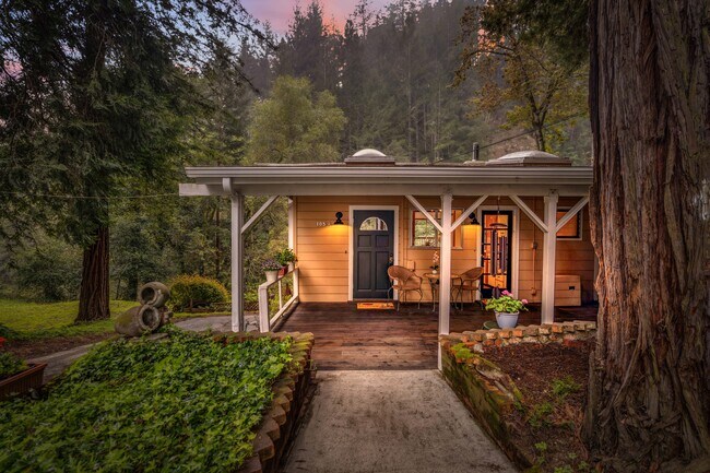


Property Detail
291 Stewart St
072-201-03-000
LOT 1
Multifamilydwelling
Tuolumne
R-1-15
California
AE The base floodplain where base flood elevations are provided. AE Zones are now used on new format FIRMs instead of A1-A30 Zones.
1
2024
0.77 AC
2025
Outlying Santa Cruz County
120302
Santa Cruz/Watsonville
2,326 SF
Santa Cruz-Watsonville, CA
NEARBY LISTINGS FOR SALE OR LEASE
DEMOGRAPHICS near 291 Stewart St
1 mile
3 mile
5 mile
2025 Total Population
2,817
13,731
33,995
2030 Population
2,674
12,946
32,440
Pop Growth 2025-2030
(5.08%)
(5.72%)
(4.57%)
Average Age
45
44
44
2025 Total Households
1,089
5,297
12,924
HH Growth 2025-2030
(5.79%)
(6.32%)
(5.15%)
Median Household Inc
$118,005
$117,535
$122,362
Avg Household Size
2.50
2.50
2.50
2025 Avg HH Vehicles
2.00
2.00
2.00
Median Home Value
$911,571
$892,141
$1,001,397
Median Year Built
1965
1964
1971
Nearby Places
Map Layers
Map Styles
 Street
 Aerial
Layers
 Traffic
 Biking
Places
Listings with unknown addresses are not visible on the map
- Restaurants
- Banks
- Shops
- Fitness
- Groceries
SALE & LEASE HISTORY
LISTING DATE
SALE/LEASE

Apr 02, 2024
For Sale
Nearby Properties
Address
Land Use
TOTAL SIZE
Lot Size
Zoning
Address
Land Use
TOTAL SIZE
Lot Size
Zoning
11.46 AC
C,R-3
Address
Land Use
TOTAL SIZE
Lot Size
Zoning
66,026 SF
2.50 AC
CG
Address
Land Use
TOTAL SIZE
Lot Size
Zoning
45,665 SF
6.53 AC
C-1 & O
Address
Land Use
TOTAL SIZE
Lot Size
Zoning
54,206 SF
4.75 AC
CG
Address
Land Use
TOTAL SIZE
Lot Size
Zoning
165,763 SF
12.91 AC
CG
Address
Land Use
TOTAL SIZE
Lot Size
Zoning
131,601 SF
10.91 AC
C
Address
Land Use
TOTAL SIZE
Lot Size
Zoning
111,559 SF
10.22 AC
ML
Address
Land Use
TOTAL SIZE
Lot Size
Zoning
89,098 SF
2.72 AC
C-O,MX
Address
Land Use
TOTAL SIZE
Lot Size
Zoning
55,300 SF
6.58 AC
C-1 & O-1
Address
Land Use
TOTAL SIZE
Lot Size
Zoning
62,000 SF
5.50 AC
CG
Address
Land Use
TOTAL SIZE
Lot Size
Zoning
22,495 SF
1.74 AC
C-1
Address
Land Use
TOTAL SIZE
Lot Size
Zoning
23,820 SF
1.52 AC
C-1
Address
Land Use
TOTAL SIZE
Lot Size
Zoning
6.70 AC
PD
Address
Land Use
TOTAL SIZE
Lot Size
Zoning
44,730 SF
7.42 AC
C-O
Address
Land Use
TOTAL SIZE
Lot Size
Zoning
106,879 SF
8.10 AC
R-3,D,MX
Address
Land Use
TOTAL SIZE
Lot Size
Zoning
20,419 SF
0.98 AC
CG
Address
Land Use
TOTAL SIZE
Lot Size
Zoning
19,388 SF
1.41 AC
C
Address
Land Use
TOTAL SIZE
Lot Size
Zoning
28,175 SF
2.08 AC
CO
Address
Land Use
TOTAL SIZE
Lot Size
Zoning
58,129 SF
8.24 AC
Address
Land Use
TOTAL SIZE
Lot Size
Zoning
44,235 SF
Address
Land Use
TOTAL SIZE
Lot Size
Zoning
2,324 SF
0.48 AC
C-1,MX
Address
Land Use
TOTAL SIZE
Lot Size
Zoning
4.19 AC
R-3,MX
Address
Land Use
TOTAL SIZE
Lot Size
Zoning
4.89 AC
R-3,MX
Address
Land Use
TOTAL SIZE
Lot Size
Zoning
4.51 AC
R-3,MX
Address
Land Use
TOTAL SIZE
Lot Size
Zoning
11,511 SF
1.41 AC
C-1
Address
Land Use
TOTAL SIZE
Lot Size
Zoning
2,498 SF
0.75 AC
PD
Address
Land Use
TOTAL SIZE
Lot Size
Zoning
62,810 SF
1.56 AC
C-1
Address
Land Use
TOTAL SIZE
Lot Size
Zoning
23,027 SF
0.36 AC
C
Address
Land Use
TOTAL SIZE
Lot Size
Zoning
20,544 SF
23.24 AC
RE-2
The World's #1 Commercial Real Estate Marketplace
Connect with us
© 2026 CoStar Group
The information above has been obtained from sources believed reliable. While we do not doubt its accuracy we have not verified it and make no guarantee, warranty or representation about it. It is your responsibility to independently confirm its accuracy and completeness. Any projections, opinions, assumptions, or estimates used are for example only and do not represent the current or future performance of the property. The value of this transaction to you depends on tax and other factors which should be evaluated by your tax, financial, and legal advisors. You and your advisors should conduct a careful, independent investigation of the property to determine to your satisfaction the suitability of the property for your needs.