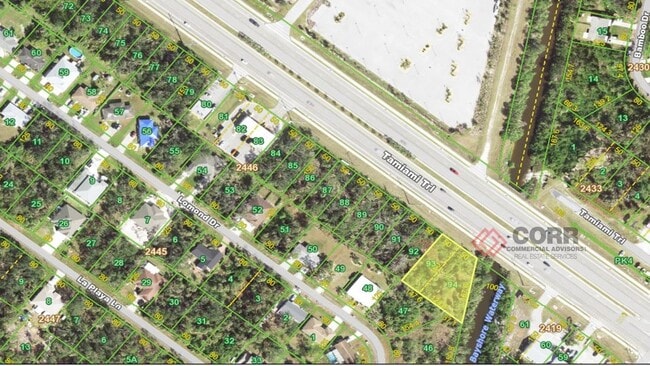
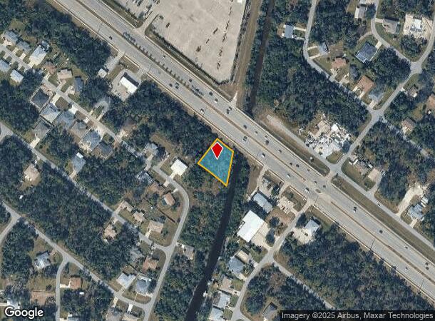
Property Record
291 Tamiami Trl, Port Charlotte, FL 33953
NEARBY LISTINGS FOR SALE OR LEASE
Property Detail
291 Tamiami Trl
Punta Gorda, FL
Port Charlotte
402103251005
PORT CHARLOTTE SEC32 BLK2446 LTS 93 94 403/628 5058/2113
Commercialacreage
Charlotte
AE
Florida
12015C0040G
93
2024
0.47 AC
2025
Charlotte County
020402
Southwest Florida
DEMOGRAPHICS near 291 Tamiami Trl
1 Mile
3 Mile
5 Mile
2024 Total Population
3,486
30,246
86,651
2029 Population
4,107
35,021
100,578
Pop Growth 2024-2029
+ 17.81%
+ 15.79%
+ 16.07%
Average Age
45
47
47
2024 Total Households
1,382
12,509
36,105
HH Growth 2024-2029
+ 18.09%
+ 15.88%
+ 16.28%
Median Household Inc
$56,242
$60,140
$61,608
Avg Household Size
2.50
2.40
2.30
2024 Avg HH Vehicles
2.00
2.00
2.00
Median Home Value
$263,739
$245,895
$238,857
Median Year Built
2000
2001
1999
Nearby Places
- Restaurants
- Banks
- Shops
- Fitness
- Groceries
PUBLIC TRANSPORTATION
AIRPORT
Punta Gorda
DRIVE
WALK
Distance
Punta Gorda
28 min
15.7 mi
Freight Ports
Port Manatee
DRIVE
WALK
Distance
Port Manatee
73 min
55.9 mi
SALE & LEASE HISTORY
LISTING DATE
SALE/LEASE

Jun 30, 2020
For Sale
Nearby Properties
Address
Land Use
TOTAL SIZE
Lot Size
Zoning
Address
Land Use
TOTAL SIZE
Lot Size
Zoning
316,994 SF
40.88 AC
V
Address
Land Use
TOTAL SIZE
Lot Size
Zoning
103,886 SF
21.48 AC
PD
Address
Land Use
TOTAL SIZE
Lot Size
Zoning
267,412 SF
23.26 AC
AC1
Address
Land Use
TOTAL SIZE
Lot Size
Zoning
198,132 SF
17.61 AC
RMF15
Address
Land Use
TOTAL SIZE
Lot Size
Zoning
132,969 SF
80.28 AC
PKR
Address
Land Use
TOTAL SIZE
Lot Size
Zoning
131,053 SF
14.40 AC
PD
Address
Land Use
TOTAL SIZE
Lot Size
Zoning
9,511 SF
40.53 AC
PD
Address
Land Use
TOTAL SIZE
Lot Size
Zoning
205,624 SF
21.37 AC
AC1
Address
Land Use
TOTAL SIZE
Lot Size
Zoning
94,423 SF
12.87 AC
V
Address
Land Use
TOTAL SIZE
Lot Size
Zoning
114,985 SF
29.77 AC
GU
Address
Land Use
TOTAL SIZE
Lot Size
Zoning
79,944 SF
15.64 AC
PCDN
Address
Land Use
TOTAL SIZE
Lot Size
Zoning
95.20 AC
PD
Address
Land Use
TOTAL SIZE
Lot Size
Zoning
115,678 SF
8.58 AC
R3
Address
Land Use
TOTAL SIZE
Lot Size
Zoning
142,364 SF
13.87 AC
AC1
Address
Land Use
TOTAL SIZE
Lot Size
Zoning
37,567 SF
36.76 AC
PKR
Address
Land Use
TOTAL SIZE
Lot Size
Zoning
4,562 SF
8.08 AC
CG
Address
Land Use
TOTAL SIZE
Lot Size
Zoning
74,447 SF
4.50 AC
CG
Address
Land Use
TOTAL SIZE
Lot Size
Zoning
85,529 SF
11.41 AC
CG
Address
Land Use
TOTAL SIZE
Lot Size
Zoning
105,046 SF
12.69 AC
AC1
Address
Land Use
TOTAL SIZE
Lot Size
Zoning
135,430 SF
18.50 AC
CG
Address
Land Use
TOTAL SIZE
Lot Size
Zoning
48,392 SF
3.89 AC
PD
Address
Land Use
TOTAL SIZE
Lot Size
Zoning
17.48 AC
AC1
Address
Land Use
TOTAL SIZE
Lot Size
Zoning
30,242 SF
7.40 AC
CG
Address
Land Use
TOTAL SIZE
Lot Size
Zoning
42,923 SF
403.06 AC
PCDN
Address
Land Use
TOTAL SIZE
Lot Size
Zoning
40,467 SF
2.89 AC
CG
Address
Land Use
TOTAL SIZE
Lot Size
Zoning
22.07 AC
PD
Address
Land Use
TOTAL SIZE
Lot Size
Zoning
63,016 SF
2.56 AC
AC1
Address
Land Use
TOTAL SIZE
Lot Size
Zoning
12,670 SF
17.20 AC
CG
Address
Land Use
TOTAL SIZE
Lot Size
Zoning
31,470 SF
20.05 AC
PD
Address
Land Use
TOTAL SIZE
Lot Size
Zoning
29,760 SF
118.84 AC
PD
The World's #1 Commercial Real Estate Marketplace
Connect with us
© 2025 CoStar Group
The information above has been obtained from sources believed reliable. While we do not doubt its accuracy we have not verified it and make no guarantee, warranty or representation about it. It is your responsibility to independently confirm its accuracy and completeness. Any projections, opinions, assumptions, or estimates used are for example only and do not represent the current or future performance of the property. The value of this transaction to you depends on tax and other factors which should be evaluated by your tax, financial, and legal advisors. You and your advisors should conduct a careful, independent investigation of the property to determine to your satisfaction the suitability of the property for your needs.