Property Record
2910 20Th Ave, Valley, AL 36854

NEARBY LISTINGS FOR SALE OR LEASE
Property Detail
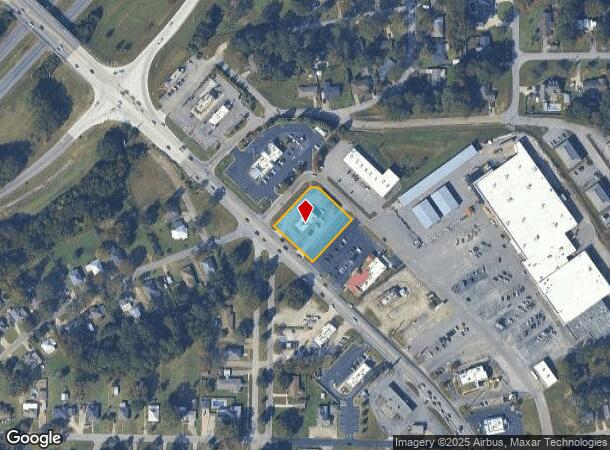
2910 20Th Ave
17-01-01-1-001-001.002
START AT NE COR OF NE1/4 OF NE1/4, RUN S385.18',SW'LY412.29'TO U.S. 29, NW'LY ALONG HWAY 200' TO P.O.B., RUN NW'LY ALONGHWAY
Restaurantdrivein
Chambers
X
Alabama
13285C0310F
0.76 AC
2025
Chambers County
2024
Columbus GA
954600
Valley, AL
2,934 SF
DEMOGRAPHICS near 2910 20Th Ave
1 Mile
3 Mile
5 Mile
2024 Total Population
2,951
18,779
25,506
2029 Population
2,868
18,731
25,326
Pop Growth 2024-2029
(2.81%)
(0.26%)
(0.71%)
Average Age
41
41
41
2024 Total Households
1,200
7,562
10,305
HH Growth 2024-2029
(2.67%)
(0.16%)
(0.60%)
Median Household Inc
$39,059
$46,986
$48,203
Avg Household Size
2.30
2.40
2.40
2024 Avg HH Vehicles
2.00
2.00
2.00
Median Home Value
$135,630
$127,754
$122,148
Median Year Built
1963
1973
1974
Nearby Places
Map Layers
Map Styles
 Street
 Aerial
- Restaurants
- Banks
- Shops
- Fitness
- Groceries
PUBLIC TRANSPORTATION
AIRPORT
Columbus
DRIVE
WALK
Distance
Columbus
47 min
35.7 mi
Nearby Properties
Address
Land Use
TOTAL SIZE
Lot Size
Zoning
Address
Land Use
TOTAL SIZE
Lot Size
Zoning
23,004 SF
38.40 AC
Address
Land Use
TOTAL SIZE
Lot Size
Zoning
13,920 SF
58.66 AC
Address
Land Use
TOTAL SIZE
Lot Size
Zoning
28,850 SF
6.63 AC
17-MXD-1
Address
Land Use
TOTAL SIZE
Lot Size
Zoning
6,800 SF
10 AC
17-I-1
Address
Land Use
TOTAL SIZE
Lot Size
Zoning
42,369 SF
1.49 AC
17-I-1
Address
Land Use
TOTAL SIZE
Lot Size
Zoning
6,990 SF
15.99 AC
Address
Land Use
TOTAL SIZE
Lot Size
Zoning
28,768 SF
9.40 AC
Address
Land Use
TOTAL SIZE
Lot Size
Zoning
64.60 AC
Address
Land Use
TOTAL SIZE
Lot Size
Zoning
31,290 SF
0.75 AC
17-CGN
Address
Land Use
TOTAL SIZE
Lot Size
Zoning
185.02 AC
17-R/P
Address
Land Use
TOTAL SIZE
Lot Size
Zoning
19,493 SF
15 AC
17-R-1
Address
Land Use
TOTAL SIZE
Lot Size
Zoning
106,133 SF
8.37 AC
17-I-1
Address
Land Use
TOTAL SIZE
Lot Size
Zoning
146,616 SF
9.10 AC
Address
Land Use
TOTAL SIZE
Lot Size
Zoning
7,326 SF
4.50 AC
17-I-1
Address
Land Use
TOTAL SIZE
Lot Size
Zoning
20,409 SF
2.46 AC
17-R-1
Address
Land Use
TOTAL SIZE
Lot Size
Zoning
7,872 SF
8.41 AC
Address
Land Use
TOTAL SIZE
Lot Size
Zoning
72,300 SF
2.77 AC
Address
Land Use
TOTAL SIZE
Lot Size
Zoning
8,264 SF
7.88 AC
Address
Land Use
TOTAL SIZE
Lot Size
Zoning
18,960 SF
0.36 AC
17-CBD
Address
Land Use
TOTAL SIZE
Lot Size
Zoning
34,584 SF
3.68 AC
17-I-1
Address
Land Use
TOTAL SIZE
Lot Size
Zoning
17,852 SF
1.26 AC
17-CBD
Address
Land Use
TOTAL SIZE
Lot Size
Zoning
2,145 SF
8.59 AC
17-MXD-1
Address
Land Use
TOTAL SIZE
Lot Size
Zoning
15,711 SF
0.71 AC
17-R-1
Address
Land Use
TOTAL SIZE
Lot Size
Zoning
23,487 SF
2 AC
17-I-1
Address
Land Use
TOTAL SIZE
Lot Size
Zoning
8,032 SF
32.02 AC
Address
Land Use
TOTAL SIZE
Lot Size
Zoning
10,794 SF
1.35 AC
17-CBD
Address
Land Use
TOTAL SIZE
Lot Size
Zoning
10,752 SF
0.70 AC
17-CBD
Address
Land Use
TOTAL SIZE
Lot Size
Zoning
14,075 SF
0.41 AC
17-I-1
Address
Land Use
TOTAL SIZE
Lot Size
Zoning
7,200 SF
9.90 AC
17-R-1
Address
Land Use
TOTAL SIZE
Lot Size
Zoning
0.09 AC
RH2
The World's #1 Commercial Real Estate Marketplace
Connect with us
© 2026 CoStar Group
The information above has been obtained from sources believed reliable. While we do not doubt its accuracy we have not verified it and make no guarantee, warranty or representation about it. It is your responsibility to independently confirm its accuracy and completeness. Any projections, opinions, assumptions, or estimates used are for example only and do not represent the current or future performance of the property. The value of this transaction to you depends on tax and other factors which should be evaluated by your tax, financial, and legal advisors. You and your advisors should conduct a careful, independent investigation of the property to determine to your satisfaction the suitability of the property for your needs.