Property Record
2910 Highway 25, Watertown, MN 55388


NEARBY LISTINGS FOR SALE OR LEASE
-
-
View all Watertown listings for sale on LoopNet.com
Property Detail
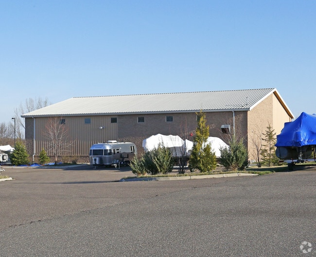
2910 Highway 25
85.0080710
P/O S1/2 SW1/4 SECT 8 DESC AS: BEG AT NE CORN S1/2 SW1/4 TH S ON E LINE 452.64' TH N88*W
Industrialgeneral
Carver
A
Minnesota
27019C0053D
7.30 AC
2025
Southwest
2025
Minneapolis/St Paul
090102
Minneapolis-St. Paul-Bloomington, MN-WI
7,680 SF
DEMOGRAPHICS near 2910 Highway 25
1 Mile
3 Mile
5 Mile
2024 Total Population
2,048
5,904
9,343
2029 Population
2,215
6,372
10,098
Pop Growth 2024-2029
+ 8.15%
+ 7.93%
+ 8.08%
Average Age
40
39
39
2024 Total Households
750
2,177
3,388
HH Growth 2024-2029
+ 8.40%
+ 8.18%
+ 8.29%
Median Household Inc
$92,960
$91,028
$92,986
Avg Household Size
2.50
2.60
2.70
2024 Avg HH Vehicles
2.00
2.00
2.00
Median Home Value
$266,254
$297,490
$313,982
Median Year Built
1982
1988
1989
Nearby Places
Map Layers
Map Styles
 Street
 Aerial
- Restaurants
- Banks
- Shops
- Fitness
- Groceries
PUBLIC TRANSPORTATION
AIRPORT
Minneapolis-St Paul International/Wold-Chamberlain
DRIVE
WALK
Distance
Minneapolis-St Paul International/Wold-Chamberlain
50 min
38.3 mi
SALE & LEASE HISTORY
LISTING DATE
SALE/LEASE

Sep 25, 2016
For Lease
Sep 23, 2016
For Sale
Feb 26, 2021
For Sale
Nearby Properties
Address
Land Use
TOTAL SIZE
Lot Size
Zoning
Address
Land Use
TOTAL SIZE
Lot Size
Zoning
78,840 SF
69.46 AC
Address
Land Use
TOTAL SIZE
Lot Size
Zoning
54,140 SF
16.35 AC
Address
Land Use
TOTAL SIZE
Lot Size
Zoning
1,333 SF
27.59 AC
Address
Land Use
TOTAL SIZE
Lot Size
Zoning
78,008 SF
7.18 AC
Address
Land Use
TOTAL SIZE
Lot Size
Zoning
26,591 SF
9.38 AC
Address
Land Use
TOTAL SIZE
Lot Size
Zoning
341.97 AC
Address
Land Use
TOTAL SIZE
Lot Size
Zoning
11,695 SF
2.48 AC
Address
Land Use
TOTAL SIZE
Lot Size
Zoning
7,615 SF
0.53 AC
Address
Land Use
TOTAL SIZE
Lot Size
Zoning
4,978 SF
4.62 AC
Address
Land Use
TOTAL SIZE
Lot Size
Zoning
17,406 SF
3.51 AC
Address
Land Use
TOTAL SIZE
Lot Size
Zoning
32,574 SF
4.29 AC
Address
Land Use
TOTAL SIZE
Lot Size
Zoning
13,260 SF
1.92 AC
Address
Land Use
TOTAL SIZE
Lot Size
Zoning
16,800 SF
17.47 AC
Address
Land Use
TOTAL SIZE
Lot Size
Zoning
9,649 SF
4.90 AC
Address
Land Use
TOTAL SIZE
Lot Size
Zoning
6,900 SF
0.66 AC
Address
Land Use
TOTAL SIZE
Lot Size
Zoning
6,512 SF
10.08 AC
Address
Land Use
TOTAL SIZE
Lot Size
Zoning
6,596 SF
0.58 AC
Address
Land Use
TOTAL SIZE
Lot Size
Zoning
4,800 SF
4.37 AC
Address
Land Use
TOTAL SIZE
Lot Size
Zoning
6,596 SF
0.58 AC
Address
Land Use
TOTAL SIZE
Lot Size
Zoning
4,281 SF
24.92 AC
Address
Land Use
TOTAL SIZE
Lot Size
Zoning
141.60 AC
Address
Land Use
TOTAL SIZE
Lot Size
Zoning
81.05 AC
Address
Land Use
TOTAL SIZE
Lot Size
Zoning
30.53 AC
Address
Land Use
TOTAL SIZE
Lot Size
Zoning
4,662 SF
50.51 AC
Address
Land Use
TOTAL SIZE
Lot Size
Zoning
Address
Land Use
TOTAL SIZE
Lot Size
Zoning
4,273 SF
20.60 AC
Address
Land Use
TOTAL SIZE
Lot Size
Zoning
19,731 SF
1.10 AC
Address
Land Use
TOTAL SIZE
Lot Size
Zoning
Address
Land Use
TOTAL SIZE
Lot Size
Zoning
9,270 SF
7.21 AC
The World's #1 Commercial Real Estate Marketplace
Connect with us
© 2025 CoStar Group
The information above has been obtained from sources believed reliable. While we do not doubt its accuracy we have not verified it and make no guarantee, warranty or representation about it. It is your responsibility to independently confirm its accuracy and completeness. Any projections, opinions, assumptions, or estimates used are for example only and do not represent the current or future performance of the property. The value of this transaction to you depends on tax and other factors which should be evaluated by your tax, financial, and legal advisors. You and your advisors should conduct a careful, independent investigation of the property to determine to your satisfaction the suitability of the property for your needs.