Property Record
2910 Quant Ave N, Stillwater, MN 55082


Current Lease Availabilities
NEARBY LISTINGS FOR SALE OR LEASE
Property Detail
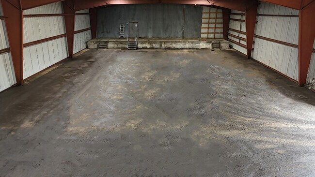
2910 Quant Ave N
23-029-20-22-0001
PT GOV LOT 2 W OF HWY EXCEPT SLY 24 FT THEREOF EXCEPT THE NORTH 300FT EXCEPT TO HWY EXCEPT FOLL: BEG AT NW COR OF SEC 23 THN
Apartment
Washington
X
Minnesota
27163C0357E
2
2025
7.02 AC
2024
East
070705
Minneapolis/St Paul
13,648 SF
Minneapolis-St. Paul-Bloomington, MN-WI
DEMOGRAPHICS near 2910 Quant Ave N
1 Mile
3 Mile
5 Mile
2024 Total Population
552
21,362
53,757
2029 Population
593
23,057
58,162
Pop Growth 2024-2029
+ 7.43%
+ 7.93%
+ 8.19%
Average Age
41
42
43
2024 Total Households
228
8,549
21,918
HH Growth 2024-2029
+ 7.46%
+ 7.98%
+ 8.27%
Median Household Inc
$118,055
$106,820
$103,751
Avg Household Size
2.40
2.50
2.40
2024 Avg HH Vehicles
2.00
2.00
2.00
Median Home Value
$537,162
$373,016
$379,190
Median Year Built
1989
1982
1989
Nearby Places
Map Layers
Map Styles
 Street
 Aerial
- Restaurants
- Banks
- Shops
- Fitness
- Groceries
PUBLIC TRANSPORTATION
AIRPORT
Minneapolis-St Paul International/Wold-Chamberlain
DRIVE
WALK
Distance
Minneapolis-St Paul International/Wold-Chamberlain
37 min
27.5 mi
Freight Ports
Port Milwaukee
DRIVE
WALK
Distance
Port Milwaukee
345 min
315.1 mi
Nearby Properties
Address
Land Use
TOTAL SIZE
Lot Size
Zoning
Address
Land Use
TOTAL SIZE
Lot Size
Zoning
519,636 SF
40.40 AC
Address
Land Use
TOTAL SIZE
Lot Size
Zoning
600,000 SF
77.70 AC
Address
Land Use
TOTAL SIZE
Lot Size
Zoning
84.75 AC
Address
Land Use
TOTAL SIZE
Lot Size
Zoning
Address
Land Use
TOTAL SIZE
Lot Size
Zoning
132,967 SF
18.10 AC
Address
Land Use
TOTAL SIZE
Lot Size
Zoning
3.78 AC
Address
Land Use
TOTAL SIZE
Lot Size
Zoning
194,684 SF
14.86 AC
Address
Land Use
TOTAL SIZE
Lot Size
Zoning
43,888 SF
1.37 AC
Address
Land Use
TOTAL SIZE
Lot Size
Zoning
199,652 SF
5.02 AC
Address
Land Use
TOTAL SIZE
Lot Size
Zoning
15,072 SF
0.33 AC
Address
Land Use
TOTAL SIZE
Lot Size
Zoning
17,524 SF
4.16 AC
Address
Land Use
TOTAL SIZE
Lot Size
Zoning
11,576 SF
3.86 AC
B-2
Address
Land Use
TOTAL SIZE
Lot Size
Zoning
18,160 SF
3.38 AC
OFC
Address
Land Use
TOTAL SIZE
Lot Size
Zoning
12,244 SF
0.69 AC
Address
Land Use
TOTAL SIZE
Lot Size
Zoning
10,669 SF
3.83 AC
RM-1
Address
Land Use
TOTAL SIZE
Lot Size
Zoning
20,300 SF
2.43 AC
I-1
Address
Land Use
TOTAL SIZE
Lot Size
Zoning
52,764 SF
4.40 AC
RM-1
Address
Land Use
TOTAL SIZE
Lot Size
Zoning
5,284 SF
15.33 AC
Address
Land Use
TOTAL SIZE
Lot Size
Zoning
3,472 SF
1.97 AC
B-2
Address
Land Use
TOTAL SIZE
Lot Size
Zoning
40,908 SF
3.17 AC
RM-1
Address
Land Use
TOTAL SIZE
Lot Size
Zoning
18,557 SF
1.94 AC
Address
Land Use
TOTAL SIZE
Lot Size
Zoning
11,554 SF
0.80 AC
I-1 & B-3
Address
Land Use
TOTAL SIZE
Lot Size
Zoning
14,820 SF
0.56 AC
Address
Land Use
TOTAL SIZE
Lot Size
Zoning
17,741 SF
0.28 AC
B-3
Address
Land Use
TOTAL SIZE
Lot Size
Zoning
1,824 SF
1.29 AC
Address
Land Use
TOTAL SIZE
Lot Size
Zoning
5,312 SF
14.88 AC
Address
Land Use
TOTAL SIZE
Lot Size
Zoning
4 AC
I-1
Address
Land Use
TOTAL SIZE
Lot Size
Zoning
3,608 SF
50 AC
Address
Land Use
TOTAL SIZE
Lot Size
Zoning
32,440 SF
2 AC
The World's #1 Commercial Real Estate Marketplace
Connect with us
© 2025 CoStar Group
The information above has been obtained from sources believed reliable. While we do not doubt its accuracy we have not verified it and make no guarantee, warranty or representation about it. It is your responsibility to independently confirm its accuracy and completeness. Any projections, opinions, assumptions, or estimates used are for example only and do not represent the current or future performance of the property. The value of this transaction to you depends on tax and other factors which should be evaluated by your tax, financial, and legal advisors. You and your advisors should conduct a careful, independent investigation of the property to determine to your satisfaction the suitability of the property for your needs.