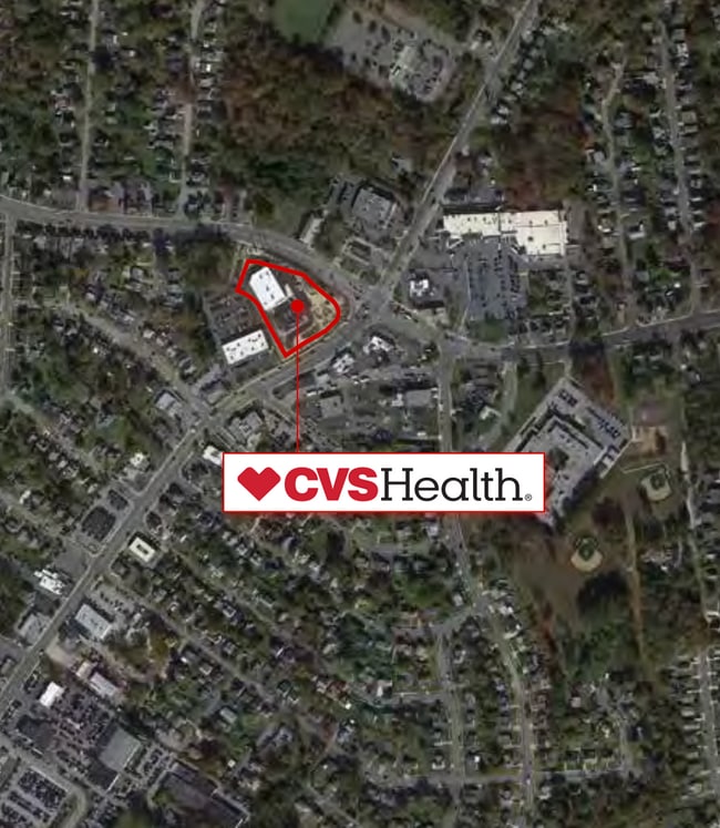
Property Record
2915 E Joppa Rd, Parkville, MD 21234


Property Detail
2915 E Joppa Rd
09-0912590640
SS JOPPA RD
Storebuilding
Baltimore
BL
Maryland
B and X Area of moderate flood hazard, usually the area between the limits of the 100-year and 500-year floods.
2.68 AC
2024
Baltimore County East
2025
Baltimore
491900
Baltimore-Columbia-Towson, MD
12,672 SF
NEARBY LISTINGS FOR SALE OR LEASE
DEMOGRAPHICS near 2915 E Joppa Rd
1 mile
3 mile
5 mile
2024 Total Population
14,867
116,339
280,081
2029 Population
14,862
115,674
277,694
Pop Growth 2024-2029
(0.03%)
(0.57%)
(0.85%)
Average Age
43
41
41
2024 Total Households
6,204
46,926
112,075
HH Growth 2024-2029
(0.08%)
(0.64%)
(0.89%)
Median Household Inc
$90,386
$88,298
$83,479
Avg Household Size
2.30
2.40
2.40
2024 Avg HH Vehicles
2.00
2.00
2.00
Median Home Value
$309,006
$294,731
$293,115
Median Year Built
1969
1967
1963
Nearby Places
Map Layers
Map Styles
 Street
 Aerial
Transit
 Traffic
 Biking
Places
Listings with unknown addresses are not visible on the map
- Restaurants
- Banks
- Shops
- Fitness
- Groceries
PUBLIC TRANSPORTATION
COMMUTER RAIL
Penn Station (PENN - WASHINGTON - Maryland Area Regional Commuter Trains (The MARC), Penn Line - Maryland Area Regional Commuter Trains (The MARC), Penn Station & Camden Yards - Maryland Area Regional Commuter Trains (The MARC))
Drive
Walk
Distance
Penn Station (PENN - WASHINGTON - Maryland Area Regional Commuter Trains (The MARC), Penn Line - Maryland Area Regional Commuter Trains (The MARC), Penn Station & Camden Yards - Maryland Area Regional Commuter Trains (The MARC))
22 min
9.7 mi
AIRPORT
Baltimore/Washington International Thurgood Marshall
Drive
Walk
Distance
Baltimore/Washington International Thurgood Marshall
37 min
23.0 mi
Freight Ports
Port of Baltimore
Drive
Walk
Distance
Port of Baltimore
24 min
14.3 mi
SALE & LEASE HISTORY
LISTING DATE
SALE/LEASE

Apr 26, 2022
For Sale
Nearby Properties
Address
Land Use
TOTAL SIZE
Lot Size
Zoning
Address
Land Use
TOTAL SIZE
Lot Size
Zoning
1,704,075 SF
76.16 AC
Address
Land Use
TOTAL SIZE
Lot Size
Zoning
31.22 AC
DR16
Address
Land Use
TOTAL SIZE
Lot Size
Zoning
46.20 AC
DR105
Address
Land Use
TOTAL SIZE
Lot Size
Zoning
303,115 SF
7.62 AC
R-3
Address
Land Use
TOTAL SIZE
Lot Size
Zoning
204,974 SF
5.87 AC
DR16
Address
Land Use
TOTAL SIZE
Lot Size
Zoning
16.08 AC
DR16
Address
Land Use
TOTAL SIZE
Lot Size
Zoning
19.93 AC
Address
Land Use
TOTAL SIZE
Lot Size
Zoning
67,938 SF
31.72 AC
BL
Address
Land Use
TOTAL SIZE
Lot Size
Zoning
15.82 AC
BLCCC
Address
Land Use
TOTAL SIZE
Lot Size
Zoning
41,184 SF
93.14 AC
EC-1
Address
Land Use
TOTAL SIZE
Lot Size
Zoning
214,738 SF
5.92 AC
Address
Land Use
TOTAL SIZE
Lot Size
Zoning
190,826 SF
9.89 AC
Address
Land Use
TOTAL SIZE
Lot Size
Zoning
12.20 AC
DR16
Address
Land Use
TOTAL SIZE
Lot Size
Zoning
9.54 AC
DR16
Address
Land Use
TOTAL SIZE
Lot Size
Zoning
7.72 AC
DR5.5
Address
Land Use
TOTAL SIZE
Lot Size
Zoning
11.38 AC
Address
Land Use
TOTAL SIZE
Lot Size
Zoning
14.47 AC
DR16
Address
Land Use
TOTAL SIZE
Lot Size
Zoning
10.51 AC
DR16
Address
Land Use
TOTAL SIZE
Lot Size
Zoning
7.38 AC
DR16
Address
Land Use
TOTAL SIZE
Lot Size
Zoning
14.10 AC
DR16
Address
Land Use
TOTAL SIZE
Lot Size
Zoning
7.85 AC
DR5.5
Address
Land Use
TOTAL SIZE
Lot Size
Zoning
10.96 AC
DR16
Address
Land Use
TOTAL SIZE
Lot Size
Zoning
111,000 SF
29.85 AC
BM
Address
Land Use
TOTAL SIZE
Lot Size
Zoning
10.47 AC
Address
Land Use
TOTAL SIZE
Lot Size
Zoning
14.23 AC
R-5
Address
Land Use
TOTAL SIZE
Lot Size
Zoning
11.25 AC
DR16
Address
Land Use
TOTAL SIZE
Lot Size
Zoning
11.57 AC
DR16
Address
Land Use
TOTAL SIZE
Lot Size
Zoning
13.85 AC
DR5.5
Address
Land Use
TOTAL SIZE
Lot Size
Zoning
10.12 AC
DR16
Address
Land Use
TOTAL SIZE
Lot Size
Zoning
168,951 SF
18.36 AC
BR
The World's #1 Commercial Real Estate Marketplace
Connect with us
© 2026 CoStar Group
The information above has been obtained from sources believed reliable. While we do not doubt its accuracy we have not verified it and make no guarantee, warranty or representation about it. It is your responsibility to independently confirm its accuracy and completeness. Any projections, opinions, assumptions, or estimates used are for example only and do not represent the current or future performance of the property. The value of this transaction to you depends on tax and other factors which should be evaluated by your tax, financial, and legal advisors. You and your advisors should conduct a careful, independent investigation of the property to determine to your satisfaction the suitability of the property for your needs.