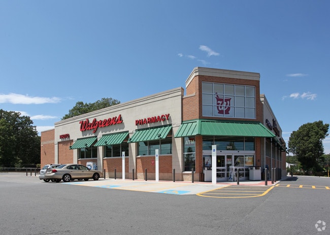
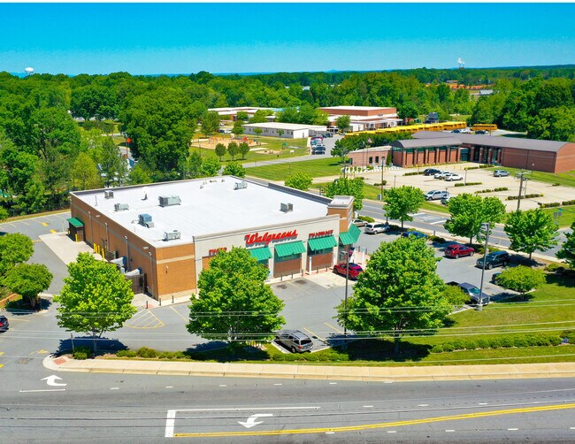
Property Record
2912 Main St, Walkertown, NC 27051

Property Detail
2912 Main St
6868-02-0546
WALGREENS LO:300B BL:2153 BU:1
Storebuilding
Forsyth
HB,LB,RS20
North Carolina
B and X Area of moderate flood hazard, usually the area between the limits of the 100-year and 500-year floods.
300b
2024
1.88 AC
2025
NE Forsyth County
003105
Greensboro/Winston-Salem
14,424 SF
Winston-Salem, NC
NEARBY LISTINGS FOR SALE OR LEASE
DEMOGRAPHICS near 2912 Main St
1 mile
3 mile
5 mile
2025 Total Population
2,567
16,675
52,205
2030 Population
2,666
17,349
54,218
Pop Growth 2025-2030
+ 3.86%
+ 4.04%
+ 3.86%
Average Age
42
42
41
2025 Total Households
1,030
6,619
20,586
HH Growth 2025-2030
+ 3.98%
+ 4.20%
+ 4.01%
Median Household Inc
$71,735
$78,108
$71,939
Avg Household Size
2.40
2.50
2.50
2025 Avg HH Vehicles
2.00
2.00
2.00
Median Home Value
$261,641
$254,802
$257,767
Median Year Built
1992
1987
1983
Nearby Places
Map Layers
Map Styles
 Street
 Aerial
Layers
 Traffic
 Biking
Places
Listings with unknown addresses are not visible on the map
- Restaurants
- Banks
- Shops
- Fitness
- Groceries
PUBLIC TRANSPORTATION
AIRPORT
Piedmont Triad International
Drive
Walk
Distance
Piedmont Triad International
31 min
19.8 mi
SALE & LEASE HISTORY
LISTING DATE
SALE/LEASE

Jul 11, 2022
For Sale
Nearby Properties
Address
Land Use
TOTAL SIZE
Lot Size
Zoning
Address
Land Use
TOTAL SIZE
Lot Size
Zoning
73,908 SF
14.40 AC
GB-S
Address
Land Use
TOTAL SIZE
Lot Size
Zoning
77,879 SF
9.56 AC
GB-S
Address
Land Use
TOTAL SIZE
Lot Size
Zoning
83,027 SF
14.47 AC
HB-S,LO-S
Address
Land Use
TOTAL SIZE
Lot Size
Zoning
98,617 SF
37.44 AC
RS20
Address
Land Use
TOTAL SIZE
Lot Size
Zoning
77,891 SF
20.91 AC
RS9
Address
Land Use
TOTAL SIZE
Lot Size
Zoning
113,016 SF
6.45 AC
IP
Address
Land Use
TOTAL SIZE
Lot Size
Zoning
11,500 SF
139.75 AC
GI,RS9
Address
Land Use
TOTAL SIZE
Lot Size
Zoning
107,609 SF
11.53 AC
HB-S
Address
Land Use
TOTAL SIZE
Lot Size
Zoning
39,445 SF
3.49 AC
IP
Address
Land Use
TOTAL SIZE
Lot Size
Zoning
68,106 SF
18.45 AC
IP
Address
Land Use
TOTAL SIZE
Lot Size
Zoning
22,053 SF
5.28 AC
HB-S
Address
Land Use
TOTAL SIZE
Lot Size
Zoning
6,436 SF
23.85 AC
RM8-S
Address
Land Use
TOTAL SIZE
Lot Size
Zoning
66,636 SF
14.81 AC
IP
Address
Land Use
TOTAL SIZE
Lot Size
Zoning
41,743 SF
8.51 AC
RM18-S
Address
Land Use
TOTAL SIZE
Lot Size
Zoning
48,400 SF
8.59 AC
HB-S
Address
Land Use
TOTAL SIZE
Lot Size
Zoning
40,714 SF
10.50 AC
IP
Address
Land Use
TOTAL SIZE
Lot Size
Zoning
31,290 SF
9.76 AC
IP,RS9
Address
Land Use
TOTAL SIZE
Lot Size
Zoning
13,101 SF
1.73 AC
HB-S
Address
Land Use
TOTAL SIZE
Lot Size
Zoning
18,076 SF
3.60 AC
RS20
Address
Land Use
TOTAL SIZE
Lot Size
Zoning
15,702 SF
2.55 AC
LB-S
Address
Land Use
TOTAL SIZE
Lot Size
Zoning
24,355 SF
11.32 AC
GI
Address
Land Use
TOTAL SIZE
Lot Size
Zoning
30,435 SF
7.04 AC
HB
Address
Land Use
TOTAL SIZE
Lot Size
Zoning
34,540 SF
13.16 AC
IP
Address
Land Use
TOTAL SIZE
Lot Size
Zoning
15,435 SF
3.33 AC
LO-S,PB-S
Address
Land Use
TOTAL SIZE
Lot Size
Zoning
5,663 SF
1.40 AC
HB-S
Address
Land Use
TOTAL SIZE
Lot Size
Zoning
11,664 SF
2.43 AC
IP
Address
Land Use
TOTAL SIZE
Lot Size
Zoning
4,875 SF
1.50 AC
HB-S
Address
Land Use
TOTAL SIZE
Lot Size
Zoning
12,315 SF
1.09 AC
HB-S
Address
Land Use
TOTAL SIZE
Lot Size
Zoning
29,635 SF
3.16 AC
IP
The World's #1 Commercial Real Estate Marketplace
Connect with us
© 2026 CoStar Group
The information above has been obtained from sources believed reliable. While we do not doubt its accuracy we have not verified it and make no guarantee, warranty or representation about it. It is your responsibility to independently confirm its accuracy and completeness. Any projections, opinions, assumptions, or estimates used are for example only and do not represent the current or future performance of the property. The value of this transaction to you depends on tax and other factors which should be evaluated by your tax, financial, and legal advisors. You and your advisors should conduct a careful, independent investigation of the property to determine to your satisfaction the suitability of the property for your needs.