Property Record
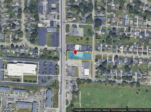
2912 S High St, Columbus, OH 43207


NEARBY LISTINGS FOR SALE OR LEASE
Property Detail
2912 S High St
010-008846
New Amsterdam Village
Medicalbuilding
2920 S HIGH STREET NEW AMSTERDAM VILLAG RES A .693 ACRE
X
Franklin
39049C0338K
Ohio
2024
0.69 AC
2024
Southeast
008821
Columbus
6,000 SF
Columbus, OH
DEMOGRAPHICS near 2912 S High St
1 Mile
3 Mile
5 Mile
2024 Total Population
5,124
54,620
201,414
2029 Population
5,118
54,904
203,929
Pop Growth 2024-2029
(0.12%)
+ 0.52%
+ 1.25%
Average Age
43
39
38
2024 Total Households
2,153
21,726
84,847
HH Growth 2024-2029
(0.19%)
+ 0.52%
+ 1.34%
Median Household Inc
$46,777
$57,993
$57,830
Avg Household Size
2.30
2.40
2.20
2024 Avg HH Vehicles
2.00
2.00
2.00
Median Home Value
$132,970
$163,878
$194,360
Median Year Built
1962
1960
1965
Nearby Places
Map Layers
Map Styles
 Street
 Aerial
- Restaurants
- Banks
- Shops
- Fitness
- Groceries
PUBLIC TRANSPORTATION
AIRPORT
Rickenbacker International
DRIVE
WALK
Distance
Rickenbacker International
18 min
9.8 mi
John Glenn Columbus International
DRIVE
WALK
Distance
John Glenn Columbus International
21 min
13.4 mi
SALE & LEASE HISTORY
LISTING DATE
SALE/LEASE

Sep 25, 2016
For Lease
Mar 22, 2018
For Sale
Jul 29, 2021
For Lease
Jul 29, 2021
For Sale
Nearby Properties
Address
Land Use
TOTAL SIZE
Lot Size
Zoning
Address
Land Use
TOTAL SIZE
Lot Size
Zoning
382.42 AC
Address
Land Use
TOTAL SIZE
Lot Size
Zoning
1,058 SF
0.03 AC
Address
Land Use
TOTAL SIZE
Lot Size
Zoning
859,800 SF
68.91 AC
Address
Land Use
TOTAL SIZE
Lot Size
Zoning
125,467 SF
20.61 AC
Address
Land Use
TOTAL SIZE
Lot Size
Zoning
169,252 SF
22.06 AC
Address
Land Use
TOTAL SIZE
Lot Size
Zoning
163,629 SF
26.71 AC
Address
Land Use
TOTAL SIZE
Lot Size
Zoning
322,000 SF
22.14 AC
Address
Land Use
TOTAL SIZE
Lot Size
Zoning
705,600 SF
43.41 AC
Address
Land Use
TOTAL SIZE
Lot Size
Zoning
111,874 SF
21.97 AC
Address
Land Use
TOTAL SIZE
Lot Size
Zoning
137,488 SF
13.44 AC
Address
Land Use
TOTAL SIZE
Lot Size
Zoning
196,580 SF
38.88 AC
Address
Land Use
TOTAL SIZE
Lot Size
Zoning
169,066 SF
11.72 AC
Address
Land Use
TOTAL SIZE
Lot Size
Zoning
150,289 SF
25.19 AC
Address
Land Use
TOTAL SIZE
Lot Size
Zoning
761,098 SF
35.07 AC
Address
Land Use
TOTAL SIZE
Lot Size
Zoning
146,172 SF
26.42 AC
Address
Land Use
TOTAL SIZE
Lot Size
Zoning
204,782 SF
20.82 AC
Address
Land Use
TOTAL SIZE
Lot Size
Zoning
73,908 SF
9 AC
Address
Land Use
TOTAL SIZE
Lot Size
Zoning
139,123 SF
24.67 AC
Address
Land Use
TOTAL SIZE
Lot Size
Zoning
736,660 SF
34.40 AC
Address
Land Use
TOTAL SIZE
Lot Size
Zoning
277,746 SF
24.13 AC
Address
Land Use
TOTAL SIZE
Lot Size
Zoning
54,209 SF
13.64 AC
Address
Land Use
TOTAL SIZE
Lot Size
Zoning
231,838 SF
13.17 AC
Address
Land Use
TOTAL SIZE
Lot Size
Zoning
236,000 SF
10.66 AC
Address
Land Use
TOTAL SIZE
Lot Size
Zoning
406,364 SF
22.03 AC
Address
Land Use
TOTAL SIZE
Lot Size
Zoning
29,128 SF
24.45 AC
Address
Land Use
TOTAL SIZE
Lot Size
Zoning
1,316 SF
1.26 AC
Address
Land Use
TOTAL SIZE
Lot Size
Zoning
86,194 SF
8.09 AC
Address
Land Use
TOTAL SIZE
Lot Size
Zoning
398,594 SF
25.50 AC
Address
Land Use
TOTAL SIZE
Lot Size
Zoning
306,585 SF
37.90 AC
Address
Land Use
TOTAL SIZE
Lot Size
Zoning
57,911 SF
7.17 AC
The World's #1 Commercial Real Estate Marketplace
Connect with us
© 2025 CoStar Group
The information above has been obtained from sources believed reliable. While we do not doubt its accuracy we have not verified it and make no guarantee, warranty or representation about it. It is your responsibility to independently confirm its accuracy and completeness. Any projections, opinions, assumptions, or estimates used are for example only and do not represent the current or future performance of the property. The value of this transaction to you depends on tax and other factors which should be evaluated by your tax, financial, and legal advisors. You and your advisors should conduct a careful, independent investigation of the property to determine to your satisfaction the suitability of the property for your needs.