Property Record
2914 Latham Dr, Madison, WI 53713


NEARBY LISTINGS FOR SALE OR LEASE
Property Detail
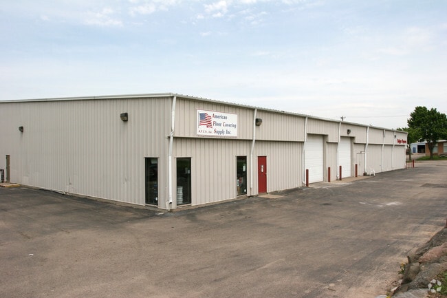
2914 Latham Dr
Madison, WI
Jordan Commercial Plat
0709-344-0302-6
JORDAN COMMERCIAL PLAT, LOT 6 & 7
Industrialgeneral
Dane
X
Wisconsin
55025C0417G
6,7
2024
1.61 AC
2024
S Central Madison
001405
Milwaukee/Madison
21,000 SF
DEMOGRAPHICS near 2914 Latham Dr
1 mile
3 mile
5 mile
2024 Total Population
10,781
92,080
187,389
2029 Population
11,208
94,783
193,356
Pop Growth 2024-2029
+ 3.96%
+ 2.94%
+ 3.18%
Average Age
34
34
36
2024 Total Households
4,982
39,165
82,687
HH Growth 2024-2029
+ 4.15%
+ 3.25%
+ 3.45%
Median Household Inc
$40,680
$59,627
$63,861
Avg Household Size
2.10
2.10
2.10
2024 Avg HH Vehicles
1.00
1.00
1.00
Median Home Value
$196,617
$378,176
$360,800
Median Year Built
1979
1979
1974
Nearby Places
Map Layers
Map Styles
 Street
 Aerial
Transit
 Traffic
 Biking
Places
Listings with unknown addresses are not visible on the map
- Restaurants
- Banks
- Shops
- Fitness
- Groceries
PUBLIC TRANSPORTATION
AIRPORT
Dane County Regional/Truax Field
Drive
Walk
Distance
Dane County Regional/Truax Field
22 min
10.2 mi
Nearby Properties
Address
Land Use
TOTAL SIZE
Lot Size
Zoning
Address
Land Use
TOTAL SIZE
Lot Size
Zoning
484,764 SF
1.62 AC
DC
Address
Land Use
TOTAL SIZE
Lot Size
Zoning
395,505 SF
0.99 AC
UMX
Address
Land Use
TOTAL SIZE
Lot Size
Zoning
8.42 AC
Address
Land Use
TOTAL SIZE
Lot Size
Zoning
466,963 SF
761.23 AC
PD
Address
Land Use
TOTAL SIZE
Lot Size
Zoning
21.49 AC
Address
Land Use
TOTAL SIZE
Lot Size
Zoning
463,006 SF
1.43 AC
UMX
Address
Land Use
TOTAL SIZE
Lot Size
Zoning
169,224 SF
5.49 AC
CC-T
Address
Land Use
TOTAL SIZE
Lot Size
Zoning
460,603 SF
1.08 AC
PD
Address
Land Use
TOTAL SIZE
Lot Size
Zoning
280,769 SF
0.80 AC
UMX
Address
Land Use
TOTAL SIZE
Lot Size
Zoning
18.97 AC
Address
Land Use
TOTAL SIZE
Lot Size
Zoning
230,268 SF
0.87 AC
UMX
Address
Land Use
TOTAL SIZE
Lot Size
Zoning
183,407 SF
2.71 AC
PD
Address
Land Use
TOTAL SIZE
Lot Size
Zoning
2.97 AC
Address
Land Use
TOTAL SIZE
Lot Size
Zoning
254,812 SF
0.64 AC
PD
Address
Land Use
TOTAL SIZE
Lot Size
Zoning
182,821 SF
1.19 AC
PD
Address
Land Use
TOTAL SIZE
Lot Size
Zoning
172,984 SF
1.59 AC
PD
Address
Land Use
TOTAL SIZE
Lot Size
Zoning
160,531 SF
0.41 AC
UMX
Address
Land Use
TOTAL SIZE
Lot Size
Zoning
6.30 AC
Address
Land Use
TOTAL SIZE
Lot Size
Zoning
Address
Land Use
TOTAL SIZE
Lot Size
Zoning
Address
Land Use
TOTAL SIZE
Lot Size
Zoning
14.47 AC
Address
Land Use
TOTAL SIZE
Lot Size
Zoning
24.62 AC
Address
Land Use
TOTAL SIZE
Lot Size
Zoning
3.21 AC
Address
Land Use
TOTAL SIZE
Lot Size
Zoning
404,794 SF
4.86 AC
CC-T
Address
Land Use
TOTAL SIZE
Lot Size
Zoning
234,075 SF
0.80 AC
UMX
Address
Land Use
TOTAL SIZE
Lot Size
Zoning
13.40 AC
Address
Land Use
TOTAL SIZE
Lot Size
Zoning
6.39 AC
Address
Land Use
TOTAL SIZE
Lot Size
Zoning
24,245 SF
2.23 AC
TSS
Address
Land Use
TOTAL SIZE
Lot Size
Zoning
2,454 SF
0.40 AC
PD
Address
Land Use
TOTAL SIZE
Lot Size
Zoning
185,443 SF
0.50 AC
PD
The World's #1 Commercial Real Estate Marketplace
Connect with us
© 2026 CoStar Group
The information above has been obtained from sources believed reliable. While we do not doubt its accuracy we have not verified it and make no guarantee, warranty or representation about it. It is your responsibility to independently confirm its accuracy and completeness. Any projections, opinions, assumptions, or estimates used are for example only and do not represent the current or future performance of the property. The value of this transaction to you depends on tax and other factors which should be evaluated by your tax, financial, and legal advisors. You and your advisors should conduct a careful, independent investigation of the property to determine to your satisfaction the suitability of the property for your needs.