Property Record
29141 Vallejo Ave, Temecula, CA 92592
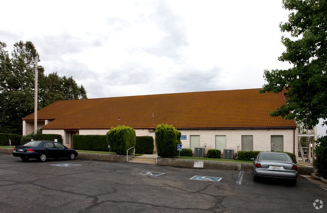

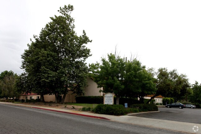

Property Detail
29141 Vallejo Ave
922-170-011
6.29 ACRES M/L IN POR LOT 11 AND LOT 10 MB 056/063 TR 3552
Publicschool
Riverside
VL
California
B and X Area of moderate flood hazard, usually the area between the limits of the 100-year and 500-year floods.
11
2024
6.29 AC
2025
South Riverside
043222
Inland Empire (California)
28,568 SF
Riverside-San Bernardino-Ontario, CA
NEARBY LISTINGS FOR SALE OR LEASE
-
-
View all Temecula listings for sale on LoopNet.com
DEMOGRAPHICS near 29141 Vallejo Ave
1 mile
3 mile
5 mile
2025 Total Population
3,939
64,920
131,563
2030 Population
3,975
66,228
134,251
Pop Growth 2025-2030
+ 0.91%
+ 2.01%
+ 2.04%
Average Age
39
37
38
2025 Total Households
1,378
21,377
41,729
HH Growth 2025-2030
+ 0.29%
+ 1.57%
+ 1.56%
Median Household Inc
$103,320
$110,343
$120,486
Avg Household Size
2.80
2.90
3.00
2025 Avg HH Vehicles
2.00
2.00
2.00
Median Home Value
$814,551
$716,850
$736,372
Median Year Built
1989
1994
1998
Nearby Places
Map Layers
Map Styles
 Street
 Aerial
Layers
 Traffic
 Biking
Places
Listings with unknown addresses are not visible on the map
- Restaurants
- Banks
- Shops
- Fitness
- Groceries
Nearby Properties
Address
Land Use
TOTAL SIZE
Lot Size
Zoning
Address
Land Use
TOTAL SIZE
Lot Size
Zoning
79,448 SF
19.66 AC
R3
Address
Land Use
TOTAL SIZE
Lot Size
Zoning
142,800 SF
13.39 AC
Address
Land Use
TOTAL SIZE
Lot Size
Zoning
14,438 SF
20.66 AC
R3
Address
Land Use
TOTAL SIZE
Lot Size
Zoning
214,532 SF
13.34 AC
R4
Address
Land Use
TOTAL SIZE
Lot Size
Zoning
103,517 SF
10.44 AC
Address
Land Use
TOTAL SIZE
Lot Size
Zoning
371,094 SF
20.90 AC
Address
Land Use
TOTAL SIZE
Lot Size
Zoning
50,638 SF
22.82 AC
Address
Land Use
TOTAL SIZE
Lot Size
Zoning
391,231 SF
28.77 AC
M1
Address
Land Use
TOTAL SIZE
Lot Size
Zoning
206,736 SF
13.63 AC
R3
Address
Land Use
TOTAL SIZE
Lot Size
Zoning
26,380 SF
15.99 AC
HDR
Address
Land Use
TOTAL SIZE
Lot Size
Zoning
Address
Land Use
TOTAL SIZE
Lot Size
Zoning
6.88 AC
Address
Land Use
TOTAL SIZE
Lot Size
Zoning
39,345 SF
20.56 AC
Address
Land Use
TOTAL SIZE
Lot Size
Zoning
91,318 SF
6.04 AC
Address
Land Use
TOTAL SIZE
Lot Size
Zoning
6,252 SF
11.24 AC
HDR
Address
Land Use
TOTAL SIZE
Lot Size
Zoning
255,668 SF
5.73 AC
Address
Land Use
TOTAL SIZE
Lot Size
Zoning
162,520 SF
11.47 AC
LI
Address
Land Use
TOTAL SIZE
Lot Size
Zoning
233,625 SF
18.57 AC
Address
Land Use
TOTAL SIZE
Lot Size
Zoning
26,279 SF
5.29 AC
PO
Address
Land Use
TOTAL SIZE
Lot Size
Zoning
87,565 SF
9.82 AC
H/TC
Address
Land Use
TOTAL SIZE
Lot Size
Zoning
52,340 SF
21.45 AC
R3
Address
Land Use
TOTAL SIZE
Lot Size
Zoning
164,991 SF
13.35 AC
Address
Land Use
TOTAL SIZE
Lot Size
Zoning
114,520 SF
13.58 AC
Address
Land Use
TOTAL SIZE
Lot Size
Zoning
68,644 SF
0.48 AC
Address
Land Use
TOTAL SIZE
Lot Size
Zoning
91,991 SF
2.40 AC
HT
Address
Land Use
TOTAL SIZE
Lot Size
Zoning
107,998 SF
9.31 AC
CC
Address
Land Use
TOTAL SIZE
Lot Size
Zoning
276,792 SF
10.16 AC
BP
Address
Land Use
TOTAL SIZE
Lot Size
Zoning
106,897 SF
3.49 AC
PO
Address
Land Use
TOTAL SIZE
Lot Size
Zoning
11.88 AC
CC
The World's #1 Commercial Real Estate Marketplace
Connect with us
© 2026 CoStar Group
The information above has been obtained from sources believed reliable. While we do not doubt its accuracy we have not verified it and make no guarantee, warranty or representation about it. It is your responsibility to independently confirm its accuracy and completeness. Any projections, opinions, assumptions, or estimates used are for example only and do not represent the current or future performance of the property. The value of this transaction to you depends on tax and other factors which should be evaluated by your tax, financial, and legal advisors. You and your advisors should conduct a careful, independent investigation of the property to determine to your satisfaction the suitability of the property for your needs.