Property Record
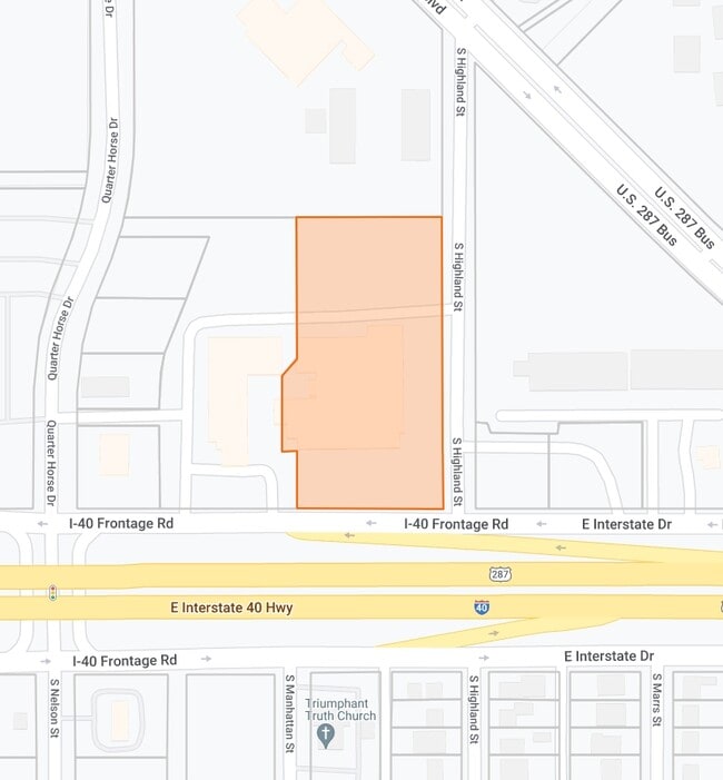
2915 E Interstate 40, Amarillo, TX 79104


This Property Is For Sale
Property Detail
2915 E Interstate 40
R-022-0700-8800-0
FAMOUS HEIGHTS PARK ADDN, BLK 86 LESS E-WAY ROW ALL OF BLK 73 PLUS VAC STS & ALLEYS LESS W IRREG 20FT OF EACH, 3.2900 ACRES
Motel
Potter
GR
Texas
AE The base floodplain where base flood elevations are provided. AE Zones are now used on new format FIRMs instead of A1-A30 Zones.
3.29 AC
2024
Amarillo
2025
Other Market Areas
011000
Amarillo, TX
48,186 SF
NEARBY LISTINGS FOR SALE OR LEASE
DEMOGRAPHICS near 2915 E Interstate 40
1 mile
3 mile
5 mile
2025 Total Population
8,683
53,025
120,243
2030 Population
8,482
53,076
121,259
Pop Growth 2025-2030
(2.31%)
+ 0.10%
+ 0.84%
Average Age
36
36
37
2025 Total Households
3,032
19,277
45,946
HH Growth 2025-2030
(2.54%)
+ 0.06%
+ 0.95%
Median Household Inc
$53,707
$50,408
$51,162
Avg Household Size
2.80
2.70
2.50
2025 Avg HH Vehicles
2.00
2.00
2.00
Median Home Value
$128,938
$127,903
$143,098
Median Year Built
1959
1958
1961
Nearby Places
Map Layers
Map Styles
 Street
 Aerial
Transit
 Traffic
 Biking
Places
Listings with unknown addresses are not visible on the map
- Restaurants
- Banks
- Shops
- Fitness
- Groceries
PUBLIC TRANSPORTATION
AIRPORT
Rick Husband Amarillo International
Drive
Walk
Distance
Rick Husband Amarillo International
12 min
7.3 mi
Freight Ports
Tulsa Port Of Catoosa
Drive
Walk
Distance
Tulsa Port Of Catoosa
394 min
375.3 mi
Nearby Properties
Address
Land Use
TOTAL SIZE
Lot Size
Zoning
Address
Land Use
TOTAL SIZE
Lot Size
Zoning
431,320 SF
14.82 AC
1F2 S
Address
Land Use
TOTAL SIZE
Lot Size
Zoning
414,471 SF
104.16 AC
LC
Address
Land Use
TOTAL SIZE
Lot Size
Zoning
250,705 SF
2.07 AC
CB
Address
Land Use
TOTAL SIZE
Lot Size
Zoning
168,978 SF
4.23 AC
1F2 S
Address
Land Use
TOTAL SIZE
Lot Size
Zoning
350,459 SF
10.71 AC
Address
Land Use
TOTAL SIZE
Lot Size
Zoning
2,419 SF
8.93 AC
PD
Address
Land Use
TOTAL SIZE
Lot Size
Zoning
116,842 SF
4.17 AC
Address
Land Use
TOTAL SIZE
Lot Size
Zoning
45,380 SF
2.62 AC
Address
Land Use
TOTAL SIZE
Lot Size
Zoning
325,727 SF
26.09 AC
2F
Address
Land Use
TOTAL SIZE
Lot Size
Zoning
254,693 SF
5.24 AC
LC
Address
Land Use
TOTAL SIZE
Lot Size
Zoning
325,220 SF
26.22 AC
PD
Address
Land Use
TOTAL SIZE
Lot Size
Zoning
371,536 SF
2.07 AC
CB
Address
Land Use
TOTAL SIZE
Lot Size
Zoning
89,206 SF
17.98 AC
Address
Land Use
TOTAL SIZE
Lot Size
Zoning
133,279 SF
2.07 AC
CB
Address
Land Use
TOTAL SIZE
Lot Size
Zoning
100,350 SF
1.24 AC
CB
Address
Land Use
TOTAL SIZE
Lot Size
Zoning
125,357 SF
4.34 AC
LC
Address
Land Use
TOTAL SIZE
Lot Size
Zoning
80,298 SF
7.75 AC
Address
Land Use
TOTAL SIZE
Lot Size
Zoning
80,476 SF
7.51 AC
I1
Address
Land Use
TOTAL SIZE
Lot Size
Zoning
388,909 SF
2.07 AC
CB
Address
Land Use
TOTAL SIZE
Lot Size
Zoning
77,549 SF
0.19 AC
CB
Address
Land Use
TOTAL SIZE
Lot Size
Zoning
110,796 SF
0.55 AC
MF2
Address
Land Use
TOTAL SIZE
Lot Size
Zoning
193,004 SF
Address
Land Use
TOTAL SIZE
Lot Size
Zoning
127,654 SF
5.73 AC
HC
Address
Land Use
TOTAL SIZE
Lot Size
Zoning
276,741 SF
10.07 AC
GR
Address
Land Use
TOTAL SIZE
Lot Size
Zoning
132,820 SF
15.85 AC
R2
Address
Land Use
TOTAL SIZE
Lot Size
Zoning
169,056 SF
2.35 AC
MF2
Address
Land Use
TOTAL SIZE
Lot Size
Zoning
64,847 SF
25.67 AC
R1
Address
Land Use
TOTAL SIZE
Lot Size
Zoning
128,891 SF
0.96 AC
CB
Address
Land Use
TOTAL SIZE
Lot Size
Zoning
205,577 SF
18.68 AC
I1
Address
Land Use
TOTAL SIZE
Lot Size
Zoning
251,206 SF
1.50 AC
The World's #1 Commercial Real Estate Marketplace
Connect with us
© 2026 CoStar Group
The information above has been obtained from sources believed reliable. While we do not doubt its accuracy we have not verified it and make no guarantee, warranty or representation about it. It is your responsibility to independently confirm its accuracy and completeness. Any projections, opinions, assumptions, or estimates used are for example only and do not represent the current or future performance of the property. The value of this transaction to you depends on tax and other factors which should be evaluated by your tax, financial, and legal advisors. You and your advisors should conduct a careful, independent investigation of the property to determine to your satisfaction the suitability of the property for your needs.