Property Record
29161 Fm 306, Spring Branch, TX 78070
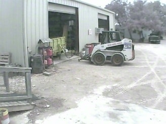

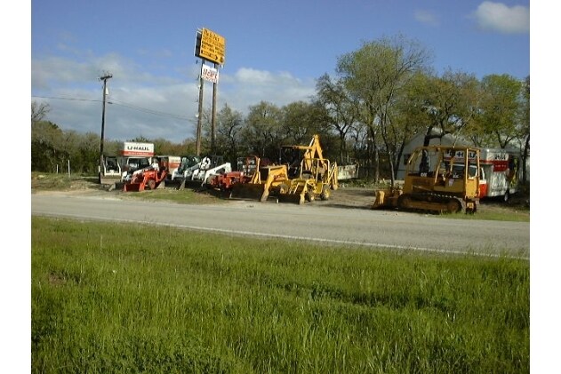
Property Detail
29161 Fm 306
San Antonio-New Braunfels, TX
REBECCA CROSSING, LOT 5
45-0402-0005-01
Comal
Commercialnec
Texas
B and X Area of moderate flood hazard, usually the area between the limits of the 100-year and 500-year floods.
5
2023
6.97 AC
2025
Comal County
310609
San Antonio
4,529 SF
NEARBY LISTINGS FOR SALE OR LEASE
DEMOGRAPHICS near 29161 Fm 306
1 mile
3 mile
5 mile
2025 Total Population
668
8,583
12,641
2030 Population
786
10,107
14,911
Pop Growth 2025-2030
+ 17.66%
+ 17.76%
+ 17.96%
Average Age
45
44
44
2025 Total Households
261
3,349
4,949
HH Growth 2025-2030
+ 17.62%
+ 17.83%
+ 18.04%
Median Household Inc
$105,555
$87,321
$94,008
Avg Household Size
2.50
2.50
2.50
2025 Avg HH Vehicles
2.00
2.00
2.00
Median Home Value
$455,357
$363,636
$416,209
Median Year Built
2010
2007
2007
Nearby Places
Map Layers
Map Styles
 Street
 Aerial
Transit
 Traffic
 Biking
Places
Listings with unknown addresses are not visible on the map
- Restaurants
- Banks
- Shops
- Fitness
- Groceries
PUBLIC TRANSPORTATION
AIRPORT
San Antonio International
Drive
Walk
Distance
San Antonio International
40 min
32.7 mi
Freight Ports
Calhoun Port
Drive
Walk
Distance
Calhoun Port
204 min
164.2 mi
Nearby Properties
Address
Land Use
TOTAL SIZE
Lot Size
Zoning
Address
Land Use
TOTAL SIZE
Lot Size
Zoning
334.47 AC
Address
Land Use
TOTAL SIZE
Lot Size
Zoning
8,896 SF
3.19 AC
Address
Land Use
TOTAL SIZE
Lot Size
Zoning
1,728 SF
4.14 AC
Address
Land Use
TOTAL SIZE
Lot Size
Zoning
11,213 SF
7.26 AC
Address
Land Use
TOTAL SIZE
Lot Size
Zoning
95.22 AC
Address
Land Use
TOTAL SIZE
Lot Size
Zoning
5,288 SF
133.02 AC
Address
Land Use
TOTAL SIZE
Lot Size
Zoning
13,488 SF
5.87 AC
Address
Land Use
TOTAL SIZE
Lot Size
Zoning
26,658 SF
31.10 AC
Address
Land Use
TOTAL SIZE
Lot Size
Zoning
10,000 SF
2.01 AC
Address
Land Use
TOTAL SIZE
Lot Size
Zoning
13,078 SF
1.22 AC
Address
Land Use
TOTAL SIZE
Lot Size
Zoning
2,160 SF
13.79 AC
Address
Land Use
TOTAL SIZE
Lot Size
Zoning
Address
Land Use
TOTAL SIZE
Lot Size
Zoning
9,036 SF
0.98 AC
Address
Land Use
TOTAL SIZE
Lot Size
Zoning
5,109 SF
2.07 AC
Address
Land Use
TOTAL SIZE
Lot Size
Zoning
9,416 SF
3.47 AC
Address
Land Use
TOTAL SIZE
Lot Size
Zoning
9,760 SF
2.85 AC
Address
Land Use
TOTAL SIZE
Lot Size
Zoning
5,176 SF
14.23 AC
Address
Land Use
TOTAL SIZE
Lot Size
Zoning
4,023 SF
1.26 AC
Address
Land Use
TOTAL SIZE
Lot Size
Zoning
2,276 SF
2.75 AC
Address
Land Use
TOTAL SIZE
Lot Size
Zoning
4,400 SF
2 AC
Address
Land Use
TOTAL SIZE
Lot Size
Zoning
4,028 SF
2 AC
Address
Land Use
TOTAL SIZE
Lot Size
Zoning
1,268 SF
3.91 AC
Address
Land Use
TOTAL SIZE
Lot Size
Zoning
Address
Land Use
TOTAL SIZE
Lot Size
Zoning
4,216 SF
1.02 AC
Address
Land Use
TOTAL SIZE
Lot Size
Zoning
4,210 SF
10.03 AC
Address
Land Use
TOTAL SIZE
Lot Size
Zoning
3,364 SF
2 AC
Address
Land Use
TOTAL SIZE
Lot Size
Zoning
3,244 SF
1.02 AC
Address
Land Use
TOTAL SIZE
Lot Size
Zoning
6,000 SF
1.03 AC
Address
Land Use
TOTAL SIZE
Lot Size
Zoning
4,618 SF
20.91 AC
Address
Land Use
TOTAL SIZE
Lot Size
Zoning
400 SF
3.65 AC
The World's #1 Commercial Real Estate Marketplace
Connect with us
© 2026 CoStar Group
The information above has been obtained from sources believed reliable. While we do not doubt its accuracy we have not verified it and make no guarantee, warranty or representation about it. It is your responsibility to independently confirm its accuracy and completeness. Any projections, opinions, assumptions, or estimates used are for example only and do not represent the current or future performance of the property. The value of this transaction to you depends on tax and other factors which should be evaluated by your tax, financial, and legal advisors. You and your advisors should conduct a careful, independent investigation of the property to determine to your satisfaction the suitability of the property for your needs.